|
|
|
Metadata
|
|
ID
|
01014
|
|
Also Known As
|
01014
ALYC01014
A-14-01-HW
|
|
Abstract
|
United States Geological Survey, Woods Hole,
Massachusetts,United States Geological Survey, Menlo Park,
California. Chief Scientists: Mike Bothner, Mike Field.
Geological data (navigation) of field activity 01014
(A-14-01-HW) in Hawaii Molokai from 01/08/2001 to 01/10/2001
|
|
Organization
|
United States Geological Survey, Woods Hole, Massachusetts
United States Geological Survey, Menlo Park, California
|
|
Chief Scientist
|
Mike Bothner
Mike Field
|
|
Activity Type
|
Geological
|
|
Platform
|
Alyce C
|
|
Area of Operation
|
Hawaii Molokai
|
|
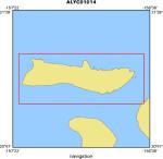
Location map
|
|
|
Bounding Coordinates
|
21.25000
-157.33000 -156.66000
21.00000
|
|
Dates
|
01/08/2001 (JD 008) to 01/10/2001 (JD 010)
|
|
Analog Materials
|
list
|
|
Index map

|
|
|
Crew
|
|
Mike Bothner
|
Chief Scientist, USGS Woods Hole
|
|
Mike Field
|
Chief Scientist, USGS Western Region
|
|
Joe Reich
|
Captain, Alyce C
|
|
Mike Casso
|
Unspecified, USGS Woods Hole
|
|
Rick Rendigs
|
Unspecified, USGS Woods Hole
|
|
Joe Newell
|
Unspecified, USGS Woods Hole
|
|
Susie Cochran
|
Project Assistant, Diver, Photographer, USGS Western Region
|
|
Curt Storlazzi
|
Lead Scuba Diver, USGS Western Region
|
|
Josh Logan
|
Field Assistant, GIS, USGS Western Region
|
|
|
Equipment Used
|
|
|
Purpose
|
|
Sedtrap, microcat, backs, dobie, dive
|
|
|
Got Help?
|
For 01014, we would appreciate any information on -- contract, days at sea, dive count, funding, information specialist, information to be derived, kms of navigation, national plan, NGDC Info, notes, owner, ports, project, project number, publications, scanned materials, seismic description, station count, station description, submersible, summary, tabulated info.
|
|


