|
|
|
Metadata
|
|
ID
|
A-1-04-CT
|
|
Also Known As
|
2004 CT mapping
|
|
Abstract
|
National Oceanic and Atmospheric Administration. Airborne
Topographic data (LIDAR) of field activity A-1-04-CT in
Connecticut from 10/08/2004 to 10/08/2004
|
|
Organization
|
National Oceanic and Atmospheric Administration
|
|
Project/Theme
|
CT Coastline Mapping 2004
|
|
Activity Type
|
Airborne Topographic
|
|
Platform
|
Airplane
|
|
Area of Operation
|
Connecticut
|
|
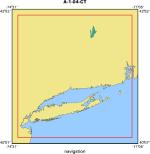
Location map
|
|
|
Bounding Coordinates
|
42.75000
-74.35000 -71.25000
40.25000
|
|
Dates
|
10/08/2004 (JD 282) to 10/08/2004 (JD 282)
|
|
Analog Materials
|
No analog holdings.
|
|
Index map

|
|
|
Information Specialist
|
|
|
Equipment Used
|
|
|
Purpose
|
|
This data was collected as part of an effort to map beach topography
|
|
efficiently and cheaply.
|
|
|
Notes
|
|
Lidar data was collected along the coast of Connecticut for the
|
|
purpose of 3D visualization, elevation based analyses, and for feature
|
|
extractions. The data were collected at submeter resolution to provide
|
|
nominal 1 meter spacing of collected points. Two elevation data sets
|
|
were recorded for the data providing first surface return data, where
|
|
features that are above the ground - such as buildings, bridges, tree
|
|
tops, etc. - have NOT been eliminated, and a Bare Earth, or last return,
|
|
data set.
|
|
|
Got Help?
|
For A-1-04-CT, we would appreciate any information on -- analog materials, chief scientist, contract, crew, days at sea, dive count, funding, information to be derived, kms of navigation, national plan, NGDC Info, owner, ports, project number, publications, scanned materials, seismic description, station count, station description, submersible, summary, tabulated info.
|
|