Seismic Network Operations
CU GRGR
Grenville, Grenada


Latitude: |
12.13 |
Longitude: |
-61.65 |
Elevation: |
195 |
Datalogger: |
Q330HR #1622 |
Broadband: |
STS2-I #10612 |
Accelerometer: |
EST-S #2212 |
Station Status: |
|
Telemetry Status: |
Site


Instrumentation
| Location Code |
Channel Code | Instrument | Flags | Sample Rate | Dip | Azimuth | Depth |
|---|---|---|---|---|---|---|---|
| HLZ | EST-S | CG | 100.00 | -90.00 | 0.00 | 0.00 | |
| HLN | EST-S | CG | 100.00 | 0.00 | 0.00 | 0.00 | |
| HLE | EST-S | CG | 100.00 | 0.00 | 90.00 | 0.00 | |
| BHZ | STS2-I | CG | 40.00 | -90.00 | 0.00 | 0.00 | |
| BHN | STS2-I | CG | 40.00 | 0.00 | 0.00 | 0.00 | |
| BHE | STS2-I | CG | 40.00 | 0.00 | 90.00 | 0.00 | |
| LHE | STS2-I | CG | 1.00 | 0.00 | 90.00 | 0.00 | |
| LHN | STS2-I | CG | 1.00 | 0.00 | 0.00 | 0.00 | |
| LHZ | STS2-I | CG | 1.00 | -90.00 | 0.00 | 0.00 | |
| LLE | EST-S | G | 1.00 | 0.00 | 90.00 | 0.00 | |
| LLN | EST-S | G | 1.00 | 0.00 | 0.00 | 0.00 | |
| LLZ | EST-S | G | 1.00 | -90.00 | 0.00 | 0.00 |
PDF, Current Week

PDF, Month

PDF, Year

PDF, All

Heliplot
Heliplot

Latency
Latency, Year

Latency, Month

Latency, Week

Latency, Day

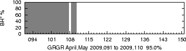
Availability
Availability, Year

Availability, Since 1972

Availability, 2 Month