Fire Weather Briefing Page for Western and Central North Dakota
Lead Weather Story
Roman 24-Hour Trend Monitor
Latest Fire Weather Planning Forecast
Hazardous Weather Outlook for Western and Central North Dakota
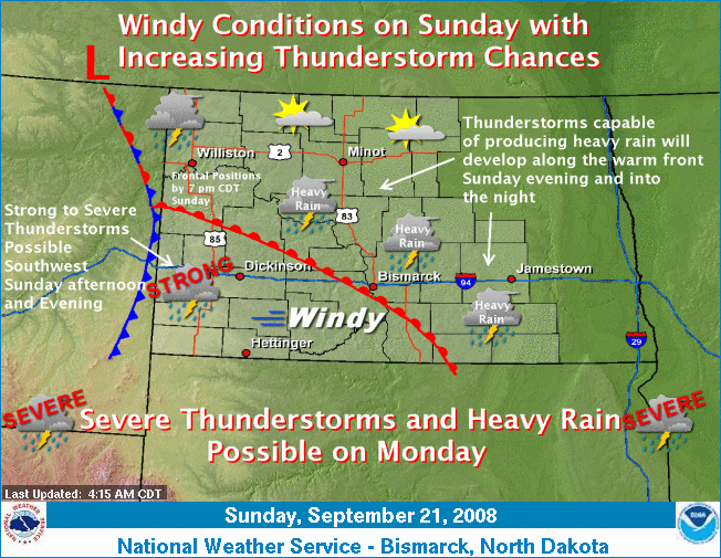
Fronts and Weather Forecasts
12-Hour Forecast:

24-Hour Forecast:
Lead Weather Story
Roman 24-Hour Trend Monitor
Latest Fire Weather Planning Forecast
Hazardous Weather Outlook for Western and Central North Dakota
Fronts and Weather Forecasts
12-Hour Forecast:
24-Hour Forecast:

36-Hour Forecast:

48-Hour Forecast:

Today's Forecast Maximum Temperature

Maximum/Minimum Relative Humidity

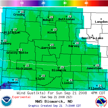
Mid-Afternoon/Early Morning Wind Forecast*

Mid-Afternoon/Early Morning Wind Gusts*
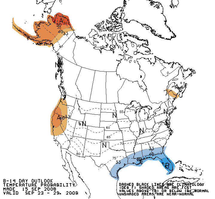
Eight to Fourteen Day Temperature Outlook
Eight to Fourteen Day Precipitation Outlook

* The wind and wind gust graphics will alternate between 4 p.m. CDT and 4 a.m. CDT, depending on the time of day. During the daylight hours, the 4 p.m. "mid afternoon" graphics will be displayed, but during the night the 4 a.m. "early morning" forecasts will be shown.