|
Looking North-Northeast at the Columbia River and Mount St. Helens, October 1994.
-- NASA Photo, courtesy "NASA Earth From Space" Website; Modified with text by USGS/CVO. STS068-262-025 Columbia River, Oregon and Washington, U.S.A. October 1994. This north-northeast-looking, low-oblique photograph features the Columbia River crossing from Astoria (near the left center) to Portland, Oregon (just below the right center). After passing through the gorge, the Columbia River from Portland to its mouth can accommodate ocean-going vessels. West of Portland, numerous agricultural field patterns are visible. Mount Saint Helens Volcano and its blast zone from the May 1980 eruption appear light gray near the top right of the photograph. Longview and Kelso, Washington, are discernible near the left center of the photograph. The Coast Range is apparent at the left edge. 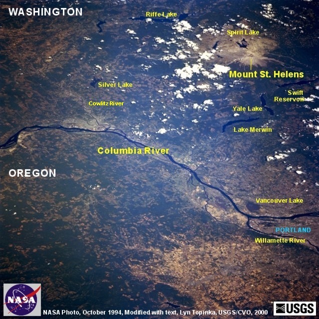
|
Return to:
[CVO Photo Archives - NASA Images Menu] ...
[CVO Photo Archives Menu] ...
[Mount St. Helens Menu] ...
[Columbia River Vicinity Menu] ...
[Washington State Volcanics Menu] ...
