|
|
|
 |
Hydrology Lab 'Happenings'
| Recent Awards and Recognition |
2008 BELTSVILLE AREA EARLY CAREER SCIENTIST
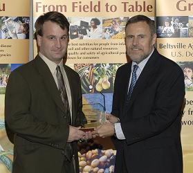 |
Dr. Michael Cosh of the Hydrology and Remote Sensing Laboratory, Animal and Natural Resources Institute (left in photo), is being recognize for developing novel methods of soil moisture remote sensing validation using in situ networks and field experimentation. |
2008 AWARD FOR EXCELLENCE IN TECHNOLOGY TRANSFER
Dr. Ray Hunt of the Hydrology and Remote Sensing Laboratory, Animal and Natural Resources Institute, has been awarded the Federal Laboratory Consortium's 2008 Excellence in Technology Transfer Award. The award in given in recognition of the work done on Dr. Hunt';s project, "Color-Infrared Digital Camera for Managing Agricultural and Natural Resources". More detail on this prestigious award can be found in the February 2008 BARC Newsletter.
2007 OUTSTANDING GRADUATE
Dr. Ali Sadeghi of the Hydrology and Remote Sensing Laboratory, Animal and Natural Resources Institute, is being recognized by the University of Arkansas, Department of Crop, Soil, and Environmental Sciences as its 2007 Outstanding Graduate. Dr. Sadeghi’s research has led to significant contributions to soil and water quality sciences, including the fate of urea/ammonia volatilization, nitrate and phosphorus movement in agricultural ecosystems, and the environmental fate of pesticides and pathogens in soils, surface runoff, and groundwater under different agronomic environments.
2007 BELTSVILLE AREA EARLY CAREER SCIENTIST
Dr. Wade Crow of the Hydrology and Remote Sensing Laboratory, Animal and Natural Resources Institute, is being recognized for enhancing the value of remote sensing observations for agricultural applications through the development of data assimilation and land surface modeling techniques.
2007 BELTSVILLE AREA SUPPORT/SERVICE EMPLOYEE OF THE YEAR
Mr. Robert Parry of the Hydrology and Remote Sensing Laboratory, Animal and Natural Resources Institute, is being recognized for exemplary computer and network support critical for maintaining the high research productivity and technology transfer capabilities of the laboratory.
Hydrology and Remote Sensing Laboratory Seminar, Thursday, October 9, 11 AM
Dr. Jean Fitzmaurice will present a seminar "Comparing reanalysis datasets using analysis increment statistics". Dr. Fitzmaurice recently received her PhD from MIT and has research interests in land surface hydrology, global reanalysis products and data assimilation.
The seminar will be presented in Building 007, Room 006 at the USDA-ARS, Beltsville Agricultural Research Center, Beltsville, MD. For more information, please contact Wade Crow, (301) 504-6847.
Soil Moisture Active Passive Validation Experiment 2008 (SMAPVEX08)
A series of aircraft-based flights of the Passive Active L-Band System (PALS) is proposed for the Mid-Atlantic region of the U.S. in the late summer-early fall of 2008. The objective is to collect data to resolve algorithm issues for SMAP, which will be described in a later section. This will be the first SMAP Validation Experiment (SMAPVEX). The experiments will leverage off the scheduled High Wind Ocean Salinity Campaign (HWOSC) that will attempt to track a hurricane for several days and record data on high winds using PALS and POLSCAT. It will also test new radio frequency interference (RFI) equipment, which is highly relevant to SMAP. Note that working with this project will reduce some costs associated with field campaigns but it will also introduce a number of constraints on data collection.
Cloud and Land Surface Interaction Campaign (CLASIC)
The Cloud and Land Surface Interaction Campaign (CLASIC) will be conducted at the ACRF Southern Great Plains (SGP) field measurement site during the summer of 2007. This cross-disciplinary interagency research effort will advance the understanding of how land surface processes influence cumulus convection. Cumulus convection is an important component in the atmospheric radiation budget and hydrologic cycle of the SGP, particularly during the summertime growing season. Human induced changes in the land surface structure associated with plowing, crop rotation, and irrigation can induce changes in the surface latent heat flux, sensible heat flux, albedo, and carbon flux. Changes in surface energy balance and moisture transport to the boundary layer influence cloud processes, thus create a feedback loop.
Research scientists and technical specialists from the Hydrology and Remote Sensing Laboratory are currently on-site in Oklahoma through the end of June, 2007, in support of this interagency research effort. Click here for more information on the Hydrology and Remote Sensing Laboratory's role in CLASIC.
Evaluating Riparian Buffers' Effectiveness
A specially designed field chamber has proved to be a good tool when used together with a computer model to evaluate how effectively riparian buffers filter out pollutants before they can reach streams or other bodies of water.
That is the finding from a series of systematic studies of a riparian grass buffer zone by scientists at the Agricultural Research Service's (ARS) Henry A. Wallace Beltsville (Md.) Agricultural Research Center (BARC).
After success with a prototype chamber in the laboratory, BARC soil scientists Jim Starr, Ali Sadeghi and Yakov Pachepsky installed a field version of the chamber in a tall fescue grass buffer near a forested stream and wetland area. The chamber has no top or bottom and encases the four sides of a 3-by-3-foot block of soil down to 4 feet.
The scientists injected water with dissolved nitrate into one side of the soil chamber. Then, as water flowed horizontally and out the other side, they monitored rates of lateral water flow and loss of nitrate due to its breakdown by soil microbes.
Riparian buffers are wooded or grassy streambanks or wetlands that filter out pollutants such as nitrate from fertilizer and other chemicals, as well as sediment. The slow movement of nitrate through highly organic riparian areas provides ideal conditions for soil microbes to break down or transform the nitrate into safer compounds.
The scientists used the two-dimensional computer model "HYDRUS-2D" to simulate water flow and transport of chemicals within the riparian zone soil. Overall, the model-chamber combination provided good results.
The experimental chamber is essential for the accurate use of the growing number of computer models being developed to assess the effectiveness of riparian buffers. Once a model gets this information for a particular location, it can predict nitrate loss rates.
A paper on this study will appear in the November-December issue of the Soil Science Society of America Journal.
Click here to view this report online, plus any included photos or other images on-line. 
Soil Moisture Experiments in 2005 (SMEX05/POLEX) June 2005- July 2005
Field experiments in support of remote sensing, hydrology and climate have included catchments throughout North America (Little Washita, Oklahoma: SGP97, SGP99, SMEX03; Little River, Georgia: SMEX03; Walnut River, Iowa: SMEX02; Walnut Gulch, Arizona: SMEX04). These experiments have been intensive efforts ranging from one to six weeks in duration. The basic approach used in these experiments has been to collect ground-based samples of soil moisture in conjunction with aircraft flights at the same time as satellite overpasses. The aims of these experiments have been: validation of remotely sensed data from aircraft and/or space-borne microwave sensors, the mapping of spatial and temporal variability of soil moisture, the relationship of soil moisture to vegetation and the near-surface atmospheric characteristics, and the collection of in-situ gravimetric data for soil moisture for validation of the land surface hydrological models used to simulate the watershed at pre-specified spatial and temporal resolutions.
Soil Moisture Experiments 2005 and Polarimetry Land Experiment (SMEX05/POLEX) will address algorithm development and validation related to all of the current and scheduled soil moisture satellite systems. Specific objectives include:
- Exploration of unique polarimetric information from satellites such as Windsat and CMIS for soil moisture with supporting aircraft instrumentation
- Diurnal effects associated with soil, vegetation and atmosphere at the 6 am/6 pm observing times of Hydros, SMOS, CMIS, and Windsat
- Enhancement of Aqua AMSR-E soil moisture validation
- Statistics and mitigation of RFI for CMIS risk reduction
Of these objectives, polarimetric microwave studies will be the primary driver for experiment design. SMEX05/POLEX will be the first campaign designed to study the unique and unexplored information that can be extracted for land applications using fully polarimetric observations. The Airborne Polarimetric Microwave Imaging Radiometer (APMIR), an aircraft simulator of WindSat and CMIS, will be available for SMEX05/POLEX that will facilitate replicate observations of a range of landscape features. In addition, with APMIR sub-band and emitter database, we will collect regional RFI statistics and evaluate the sensor capability in terms of RFI mitigation and its benefit in improving soil moisture retrieval performance. Many satellites (WindSat, CMIS, SMOS and Hydros) will share the same diurnal observation characteristics (6 am/ 6 pm). Efforts in SMEX05 to focus on this time frame will offer the opportunity to understand phenomena that may be specific to these observing times. Of particular interest is the effect of dew on the microwave brightness temperature (Jackson and Moy 1999). If the presence of dew has a significant impact on the brightness temperature it will be necessary to develop methods to identify this condition and possible correct for the dew effects.
All ground based and aircraft observations will also support the soil moisture algorithm validation of Aqua AMSR-E. WindSat will transition to CMIS on the NPOESS operational platforms and AMSR to the Japanese GCOM satellites. All efforts in SMEX05/POLEX will contribute to these programs.
Soil Moisture Experiments in 2004 (SMEX04 - NAME) July 2004 - August 2004
Field experiments in support of remote sensing, hydrology and climate have included catchments throughout North America (Little Washita, Oklahoma: SGP97, SGP99, SMEX03; Little River, Georgia: 2000, SMEX03; Walnut River, Iowa: SMEX02). These experiments have been intensive efforts ranging from one to six weeks in duration. The basic approach used in these experiments has been to collect ground-based samples of soil moisture in conjunction with aircraft flights at the same time as satellite overpasses. The aircraft instruments operate in low frequency microwave wavebands that are well suited for the measurement of soil moisture. The aims of these experiments have been: validation of remotely sensed data from aircraft and/or space-borne microwave sensors, the mapping of spatial and temporal variability of soil moisture, the relationship of soil moisture to vegetation and the near-surface atmospheric characteristics, and the collection of in-situ gravimetric data for soil moisture for validation of the land surface hydrological models used to simulate the watershed at pre-specified spatial and temporal resolutions.
SMEX04 builds on the preceding experiments by focusing specifically on topography, vegetation and strengthening the soil moisture components of the North American Monsoon Experiment (NAME). One of the main objectives of NAME is to improve prediction of warm season precipitation. Warm season precipitation is highly dependent on convection, which, in turn, is controlled, at least in part, by soil moisture and surface temperature. Therefore, an accurate characterization of spatial and temporal variability of soil moisture is critical to NAME in three ways; the spatial and temporal patterns of soil moisture estimated from remote sensing can be used for initialization and/or updating of the boundary conditions for the land surface component of land-atmosphere models, the spatial and temporal patterns of soil moisture can be used for validation of land surface model outputs, and to discern the relationship between soil moisture and warm season precipitation and associated feedback mechanisms.
The timing of SMEX04 and the NAME EOP are driven by the NAMS. Rainfall statistics demonstrate quite clearly that the field experiment should be centered around the period roughly mid-July to mid-August, when the number of rainy days is large and the possibility of having a having flights prior-to and subsequent to heavy rainfall is high.
SMEX04 will involve four complementary elements; in-situ soil moisture networks, aircraft mapping of soil moisture, intensive sampling concurrent with aircraft mission, and satellite products. Two regional study sites (~50 km by 75 km) have been established in Arizona (AZ) and Sonora (SO). A NASA P-3 aircraft will be the platform for two passive microwave instruments, the Polarimetric Scanning Radiometer (PSR) with X and C band channels and the Two Dimensional Synthetic Aperture Radiometer (2DSTAR) with L band channels. In addition, satellite data from the Aqua AMSR-E, Coriolis Windsat, TRMM TMI, DMSP SSM/I, Terra MODIS and ASTER, and Envisat ASAR will be utilized for soil moisture and vegetation studies at local and regional scales.
|
Related news articles
|
|
|
|