"Repeat Views and Annotated Images"
2004 to Current
| Current Eruption Menu | |||
| Menu of Images | Crater/Dome/Eruption Images | Field Crews/Work Images | News/Media/Miscellaneous Images |
"Camera Stations"
"Repeat Views" and "Annotated Images"
Information
|

Aerial view, high angle, Mount St. Helens crater and dome, from the north, with inset images of what the "whalebacks" use to look like. Base image is from October 30, 2005, by John Pallister. Inset images are from November 29, 2004, February 22, 2005, June 21, 2005, and August 31, 2005.
[monitor size, 72 dpi, 800 pixels wide] ...
[print size, 300 dpi, 8x8 inches]
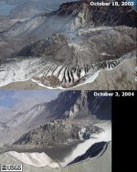
Comparison, aerial view, Mount St. Helens crater and dome from the southwest, from October 3, 2004, and October 18, 2005. Spirit Lake is just visible upper left.
USGS photograph taken on October 3, 2005, by Stephanie Konfal and Dan Dzurisin, and October 18, 2005, by Cate Fox-Lent.
[medium size]
[October 18, 2005, large size]
[October 3, 2004, large size]
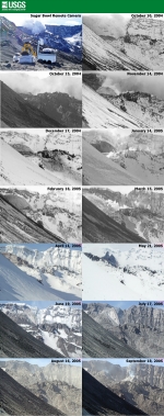
Monthly views, new dome as seen from the remote camera on Sugar Bowl, from October 10, 2004 through September 18, 2005.
USGS Photograph taken on October 10, 2004, through September 18, 2005.
[600 pixels wide] ... [1,000 pixels wide]
[Click for more Sugar Bowl sequences]
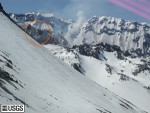
Full size image
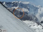
Cropped image
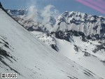
New dome as seen from the remote camera on Sugar Bowl. Compare with images below. The first and last images bracket a good size rock column which toppled (center image).
USGS Photograph taken on April 26, 2005, at 10:57:32 PDT.
[medium size, full image] ...
[medium size, cropped image] ...
[large size, full image]
Full size image

Cropped image
New dome as seen from the remote camera on Sugar Bowl.
USGS Photograph taken on April 26, 2005, at 11:26:21 PDT.
[medium size, full image] ...
[medium size, cropped image] ...
[large size, full image]
Full size image
Cropped image
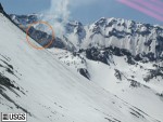
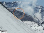
New dome as seen from the remote camera on Sugar Bowl. Compare with images above. The first and last images bracket a good size rock column which toppled (center image).
USGS Photograph taken on April 26, 2005, at 11:56:58 PDT.
[medium size, full image] ...
[medium size, cropped image] ...
[large size, full image]

East side of Mount St. Helens crater, showing crater floor, developing glacier, dome and uplift with new growth, as seen from the northeast.
USGS Photograph taken on December 28, 2004.
[medium size]

East side of Mount St. Helens crater, showing crater floor, developing glacier, dome and uplift with new growth, as seen from the northeast.
USGS Photograph taken on October 21, 2004.
[medium size] ... [print ready, views from 09-27 and 10-21-04]

East side of Mount St. Helens crater, showing crater floor, developing glacier, dome, as seen from the northeast.
USGS Photograph taken on September 27, 2004.
[medium size] ... [print ready, views from 09-27 and 10-21-04]
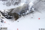
Mount St. Helens dome and uplift with new growth, with south crater wall, as seen from the west, with marked points "A" (crater floor), "B" (tip rockfall off wall), and "C" (on 1980-86 dome).
USGS Photograph taken on November 29, 2004. Original image by Dan Dzurisin.
[medium size]
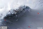
Mount St. Helens dome and uplift with new growth, with south crater wall, as seen from the west, with marked points "A" (crater floor), "B" (tip rockfall off wall), and "C" (on 1980-86 dome).
USGS Photograph taken on October 20, 2004.
[medium size] ... [print ready, 09-29 and 10-20-04]
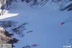
Mount St. Helens dome, with south crater wall, as seen from the west, with marked points "A" (crater floor), "B" (tip rockfall off wall), and "C" (on 1980-86 dome).
USGS Photograph taken on September 29, 2004.
[medium size] ... [print ready, 09-29 and 10-20-04]
| Menu of Images | Crater/Dome/Eruption Images | Field Crews/Work Images | News/Media/Miscellaneous Images |
| Current Eruption Menu | |||

