
 |
 |
Click here
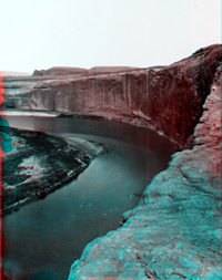
to see a collection of historic images of Glen Canyon taken by the Powell
Expedition of 1872. Website images include both standard photograph and
3D views (as anaglyphs - requiring red-and-cyan 3D viewing glasses). This view shows cliffs of Navajo Sandstone along the Colorado about midway through Glen Canyon (before the valley was flooded by Lake Powell). To learn more about Glen Canyon National Recreation Area check out the National Park Service Website at: http://www.nps.gov/glca/. |
|
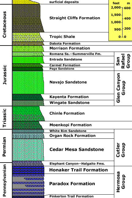
Generalized stratigraphy after: Anderson, P.P., Chisey, T.C., Sprinkel, D.A., and Willis, GC., 2000, Geology of Glen Canyon Nation Recreation Area: In Geology of Utah's Parks and Monuments, Sprinkel, D.A., Chidsey, T.C., and Anderson, P.B., eds., Utah Geological Association Publication 28., p. 301-335. Stratigraphic unit information is modified from the USGS GeoLex (Lexicon of Geology): http://ngmdb.usgs.gov/Geolex/geolex_qs.html. A generalized geologic time scale is available at: http://3dparks.wr.usgs.gov/coloradoplateau/timescale.htm. |