Click here to start a 3-D
tour of the park. You will need 3-D glasses to view this series of anaglyphic
images.
Click on any of the images to continue to the next page in the linked page series.
Otherwise, click here to see
the same tour in standard images. Click here to see a thumbnail gallery.
Click here to see Powell Survey (1871) 3-D photographs taken in the park area.
Click here to see more 3-D geology tours of National Parks.
|
|
|
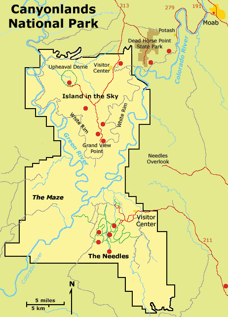
Map of Canyonlands National Park. Click on the "Next Image" (below) to continue on the image tour, or click on any of the small red dots on the map above to go directly to selected images. |
|
Check out the National Park Service's Canyonlands National Park site - http://www.nps.gov/cany/ Click here to see information about park stratigraphy and historic geologic reports. This website is an image tour of Canyonlands National
Park. All pictures were taken in early June 2003. |
 |
A search on the World Wide Web will yield many sites about anaglyphs and where to get 3-D glasses. |
This website was prepared by Phil Stoffer and Eleyne Phillips
USGS Western Earth Surface Processes
Team, Menlo Park, California.
U.S.
Department of the Interior - U.S.
Geological Survey - Geology
Discipline |