|
Click here to start a tour of Kaloko Honokohau National Monument. Click on any of the images to continue to the next page in the linked page series. Or, see a thumbnail gallery. Click here to see tours of other national parks. |
|
|
 |
Click here to see the same images as anaglyphs (3-D images). You will need red-and-cyan stereo viewing glasses to get the 3-D visual effects. |
|
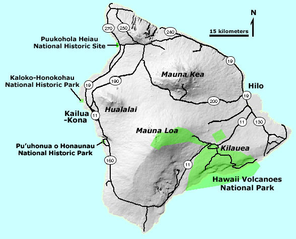
Kaloko-Honokhua National Historic Park is dedicated to historic preservation, protection, and interpretation of native Hawaiian culture and activities. The 1160 acre park was established in 1978 on the site of an ancient Hawaiian settlement on the Kona Coast of the Island of Hawaii. Istoric resources include fishponds, home site platforms (kahua), petroglyphs (ki'i'pohaku), and a religious site (heiau). These are in a setting where ancient lava flows from Hualalai Volcano entered the sea. The park is also a marine and coastal wildlife preserve. Click here to learn more about Kaloko-Honokohau National Historic Park, Hawaii (National Park Service website: http://www.nps.gov/kaho). |
Click here to see more 3-D geology tours of National Parks.
This website was prepared by Phil Stoffer
USGS Western Earth Surface Processes
Team, Menlo Park, California.
U.S.
Department of the Interior - U.S.
Geological Survey - Geology
Discipline |