|
Click here to start a tour of Mount Rainier National Park. Click on any of the images to continue to the next page in the linked page series. Or, see a thumbnail gallery. Click here to see tours of other national parks. |
|
|
 |
This website contains images produced from stereo photo pairs that were manipulated into anaglyphs (3-D images). You will need red-and-cyan stereo viewing glasses to get the 3-D visual effects. |
| Click here to see the same images in standard photography. |
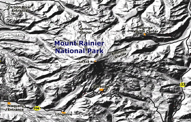
The National Park Service website for Mount Rainier National Park is: http://www.nps.gov/mora/index.htm For geologic maps and information about Mount Rainier National Park check out these USGS resources: Mount Rainier, Washington Mount Rainier National Park: (USGS/Cascades Volcano Observatory, Vancouver, Washington): http://vulcan.wr.usgs.gov/Volcanoes/Rainier/Locale/framework.html Pacific Northwest Urban Corridor Geologic Maps: Geologic maps and databases of the Mt. Rainier, WA 30' x 60' Quadrangle: http://geology.wr.usgs.gov/wgmt/pacnw/100mtr.html Fiske, Richard S., Hopson, C.A, and Waters, Arron C., 1964, Geologic Map and Section of Mount Rainier National Park, Washington: U.S. Geological Survey Miscellaneous Geologic Investigations Map I-432. |
This website was prepared by Phil Stoffer
USGS Western Earth Surface Processes
Team, Menlo Park, California.
U.S.
Department of the Interior - U.S.
Geological Survey - Geology
Discipline |