
NOAA Launches Final Two Buoys to Complete U.S. Tsunami Warning System
March 10, 2008

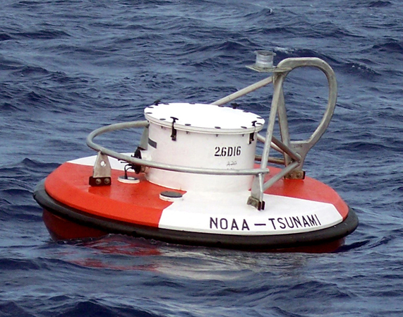
NOAA DART II buoy.
+ High Resolution (Credit: NOAA)
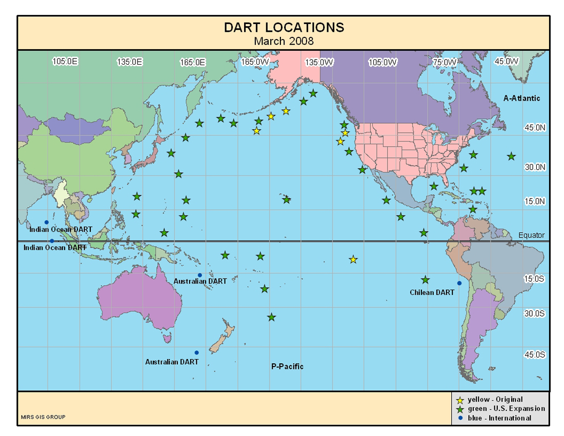
NOAA deployed the final two tsunami detection buoys in the South Pacific this week, completing the buoy network and bolstering the U.S. tsunami warning system. This vast network of 39 stations provides coastal communities in the Pacific, Atlantic, Caribbean and the Gulf of Mexico with faster and more accurate tsunami warnings.
These final two deep-ocean assessment and reporting of tsunami (DART) stations, deployed off the Solomon Islands, will give NOAA forecasters real-time data about tsunamis that could potentially impact the U.S. Pacific coast, Hawaii and U.S. Pacific territories. Tsunami sensors are now positioned between Hawaii and every seismic zone that could generate a tsunami that would impact the state and beyond, including the U.S. West Coast. Buoys already in the western Atlantic, Gulf of Mexico and Caribbean have been keeping watch over the U.S East and Gulf coasts.
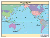
NOAA DART buoy locations.
+ High Resolution (Credit: NOAA)
“Completing the U.S. Tsunami Warning System is truly a monumental triumph that includes the advancement of the science, the development and testing of cutting edge technology, and the large scale project management skills that brought it all together on a global scale,” said retired Navy Vice Adm. Conrad C. Lautenbacher, Ph.D., undersecretary of commerce for oceans and atmosphere and NOAA administrator. “As a young scientist who researched tsunamis and built early models of their effects, I never imagined that we could come so far in our ability to understand, to detect, to model and to warn on such a scale as we have just achieved.”
DART stations consist of a bottom pressure sensor anchored to the seafloor and a companion moored surface buoy. An acoustic link transmits data from the bottom pressure sensor to the surface buoy, and then satellite links relay the data to NOAA tsunami warning centers. The DART network serves as the cornerstone to the U.S. tsunami warning system.
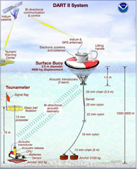
NOAA DART II buoy system.
+ High Resolution (Credit: NOAA)
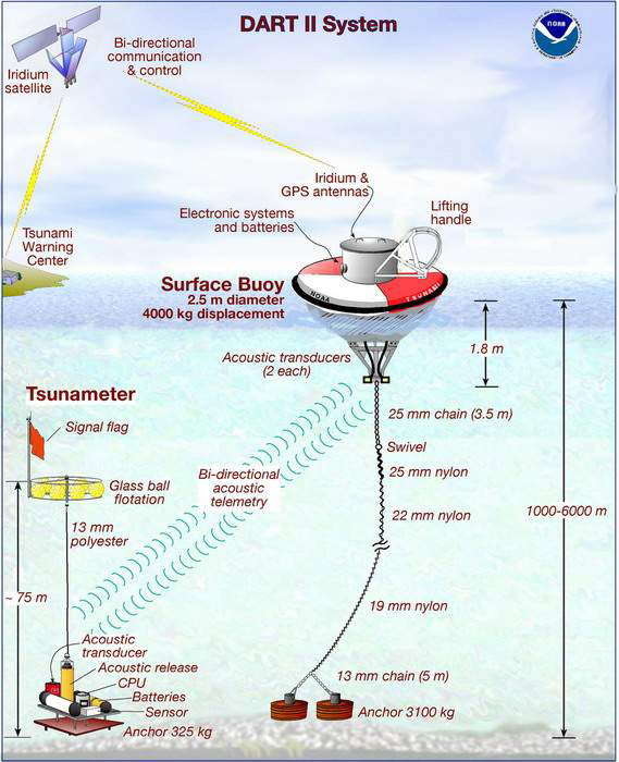
Other components of the tsunami warning system include NOAA’s tsunami warning centers, a network of tide and seismic stations, forecast models for at-risk communities, and TsunamiReady™, a public preparedness and education program.
Since the Indonesian tsunami of December 2004, NOAA has made significant upgrades to the U.S. tsunami warning system, including:
- Installing 49 new or upgraded tide gages
- Installing or upgrading eight seismic stations
- Expanding the network of DART buoys from six (exclusively in the eastern Pacific) to 39 (from the western Pacific to the Atlantic)
- Growing the number of TsunamiReady communities from 16 to more than 50 today
- Developing 26 inundation forecast models and implementing a new Tsunami Warning System
- Extending the operations of the Pacific and West Coast/Alaska Tsunami Warning Centers to 24 hours a day
- Assisting Australia and Indonesia with installing tsunami warning systems off their coasts.
NOAA encourages state and local communities to improve their resiliency to tsunamis by participating in the TsunamiReady program. This program serves to educate the public about the threat of a tsunami and ensure people know what to do when NOAA issues a tsunami warning. Through active research, NOAA is working to detect tsunamis and issue warnings more rapidly. These efforts will enhance NOAA’s ability to protect the American people from the potentially devastating hazard of a U.S.-bound tsunami.
The National Oceanic and Atmospheric Administration, an agency of the U.S. Commerce Department, is dedicated to enhancing economic security and national safety through the prediction and research of weather and climate-related events and information service delivery for transportation, and by providing environmental stewardship of our nation's coastal and marine resources. Through the emerging Global Earth Observation System of Systems (GEOSS), NOAA is working with its federal partners, more than 70 countries and the European Commission to develop a global monitoring network that is as integrated as the planet it observes, predicts and protects.