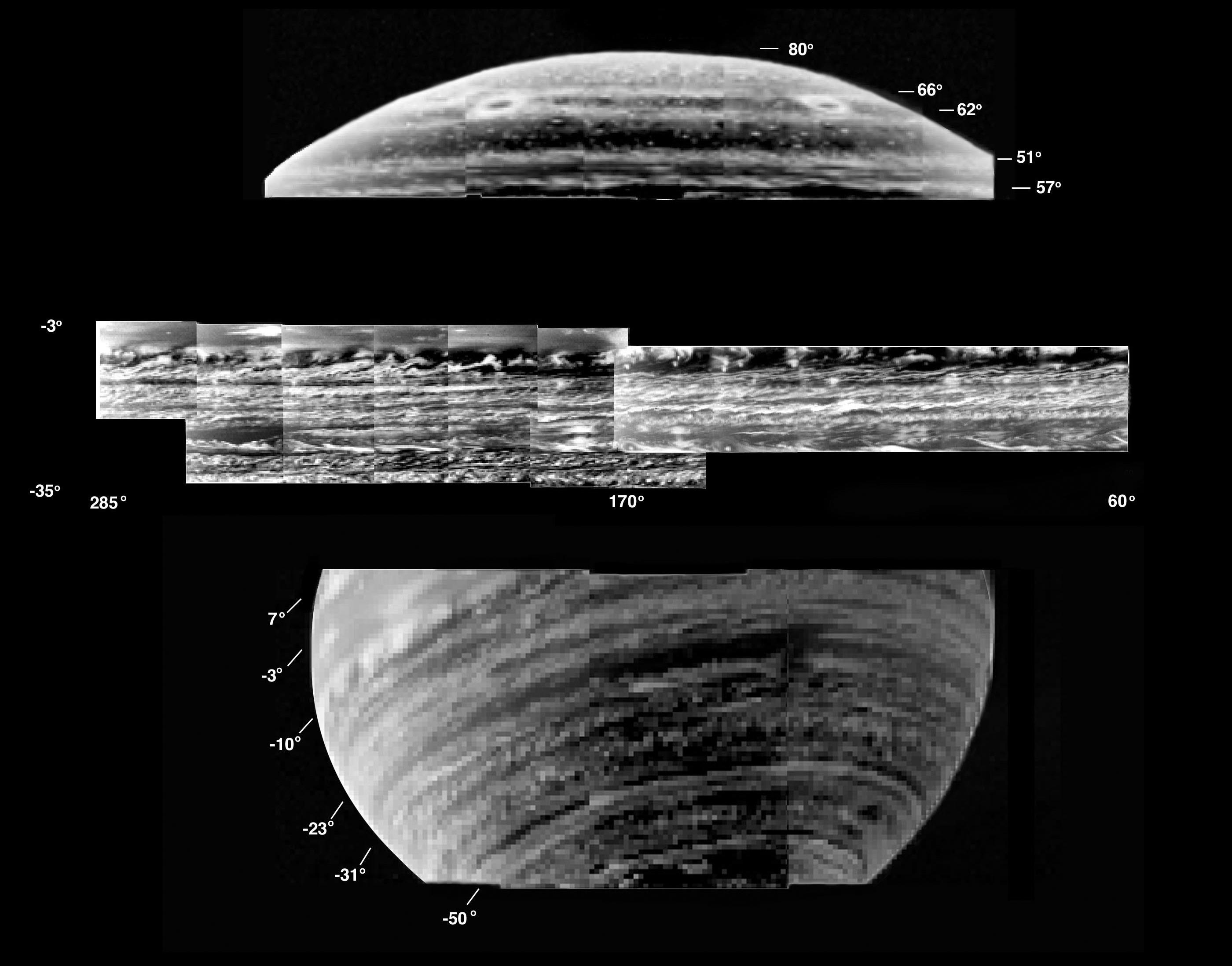
This is a collection of the most detailed images of deep-level clouds
obtained by the visual and infrared mapping spectrometer onboard the
Cassini spacecraft.
Images were obtained at 5.1 micron wavelength, inverted photographically
to show clouds as bright. Donut-shaped clouds are seen near the north
pole (upper panel).
A planetary wave pattern dominates the cloud structures just south of the
equator (upper part of middle panel), with many swirls of clouds connected
to discrete cloud "cells." The southern hemisphere is striped with
numerous thin lanes of clouds throughout the southern hemisphere (bottom
image, and middle part of middle image). Many thin wisps of clouds appear
to be connected to discrete cloud "cells."
Images were acquired during three passes by Saturn between February and
July, 2005. The top image was acquired on Feb. 17, 2005, from a distance
of 683,000 kilometers (424,397 miles). The middle image was acquired on
March 8, 2005, from 725,000 kilometers (450,494 miles) altitude. The
bottom image was acquired on July 12, 2003, from a distance of 1.1 million
kilometers (683,508 miles).
The Cassini-Huygens mission is a cooperative project of NASA, the European
Space Agency and the Italian Space Agency. The Jet Propulsion Laboratory,
a division of the California Institute of Technology in Pasadena, manages
the mission for NASA's Science Mission Directorate, Washington, D.C. The
Cassini orbiter was designed, developed and assembled at JPL. The visual
and infrared mapping spectrometer team is based at the University of
Arizona.
For more information about the Cassini-Huygens mission http://saturn.jpl.nasa.gov.
The visual and infrared mapping spectrometer team homepage is at
http://wwwvims.lpl.arizona.edu


