

 Products
One-Stop Web Shop for USGS Great ShakeOut Science Resources Now Open
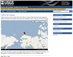
Reporters: You will have access to a journal, photographs and video during and after this expedition. Information is available at the Arctic Chronicles Web site.
A scientific expedition this fall will map the unexplored Arctic seafloor where the U.S. and Canada may have sovereign rights over natural resources such as oil and gas and control over activities such as mining.
 Both countries will use the resulting data to establish the outer limits of the continental shelf, according to the criteria set out in the Convention on the Law of the Sea. The extended continental shelf, the seafloor and subsoil beyond 200 nautical miles from shore that meet those criteria, is an area of great scientific interest and potential economic development.
The expedition will be collaboratively undertaken by the U.S. and Canada using two ships. The U.S. Geological Survey will lead data collection from September 6-October 1 on the U.S. Coast Guard Cutter Healy to map the Arctic seafloor. The Geological Survey of Canada, Natural Resources Canada will follow Healy on the Canadian Coast Guard ship Louis S. St. Laurent (Louis) and study the geology of the sub-seafloor.
"The two-ship experiment allows both the U.S. and Canada to collect and share complementary data in areas where data acquisition is costly, logistically difficult, and sometimes dangerous," said USGS scientist Deborah Hutchinson, who will sail aboard Louis. "Both countries benefit through sharing of resources and data as well as increasing likelihood of success by utilizing two ice-breaker ships in these remote areas of the Arctic Ocean."
"Healy will utilize an echo sounder, which emits sounds signals in the water, to map the seafloor. This will be done using a multibeam bathymetry system," said USGS scientist Jonathan Childs, chief scientist on Healy during the September cruise. "Unlike conventional echo sounders, which measure the water depth at a point directly beneath the ship, the multibeam system collects a ‘swath' of depth information about 3 km wide along the ship's path, creating a three-dimensional view of the seafloor."
The National Oceanic and Atmospheric Administration funded U.S. participation in the U.S.-Canadian mission and collaborated with the University of New Hampshire to collect bathymetric data in the Arctic Ocean on Healy from August 14-September 5.
Research is coordinated by the Extended Continental Shelf Task Force, a government-wide group headed by the U.S. Department of State. Participants in this Task Force include the USGS, NOAA, U.S. Coast Guard, National Science Foundation, Joint Chiefs of Staff, U.S. Navy, Department of Energy, Environmental Protection Agency, Executive Office of the President, Minerals Management Service, and the Arctic Research Commission.
For more information about the Convention on the Law of the Sea, visit http://www.un.org/Depts/los/index.htm.
