USGS

Regional and National Assessments

USGS IN YOUR STATE

USGS Water Science Centers are located in each state.

There is a USGS Water Science Center office in each State. Washington Oregon California Idaho Nevada Montana Wyoming Utah Colorado Arizona New Mexico North Dakota South Dakota Nebraska Kansas Oklahoma Texas Minnesota Iowa Missouri Arkansas Louisiana Wisconsin Illinois Mississippi Michigan Indiana Ohio Kentucky Tennessee Alabama Pennsylvania West Virginia Georgia Florida Caribbean Alaska Hawaii New York Vermont New Hampshire Maine Massachusettes South Carolina North Carolina Rhode Island Virginia Connecticut New Jersey Maryland-Delaware-D.C.

Estimation of Nutrient and Sediment Loading in the Mississippi River and Great Lakes Basins with Regional SPARROW Models

Project Number: 9KM30 and CRM60
Project Chief: Dale M. Robertson
Other Principal Investigators: Richard Alexander (Virginia), David Saad (Wisconsin), Richard Rebich (Mississippi), and Lori Sprague (Colorado)
Project Topics: Mississippi River and Great Lakes Basins
Cooperators: U.S. Environmental Protection Agency
Period of Project: October 2005 – Continuing


Wisconsin Water Science Center

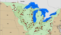
Enlarge map.   This project will develop calibrated SPARROW models to estimate nutrient and sediment loading from streams in MARB and Upper Mississippi River/Great Lakes Basin (MRB3) for conditions similar to 1992 and 2002.

Problem

As part of the U.S. Environmental Protection Agency (USEPA) National Water Quality Inventory--1996 Report to Congress, water-quality conditions in 19 percent of the Nation’s rivers and streams were surveyed.  Based on the results of the survey, nutrient over enrichment (and accompanying high productivity) and siltation were found to be the two most significant causes of impairment in those waters.  Excessive export of nutrients from the Mississippi/Atchafalaya River Basin has also been linked to hypoxia in the Gulf of Mexico. One of the principal causes for the increasing size of the hypoxic zone is believed to be the increasing supply of nitrogen delivered to the Gulf from the Mississippi River Basin.

Objectives

The objectives of this study are to:

  1. Assemble a database containing nutrient (nitrogen and phosphorus) and suspended sediment concentration data and flow data from the USGS and the major sampling agency(s) for the entire Mississippi-Atchafalya Basins (MARB) and Great Lakes Basin (GLB).
  2. Estimate nutrient and sediment loading for 1970 to 2007 for sites in MARB and GLB with sufficient data using the USGS load program Fluxmaster. These data will be detrended and used to estimate loads typical for 1992 and 2002.
  3. Develop calibrated SPARROW models to estimate nutrient and sediment loading from streams in MARB and Upper Mississippi River/Great Lakes Basin (MRB3) for conditions similar to 1992 and 2002.
    1. Loading throughout the MARB
      • 1992 Loading will be based on the 1992 National SPARROW models.
      • 2002 Loading will be based on regional models developed just for MARB.
    2. Loading throughout the Upper Misssissippi/Great Lakes Basin (MRB3)
      • 1992 and 2002 Loading will be based on regional models developed just for MRB3.
  4. Describe the distribution of nutrient and suspended sediment loading and the factors influencing these distributions throughout MARB and MRB3.
  5. Rank all of the basins based on the relative yields of nutrient and suspended sediment throughout the MARB and MRB3 for 1992 and 2002.


Web Links


Publications and Reports

Smith, R.A., Schwarz, G.E., and Alexander, R.B., 1997, Regional interpretation of water-quality monitoring data, Water Resources Research, 33, 12, 2781-2798.

Smith, R.A., Alexander, R.B., and Schwarz, G.E., 2003, Estimating the natural background concentrations of nutrients in streams and rivers of the conterminous United States, Environ. Sci. Tech., 37, 3039-3047.

Presentations

Robertson, Dale and Richard Alexander. 29 June 2007. SPARROW modeling in the Mississippi and Atchafalaya River Basins (MARB) (SPARROW_MARB_Ranking_1992.pps)

Robertson, Dale M., Saad, D.A., Alexander, R.A., and Schwarz, G.E. 24 July 2008. SPARROW Modeling – with special emphasis on modeling in the Mississippi River Basin and Upper Midwest. Upper Midwest Partnership Meeting. (MWPartnership_SPARROW_July2008.ppt)

Data Files

Ranking of Basins (to be added soon)


Accessibility FOIA Privacy Policies and Notices

Take Pride in America logo USA.gov logo U.S. Department of the Interior | U.S. Geological Survey
URL: http://wi.water.usgs.gov/rna/9km30/index.html
Page Contact Information: webmaster@wi.water.usgs.gov
Page Last Modified: Friday, 17-Oct-2008 15:23:15 EDT

05394500: Flow=67cfs,Stage=1.93ft,Floodstage=7.0ft,2008-11-05 02:00,Low,PRAIRIE RIVER NEAR MERRILL, WI 04063500: Flow=547cfs,Stage=6.36ft,Floodstage=12.0ft,2008-11-05 02:15,Low,MENOMINEE RIVER AT TWIN FALLS NEAR IRON MT, MI 04060993: Flow=174cfs,Stage=3.40ft,Floodstage=9.0ft,2008-11-05 03:30,Low,BRULE RIVER AT US HIGHWAY 2 NEAR FLORENCE, WI 05427948: Flow=4.2cfs,Stage=3.49ft,2008-11-05 00:00,>90,PHEASANT BRANCH AT MIDDLETON, WI 05414820: Flow=34cfs,Stage=4.66ft,2008-11-05 04:30,>90,SINSINAWA RIVER NEAR MENOMINEE, IL 05360500: Flow=617cfs,Stage=5.10ft,2008-11-05 00:00,<10,FLAMBEAU RIVER NEAR BRUCE, WI 05356500: Flow=482cfs,Stage=1.75ft,2008-11-05 00:00,<10,CHIPPEWA RIVER NEAR BRUCE, WI 04087088: Flow=2.7cfs,Stage=1.57ft,2008-11-05 02:15,<10,UNDERWOOD CREEK AT WAUWATOSA, WI 04069500: Flow=395cfs,Stage=1.50ft,Floodstage=10.0ft,2008-11-05 02:00,<10,PESHTIGO RIVER AT PESHTIGO, WI 04066800: Flow=1330cfs,Stage=9.85ft,Floodstage=17.0ft,2008-11-05 02:00,<10,MENOMINEE RIVER AT KOSS, MI 04060500: Flow=48cfs,Stage=4.10ft,2008-11-05 04:30,<10,IRON RIVER AT CASPIAN, MI 05404000: Flow=2480cfs,Stage=2.83ft,Floodstage=16.0ft,2008-11-04 23:45,<10,WISCONSIN RIVER NEAR WISCONSIN DELLS, WI 05397500: Flow=66cfs,Stage=0.62ft,Floodstage=7.0ft,2008-11-05 02:00,<10,EAU CLAIRE RIVER AT KELLY, WI 05395000: Flow=889cfs,Stage=3.82ft,Floodstage=11.0ft,2008-11-05 02:00,<10,WISCONSIN RIVER AT MERRILL, WI 04074950: Flow=225cfs,Stage=7.59ft,Floodstage=11.5ft,2008-11-05 02:00,<10,WOLF RIVER AT LANGLADE, WI 04067500: Flow=1320cfs,Stage=8.55ft,Floodstage=15.0ft,2008-11-05 00:00,<10,MENOMINEE RIVER NEAR MC ALLISTER, WI 04066500: Flow=102cfs,Stage=2.35ft,2008-11-05 02:00,<10,PIKE RIVER AT AMBERG, WI 04063000: Flow=632cfs,Stage=2.81ft,Floodstage=9.0ft,2008-11-05 02:30,<10,MENOMINEE RIVER NEAR FLORENCE, WI 05436500: Flow=404cfs,Stage=1.49ft,2008-11-05 02:00,76-90,SUGAR RIVER NEAR BRODHEAD, WI 05434500: Flow=754cfs,Stage=6.02ft,Floodstage=13.5ft,2008-11-05 04:00,76-90,PECATONICA RIVER AT MARTINTOWN, WI 05433000: Flow=169cfs,Stage=4.93ft,2008-11-05 02:00,76-90,EAST BRANCH PECATONICA RIVER NR BLANCHARDVILLE, WI 05431486: Flow=138cfs,Stage=3.95ft,2008-11-05 02:00,76-90,TURTLE CREEK AT CARVERS ROCK ROAD NEAR CLINTON, WI 05410490: Flow=595cfs,Stage=8.11ft,2008-11-05 02:00,76-90,KICKAPOO RIVER AT STEUBEN, WI 05408000: Flow=173cfs,Stage=3.37ft,Floodstage=12.0ft,2008-11-05 00:00,76-90,KICKAPOO RIVER AT LA FARGE, WI 05406500: Flow=49cfs,Stage=2.45ft,2008-11-05 02:00,76-90,BLACK EARTH CREEK AT BLACK EARTH, WI 05405000: Flow=377cfs,Stage=8.15ft,2008-11-05 02:00,76-90,BARABOO RIVER NEAR BARABOO, WI 04086500: Flow=113cfs,Stage=6.21ft,Floodstage=10.0ft,2008-11-05 02:00,76-90,CEDAR CREEK NEAR CEDARBURG, WI 04062000: Flow=217cfs,Stage=3.24ft,2008-11-05 02:30,76-90,PAINT RIVER NR ALPHA, MI 05407000: Flow=4340cfs,Stage=0.83ft,Floodstage=9.0ft,2008-11-05 02:00,10-24,WISCONSIN RIVER AT MUSCODA, WI 05401050: Flow=24cfs,Stage=4.34ft,2008-11-05 02:15,10-24,TENMILE CREEK NEAR NEKOOSA, WI 05391000: Flow=378cfs,Stage=1.43ft,2008-11-05 02:15,10-24,WISCONSIN RIVER @ RAINBOW LAKE NR LAKE TOMAHAWK,WI 05369500: Flow=3280cfs,Stage=3.09ft,Floodstage=13.0ft,2008-11-05 00:00,10-24,CHIPPEWA RIVER AT DURAND, WI 05368000: Flow=172cfs,Stage=3.34ft,2008-11-05 02:00,10-24,HAY RIVER AT WHEELER, WI 05365500: Flow=1610cfs,Stage=3.19ft,2008-11-05 00:00,10-24,CHIPPEWA RIVER AT CHIPPEWA FALLS, WI 04087120: Flow=20cfs,Stage=1.34ft,2008-11-05 02:00,10-24,MENOMONEE RIVER AT WAUWATOSA, WI 04087030: Flow=6.1cfs,Stage=2.93ft,2008-11-05 02:15,10-24,MENOMONEE RIVER AT MENOMONEE FALLS, WI 04085427: Flow=44cfs,Stage=4.27ft,Floodstage=10.0ft,2008-11-05 02:00,10-24,MANITOWOC RIVER AT MANITOWOC, WI 04078500: Flow=116cfs,Stage=2.75ft,Floodstage=7.0ft,2008-11-05 02:00,10-24,EMBARRASS RIVER NEAR EMBARRASS, WI 04031000: Flow=85cfs,Stage=1.19ft,Floodstage=10.0ft,2008-11-05 03:00,10-24,BLACK RIVER NEAR BESSEMER, MI 04027000: Flow=201cfs,Stage=2.71ft,Floodstage=18.0ft,2008-11-05 04:45,10-24,BAD RIVER NEAR ODANAH, WI 05548280: Flow=129cfs,Stage=4.35ft,2008-11-05 04:30,25-75,NIPPERSINK CREEK NEAR SPRING GROVE, IL 05545750: Flow=349cfs,Stage=6.22ft,2008-11-05 00:00,25-75,FOX RIVER NEAR NEW MUNSTER, WI 05544200: Flow=43cfs,Stage=2.46ft,2008-11-05 02:00,25-75,MUKWONAGO RIVER AT MUKWONAGO, WI 05527800: Flow=12cfs,Stage=1.89ft,Floodstage=7.0ft,2008-11-05 04:45,25-75,DES PLAINES RIVER AT RUSSELL, IL 05437500: Flow=3720cfs,Stage=3.85ft,2008-11-05 04:30,25-75,ROCK RIVER AT ROCKTON, IL 05430500: Flow=1570cfs,Stage=4.46ft,Floodstage=9.0ft,2008-11-05 00:00,25-75,ROCK RIVER AT AFTON, WI 05427570: Flow=1140cfs,Stage=11.56ft,Floodstage=15.0ft,2008-11-05 00:00,25-75,ROCK RIVER AT INDIANFORD, WI 05426000: Flow=187cfs,Stage=2.50ft,Floodstage=7.0ft,2008-11-05 00:00,25-75,CRAWFISH RIVER AT MILFORD, WI 05423500: Flow=7.0cfs,Stage=2.03ft,2008-11-05 02:00,25-75,SOUTH BRANCH ROCK RIVER AT WAUPUN, WI 05389500: Flow=20000cfs,Stage=13.07ft,2008-11-05 04:00,25-75,Mississippi River at McGregor, IA 05379500: Flow=346cfs,Stage=4.72ft,Floodstage=9.0ft,2008-11-05 02:00,25-75,TREMPEALEAU RIVER AT DODGE, WI 05370000: Flow=13cfs,Stage=11.88ft,2008-11-05 02:00,25-75,EAU GALLE RIVER AT SPRING VALLEY, WI 05369000: Flow=971cfs,Stage=6.50ft,2008-11-05 02:00,25-75,RED CEDAR RIVER AT MENOMONIE, WI 05333500: Flow=949cfs,Stage=1.10ft,Floodstage=7.0ft,2008-11-05 02:00,25-75,ST. CROIX RIVER NEAR DANBURY, WI 04087240: Flow=17cfs,Stage=2.31ft,2008-11-05 02:00,25-75,ROOT RIVER AT RACINE, WI 04087000: Flow=205cfs,Stage=2.00ft,Floodstage=7.0ft,2008-11-05 02:00,25-75,MILWAUKEE RIVER AT MILWAUKEE, WI 04073500: Flow=1010cfs,Stage=9.26ft,2008-11-05 02:15,25-75,FOX RIVER AT BERLIN, WI 04037500: Flow=38cfs,Stage=4.61ft,2008-11-05 04:00,25-75,CISCO BRANCH ONTONAGON R AT CISCO LAKE OUTLET, MI 464646092052900: Stage=601.64ft,2008-11-04 22:15,Not ranked,Rating being developed or revised,SUPERIOR BAY DULUTH SHIP CANAL AT DULUTH, MN 460930090035900: Stage=1583.86ft,2008-11-04 20:00:00,Not ranked,MERCER LAKE AT MERCER, WI 443014087362500: Flow=0.000000cfs,Stage=-0.002ft,2008-11-04 23:00,Not ranked,DISCOVERY FARMS TILE SITE NUMBER 2 NR KEWAUNEE, WI 443012087362500: Flow=0.007220cfs,Stage=0.044ft,2008-11-04 23:00,Not ranked,DISCOVERY FARMS WATERWAY SITE NO. 3 NR KEWAUNEE,WI 442945087354100: Flow=0.000000cfs,Stage=-0.007ft,2008-11-04 23:00,Not ranked,DISCOVERY FARMS TILE SITE NUMBER 1 NR KEWAUNEE, WI 442944087354100: Flow=0.002400cfs,Stage=0.038ft,2008-11-04 23:00,Not ranked,DISCOVERY FARMS WATERWAY SITE NO. 1 NR KEWAUNEE,WI 435444087462300: Flow=0.000000cfs,Stage=-0.018ft,2008-11-05 00:00,Not ranked,DISCOVERY FARMS WATERWAY NUMBER 2 NR CLEVELAND, WI 435441087463900: Flow=0.000000cfs,Stage=-0.011ft,2008-11-05 00:00,Not ranked,DISCOVERY FARMS WATERWAY NUMBER 1 NR CLEVELAND, WI 435440087463800: Flow=0.000000cfs,Stage=-0.016ft,2008-11-04 07:00,Not ranked,DISCOVERY FARMS TILE SITE NUMBER 2 NR CLEVELAND,WI 435414087471400: Flow=0.000000cfs,Stage=-0.011ft,2008-11-04 23:00,Not ranked,DISCOVERY FARMS WATERWAY NUMBER 3 NR CLEVELAND, WI 434928088553601: Stage=6.18ft,2008-11-04 22:00:00,Not ranked,GREEN LAKE AT COUNTY TRUNK HWY A NR GREEN LAKE, WI 431837089313402: 0000-00-00 00:00,Stage=1.05ft,2008-11-04 22:00:00,Not ranked,LODI RAINGARDEN OUTLET AT LODI, WI 431837089313401: Stage=0.08ft,2008-11-04 22:02,Not ranked,Rating being developed or revised,LODI RAINGARDEN INLET AT LODI, WI 431113088281000: Flow=0.024200cfs,Stage=0.189ft,2008-11-04 08:00,Not ranked,DISCOVERY FARMS TILE SITE NO. 1 NEAR MAPLETON, WI 431112088281100: Flow=0.000000cfs,Stage=-0.014ft,2008-11-04 08:00,Not ranked,DISCOVERY FARMS WATERWAY NEAR MAPLETON, WI 431112088281000: Flow=0.018250cfs,Stage=0.179ft,2008-11-04 08:00,Not ranked,DISCOVERY FARMS TILE SITE NO. 2 NEAR MAPLETON, WI 430748089181800: 0000-00-00 00:00,Not ranked,Rating being developed or revised,EAST WASHINGTON AVENUE STORM SEWER AT MADISON, WI 430432089313401: 2008-10-02 05:00,Not ranked,Site discontinued,OLD SAUK ROAD RAIN GARDEN AT MADISON, WI 430423089291401: 2008-10-01 17:00,Not ranked,Site discontinued,OWEN PARK RAIN GARDEN AT MADISON, WI 430412089241501: 0000-00-00 00:00,Stage=0.39ft,2008-11-05 00:00:00,Not ranked,Rating being developed or revised,CHARTER ST. POWER PLANT STORM SEWER AT MADISON, WI 430102089252000: 2008-10-21 05:00,Not ranked,Site discontinued,HATCHERY HILL STORM SEWER AT FITCHBURG, WI 425715089164700: Stage=2.86ft,2008-11-04 18:00:00,Not ranked,LAKE KEGONSA AT BARBER DRIVE NEAR STOUGHTON, WI 424848088083100: Stage=8.29ft,2008-11-04 22:00:00,Not ranked,WIND LAKE AT OUTLET AT WIND LAKE, WI 424314090240601: Flow=0.000000cfs,Stage=-0.016ft,2008-11-05 02:00,Not ranked,U.W. PLATTEVILLE FARMS SITE 02 NR PLATTEVILLE, WI 424302090231900: Flow=0.000000cfs,Stage=-0.010ft,2008-11-04 22:00,Not ranked,U.W. PLATTEVILLE FARMS SITE 10 NR PLATTEVILLE, WI 424302090225601: Flow=0.000000cfs,Stage=0.003ft,2008-11-04 22:00,Not ranked,U.W. PLATTEVILLE FARMS SITE 03 NR PLATTEVILLE, WI 424259090231301: Flow=0.000000cfs,Stage=-0.007ft,2008-11-04 22:00,Not ranked,U.W. PLATTEVILLE FARMS SITE 05 NR PLATTEVILLE, WI 424253090232100: Flow=0.000000cfs,Stage=-0.007ft,2008-11-04 22:00,Not ranked,U.W. PLATTEVILLE FARMS SITE 11 NR PLATTEVILLE, WI 424247090234500: Flow=0.000000cfs,Stage=-0.023ft,2008-11-04 22:00,Not ranked,U.W. PLATTEVILLE FARMS SITE 09 NR PLATTEVILLE, WI 424246090231700: 0000-00-00 00:00,Not ranked,Seasonal site,U.W. PLATTEVILLE FARMS SITE 12A NR PLATTEVILLE, WI 424245090231600: 0000-00-00 00:00,Not ranked,Temporarily unavailable,U.W. PLATTEVILLE FARMS SITE 12B NR PLATTEVILLE, WI 424245090231000: Flow=0.000000cfs,Stage=-0.006ft,2008-11-04 22:00,Not ranked,U.W. PLATTEVILLE FARMS SITE 08 NR PLATTEVILLE, WI 424242090230701: Flow=0.000000cfs,Stage=-0.002ft,2008-11-05 04:00,Not ranked,U.W. PLATTEVILLE FARMS SITE 07 NR PLATTEVILLE, WI 423912090170800: Flow=0.000000cfs,Stage=-0.008ft,2008-11-04 23:00,Not ranked,DISCOVERY FARMS WATERWAY SITE NO 1 NEAR BELMONT,WI 423909090172100: Flow=0.002000cfs,Stage=0.016ft,2008-11-04 23:00,Not ranked,DISCOVERY FARMS WATERWAY SITE NO 2 NEAR BELMONT,WI 423846090171600: Flow=0.003400cfs,Stage=0.008ft,2008-11-04 23:00,Not ranked,DISCOVERY FARMS WATERWAY SITE NO 3 NEAR BELMONT,WI 423706088363400: Stage=5.05ft,2008-11-05 02:00:00,Not ranked,DELAVAN LAKE NEAR DELAVAN, WI 423525088260400: Stage=2.45ft,2008-11-04 22:25:00,Not ranked,GENEVA LAKE AT LAKE GENEVA, WI 0535739503: Flow=3.9cfs,Stage=2.07ft,2008-11-04 20:00,Not ranked,LITTLE TURTLE RIVER AT GARNET STREET AT MERCER, WI 055451345: Flow=3.0cfs,Stage=8.29ft,2008-11-04 22:25,Not ranked,WHITE RIVER AT CENTER STREET AT LAKE GENEVA, WI 054310157: Flow=1.8cfs,Stage=5.55ft,2008-11-04 22:00,Not ranked,JACKSON CREEK TRIBUTARY NEAR ELKHORN, WI 053813595: Flow=187cfs,Stage=35.59ft,Floodstage=47.0ft,2008-11-05 02:00,Not ranked,BLACK RIVER DS ST HWY 54 AT BLACK RIVER FALLS, WI 053793306: 2008-10-03 09:00,Not ranked,Site discontinued,TRAVERSE VALLEY CREEK S. TRIB. NR INDEPENDENCE, WI 053793305: 2008-10-03 05:00,Not ranked,Site discontinued,TRAVERSE VALLEY CREEK N. TRIB. NR INDEPENDENCE, WI 040871488: Flow=2.3cfs,Stage=10.83ft,2008-11-04 23:00,Not ranked,WILSON PARK CR @ ST. LUKES HOSPTL @ MILWAUKEE, WI 040871476: Flow=0.00cfs,Stage=0.10ft,2008-11-04 23:00,Not ranked,HOLMES AVE CR TRB @ GMIA OUTFALL #1 @ MILWAUKEE,WI 040871475: Flow=0.50cfs,Stage=10.82ft,2008-11-04 23:00,Not ranked,WILSON PARK CREEK @ GMIA OUTFALL #7 @ MILWAUKEE,WI 040871473: Flow=0.12cfs,Stage=10.64ft,2008-11-04 23:00,Not ranked,WILSON PARK CREEK AT GMIA INFALL AT MILWAUKEE, WI 040869416: Flow=1.4cfs,Stage=3.58ft,2008-11-04 22:20,Not ranked,LINCOLN CREEK @ SHERMAN BOULEVARD AT MILWAUKEE, WI 040851385: Flow=1660cfs,Stage=577.61ft,Floodstage=584.0ft,2008-11-04 22:25,Not ranked,FOX RIVER AT OIL TANK DEPOT AT GREEN BAY, WI 040851325: Flow=2.5cfs,Stage=2.00ft,2008-11-04 23:45,Not ranked,BAIRD CREEK AT SUPERIOR ROAD AT GREEN BAY, WI 040263491: Flow=53cfs,Stage=6.72ft,Floodstage=12.0ft,2008-11-05 04:00,Not ranked,NORTH FISH CREEK NEAR MOQUAH, WI 040263205: Flow=19cfs,Stage=1.42ft,Floodstage=5.0ft,2008-11-05 00:00,Not ranked,WHITTLESEY CREEK NEAR ASHLAND, WI 05548000: Stage=3.97ft,2008-11-05 04:15:00,Not ranked,NIPPERSINK LAKE AT FOX LAKE, IL 05547500: Stage=3.95ft,2008-11-05 04:15:00,Not ranked,FOX LAKE NEAR LAKE VILLA, IL 05547000: Stage=4.04ft,2008-11-05 04:15:00,Not ranked,CHANNEL LAKE NEAR ANTIOCH, IL 05543830: Flow=53cfs,Stage=2.88ft,2008-11-04 22:15,Not ranked,FOX RIVER AT WAUKESHA, WI 05527950: Flow=31cfs,Stage=6.87ft,2008-11-05 04:45,Not ranked,MILL CREEK AT OLD MILL CREEK, IL 05527910: Stage=17.95ft,2008-11-05 04:45:00,Not ranked,NORTH MILL CREEK NEAR MILBURN, IL 05527905: Stage=11.32ft,2008-11-05 04:45:00,Not ranked,HASTINGS CREEK NEAR LINDENHURST, IL 05527900: Stage=6.50ft,2008-11-05 04:45:00,Not ranked,NORTH MILL CREEK AT HICKORY CORNERS, IL 05438283: Flow=2.9cfs,Stage=4.83ft,2008-11-05 02:00,Not ranked,PISCASAW CREEK NEAR WALWORTH, WI 05437050: Flow=1500cfs,Stage=5.85ft,Floodstage=12.0ft,2008-11-05 04:30,Not ranked,PECATONICA RIVER NR SHIRLAND, ILL 05435943: Flow=15cfs,Stage=4.58ft,2008-11-05 02:00,Not ranked,BADGER MILL CREEK AT VERONA, WI 05435935: Flow=0.36cfs,Stage=1.940ft,2008-11-05 02:00,Not ranked,BADGER MILL CREEK @ HIGHWAYS 18 & 151 @ MADISON,WI 05432927: Flow=24cfs,Stage=9.40ft,2008-11-05 01:45,Not ranked,PLEASANT VALLEY CREEK @ CTH H NR BLANCHARDVILLE,WI 05432695: Flow=15cfs,Stage=7.86ft,2008-11-05 01:45,Not ranked,RIDGEWAY BRANCH NEAR HOLLANDALE, WI 05432500: Stage=2.77ft,2008-11-05 02:00,Not ranked,PECATONICA RIVER AT DARLINGTON, WI 05431032: Flow=41cfs,Stage=1.71ft,2008-11-05 02:00,Not ranked,TURTLE CREEK AT DELAVAN, WI 05431022: Flow=0.03cfs,Stage=5.20ft,2008-11-04 22:00,Not ranked,DELAVAN LAKE OUTLET AT BORG ROAD NEAR DELAVAN, WI 05431017: Flow=31cfs,Stage=27.84ft,2008-10-25 06:25,Not ranked,DELAVAN LAKE INLET AT STATE HWY 50 AT LAKE LAWN,WI 05431016: Flow=3.5cfs,Stage=8.45ft,2008-11-04 22:00,Not ranked,JACKSON CREEK AT MOUND ROAD NEAR ELKHORN, WI 05430175: Flow=467cfs,Stage=4.80ft,Floodstage=10.0ft,2008-11-05 02:00,Not ranked,YAHARA RIVER NEAR FULTON, WI 05430150: Flow=128cfs,Stage=4.98ft,2008-11-05 02:00,Not ranked,BADFISH CREEK NEAR COOKSVILLE, WI 05429700: Flow=326cfs,Stage=6.89ft,2008-11-05 00:05,Not ranked,YAHARA RIVER @ FORTON STREET BRIDGE @ STOUGHTON,WI 05429510: Flow=338cfs,Stage=7.61ft,2008-11-05 00:05,Not ranked,YAHARA RIVER @ EXCHANGE ST. BRIDGE @ MC FARLAND,WI 05429500: Flow=285cfs,Stage=4.51ft,2008-11-04 22:30,Not ranked,YAHARA RIVER AT MC FARLAND, WI 05429485: Stage=4.52ft,2008-11-04 22:30:00,Not ranked,LAKE WAUBESA AT MC FARLAND, WI 05429000: Stage=4.92ft,2008-11-04 22:15:00,Not ranked,LAKE MONONA AT MADISON, WI 05428500: Flow=248cfs,Stage=5.20ft,2008-11-05 04:10,Not ranked,YAHARA RIVER AT EAST MAIN STREET AT MADISON, WI 05428000: Stage=9.69ft,2008-11-04 10:30:00,Not ranked,LAKE MENDOTA AT MADISON, WI 05427965: Flow=0.00cfs,Stage=0.26ft,2008-11-05 02:00,Not ranked,SPRING HARBOR STORM SEWER AT MADISON, WI 05427850: Flow=111cfs,Stage=9.84ft,2008-11-04 23:00,Not ranked,YAHARA RIVER AT STATE HIGHWAY 113 AT MADISON, WI 05427718: Flow=32cfs,Stage=1.44ft,2008-11-05 02:00,Not ranked,YAHARA RIVER AT WINDSOR, WI 05427235: Stage=5.81ft,2008-11-04 22:15:00,Not ranked,LAKE KOSHKONONG NEAR NEWVILLE, WI 05427085: Flow=969cfs,2008-11-05 02:10,Not ranked,ROCK RIVER AT ROBERT STREET AT FORT ATKINSON, WI 05426250: Flow=91cfs,Stage=0.98ft,2008-11-05 02:00,Not ranked,BARK RIVER NEAR ROME, WI 05426067: Flow=27cfs,Stage=12.61ft,2008-11-04 22:00,Not ranked,BARK RIVER AT NAGAWICKA ROAD AT DELAFIELD, WI 05425912: Flow=153cfs,Stage=840.38ft,Floodstage=843.5ft,2008-11-05 00:00,Not ranked,BEAVER DAM RIVER AT BEAVER DAM, WI 05425500: Flow=287cfs,Stage=1.71ft,Floodstage=5.5ft,2008-11-04 11:00,Not ranked,ROCK RIVER AT WATERTOWN, WI 05424057: Flow=98cfs,Stage=7.12ft,Floodstage=8.5ft,2008-11-05 02:00,Not ranked,ROCK RIVER AT HORICON, WI 05414850: Flow=1.0cfs,Stage=3.661ft,2008-11-04 22:00,Not ranked,GALENA R.-U.W. PLATTEVILLE FARMS-NR PLATTEVILLE,WI 05414000: Stage=3.90ft,Floodstage=9.0ft,2008-11-04 23:45,Not ranked,PLATTE RIVER NEAR ROCKVILLE, WI 05413500: Flow=257cfs,Stage=6.12ft,Floodstage=18.0ft,2008-11-04 22:30,Not ranked,GRANT RIVER AT BURTON, WI 05411500: Stage=11.64ft,2008-11-05 04:00:00,Not ranked,Mississippi River at Clayton, IA 05407470: Flow=61cfs,Stage=8.61ft,Floodstage=18.0ft,2008-11-05 02:00,Not ranked,KICKAPOO RIVER AT STATE HIGHWAY 33 AT ONTARIO, WI 05404500: Stage=8.72ft,2008-11-04 22:15:00,Not ranked,DEVILS LAKE NEAR BARABOO, WI 05404116: Flow=23cfs,Stage=4.97ft,Floodstage=13.0ft,2008-11-05 02:00,Not ranked,SOUTH BRANCH BARABOO RIVER AT HILLSBORO, WI 05402000: Flow=23cfs,Stage=2.05ft,Floodstage=12.0ft,2008-11-04 22:30,Not ranked,YELLOW RIVER AT BABCOCK, WI 05399500: Flow=7.9cfs,Stage=2.46ft,Floodstage=15.5ft,2008-11-04 22:15,Not ranked,BIG EAU PLEINE RIVER AT STRATFORD, WI 05398000: Flow=860cfs,Stage=12.26ft,Floodstage=25.0ft,2008-11-04 23:00,Not ranked,WISCONSIN RIVER AT ROTHSCHILD, WI 05393500: Flow=19cfs,Stage=1.79ft,Floodstage=8.0ft,2008-11-04 22:15,Not ranked,SPIRIT RIVER AT SPIRIT FALLS, WI 05390100: Stage=79.92ft,2008-11-05 04:00:00,Not ranked,LAC VIEUX DESERT NEAR LAND O\ 05389400: Flow=23cfs,Stage=4.43ft,2008-11-05 04:00,Not ranked,Bloody Run Creek near Marquette, IA 05389000: Flow=78cfs,Stage=4.93ft,2008-11-05 04:30,Not ranked,Yellow River near Ion, IA 05386400: Stage=31.11ft,2008-11-05 04:00:00,Not ranked,MISSISSIPPI RIVER AT BROWNSVILLE, MN 05383075: Flow=473cfs,Stage=3.24ft,2008-11-05 02:00,Not ranked,LA CROSSE RIVER NEAR LA CROSSE, WI 05382267: Stage=6.26ft,2008-11-05 02:00,Not ranked,Rating being developed or revised,LA CROSSE RIVER @ CNTY TRUNK HIGHWY BB NR TOMAH,WI 05382257: Flow=0.46cfs,Stage=2.40ft,2008-11-05 02:00,Not ranked,STILLWELL CREEK AT YARD ROAD NEAR TOMAH, WI 05382255: Stage=2.37ft,2008-11-05 02:00,Not ranked,Rating being developed or revised,STILLWELL CREEK AT 16TH COURT NEAR TOMAH, WI 05382000: Flow=488cfs,Stage=2.92ft,Floodstage=12.0ft,2008-11-04 22:00,Not ranked,BLACK RIVER NEAR GALESVILLE, WI 05381000: Flow=65cfs,Stage=2.83ft,Floodstage=18.0ft,2008-11-04 22:15,Not ranked,BLACK RIVER AT NEILLSVILLE, WI 05380509: Stage=1.57ft,2008-11-05 01:45:00,Not ranked,TANK CREEK NEAR GALESVILLE, WI 05378500: Stage=5.62ft,2008-11-05 04:00,Not ranked,Very low value,MISSISSIPPI RIVER AT WINONA, MN 05378490: Stage=5.82ft,2008-11-05 04:00:00,Not ranked,MISSISSIPPI RIVER AT LOCK AND DAM 5A NR WINONA, MN 05362000: Flow=73cfs,Stage=3.16ft,2008-11-04 22:00,Not ranked,JUMP RIVER AT SHELDON, WI 05357335: Flow=12cfs,Stage=2.66ft,2008-11-05 04:00,Not ranked,BEAR RIVER NEAR MANITOWISH WATERS, WI 05357254: 2008-09-26 07:15,Not ranked,Site discontinued,TROUT RIVER AT CT HWY H NEAR BOULDER JUNCTION, WI 05357245: Flow=13cfs,Stage=0.74ft,2008-11-04 05:00,Not ranked,TROUT RIVER AT TROUT LAKE NEAR BOULDER JUNCTION,WI 05357230: Flow=2.6cfs,Stage=7.80ft,2008-10-22 12:00,Not ranked,NORTH CREEK AT TROUT LAKE NEAR BOULDER JUNCTION,WI 05357225: Flow=2.8cfs,Stage=7.79ft,2008-11-04 17:00,Not ranked,STEVENSON CREEK @ CT HWY M NR BOULDER JUNCTION, WI 05357215: Flow=8.7cfs,Stage=1.42ft,2008-11-04 05:00,Not ranked,ALLEQUASH CREEK @ CT HWY M NR BOULDER JUNCTION, WI 05357206: 2008-10-16 18:00,Not ranked,ALLEQUASH CREEK SITE NO. 3 NR BOULDER JUNCTION, WI 05356000: Flow=268cfs,Stage=4.34ft,Floodstage=11.0ft,2008-11-04 22:15,Not ranked,CHIPPEWA RIVER AT BISHOPS BRIDGE NEAR WINTER, WI 05355322: 2008-11-03 12:45,Not ranked,Site discontinued,RUSH RIVER NEAR ESDAILE, WI 05346050: Stage=668.33ft,2008-11-05 04:00:00,Not ranked,CLEAR LAKE, EAST SIDE, AT PRAIRIE ISLAND, MN 05344850: Stage=674.49ft,2008-11-05 01:00:00,Not ranked,STURGEON LAKE, WEST SIDE, AT PRAIRIE ISLAND, MN 05344500: Stage=25.35ft,2008-11-05 04:00,Not ranked,Very low value,MISSISSIPPI RIVER AT PRESCOTT, WI 05344490: Flow=4360cfs,Stage=25.44ft,2008-11-05 04:30,Not ranked,ST. CROIX RIVER AT PRESCOTT, WI 05342000: Flow=85cfs,Stage=9.89ft,2008-11-04 22:00,Not ranked,KINNICKINNIC RIVER NEAR RIVER FALLS, WI 05340500: Flow=3530cfs,Stage=3.48ft,2008-11-04 22:15,Not ranked,ST. CROIX RIVER AT ST. CROIX FALLS, WI 05336000: Stage=4.50ft,2008-11-05 04:00:00,Not ranked,ST. CROIX RIVER NEAR GRANTSBURG, WI 05331833: Flow=85cfs,Stage=1.65ft,2008-11-04 22:15,Not ranked,NAMEKAGON RIVER AT LEONARDS, WI 04087257: Flow=15cfs,Stage=2.21ft,2008-11-04 22:15,Not ranked,PIKE RIVER NEAR RACINE, WI 04087233: Flow=11cfs,Stage=2.88ft,2008-11-04 22:30,Not ranked,ROOT RIVER CANAL NEAR FRANKLIN, WI 04087220: Flow=1.9cfs,Stage=2.59ft,2008-11-04 22:15,Not ranked,ROOT RIVER NEAR FRANKLIN, WI 04087214: Flow=3.3cfs,Stage=10.58ft,2008-11-04 22:00,Not ranked,ROOT RIVER AT GRANGE AVENUE AT GREENFIELD, WI 04087204: Flow=3.5cfs,Stage=2.30ft,Floodstage=8.0ft,2008-11-04 22:15,Not ranked,OAK CREEK AT SOUTH MILWAUKEE, WI 04087170: Stage=7.09ft,2008-11-05 02:00:00,Not ranked,MILWAUKEE RIVER AT MOUTH AT MILWAUKEE, WI 04087159: Flow=4.1cfs,Stage=6.06ft,Floodstage=16.0ft,2008-11-05 02:00,Not ranked,KINNICKINNIC RIVER @ S. 11TH STREET @ MILWAUKEE,WI 04087142: Stage=11.78ft,2008-11-05 00:00,Not ranked,Rating being developed or revised,MENOMONEE RIVER AT 16TH STREET AT MILWAUKEE, WI 04087119: Flow=1.5cfs,Stage=6.31ft,2008-11-05 02:00,Not ranked,HONEY CREEK AT WAUWATOSA, WI 04087070: Flow=3.1cfs,Stage=4.12ft,2008-11-04 22:00,Not ranked,LITTLE MENOMONEE RIVER AT MILWAUKEE, WI 04087050: Flow=0.63cfs,Stage=1.98ft,2008-11-05 01:45,Not ranked,LITTLE MENOMONEE RIVER NEAR FREISTADT, WI 04087048: Flow=2.7cfs,Stage=2.20ft,2008-11-05 02:00,Not ranked,LITTLE MENOMONEE CREEK @ GRANVILLE RD NR MEQUON,WI 04087047: Stage=2.26ft,2008-11-05 02:00,Not ranked,Rating being developed or revised,LITTLE MENOMONEE RIVER @ MEQUON RD NR MEQUON, WI 04086600: Flow=190cfs,Stage=5.72ft,2008-11-05 02:00,Not ranked,MILWAUKEE RIVER NEAR CEDARBURG, WI 04086000: Flow=89cfs,Stage=1.97ft,Floodstage=8.0ft,2008-11-04 23:00,Not ranked,SHEBOYGAN RIVER AT SHEBOYGAN, WI 04085200: Flow=12cfs,Stage=8.87ft,Floodstage=14.0ft,2008-11-04 22:15,Not ranked,KEWAUNEE RIVER NEAR KEWAUNEE, WI 04085119: Flow=0.00cfs,Stage=4.62ft,2008-11-05 01:45,Not ranked,BOWER CREEK @ COUNTY TRNK HIGHWAY MM NR DE PERE,WI 04084445: Flow=2140cfs,Stage=5.60ft,Floodstage=8.4ft,2008-11-05 02:00,Not ranked,FOX RIVER AT APPLETON, WI 04084255: Stage=2.31ft,2008-11-05 02:00:00,Not ranked,LAKE WINNEBAGO NEAR STOCKBRIDGE, WI 04084038: Stage=748.30ft,2008-11-04 22:15,Not ranked,DE NEVEU CREEK @ E. MERRILL ST. AT FOND DU LAC, WI 04083545: Flow=-15cfs,Stage=2.16ft,2008-11-05 00:00,Not ranked,FOND DU LAC RIVER @ W. ARNDT ST. AT FOND DU LAC,WI 04082500: Stage=2.41ft,2008-11-05 02:00:00,Floodstage=5.5ft,Not ranked,LAKE WINNEBAGO AT OSHKOSH, WI 04082400: Flow=564cfs,Stage=5.65ft,Floodstage=7.5ft,2008-11-05 02:00,Not ranked,FOX RIVER AT OSHKOSH, WI 04081000: Stage=1.47ft,Floodstage=6.0ft,2008-11-05 04:00,Not ranked,Rating being developed or revised,WAUPACA RIVER NEAR WAUPACA, WI 04080000: Stage=1.15ft,Floodstage=5.0ft,2008-11-05 04:00,Not ranked,Rating being developed or revised,LITTLE WOLF RIVER AT ROYALTON, WI 04079000: Flow=729cfs,Stage=0.96ft,Floodstage=9.0ft,2008-11-04 22:15,Not ranked,WOLF RIVER AT NEW LONDON, WI 04077630: Flow=89cfs,Stage=5.72ft,2008-11-05 02:05,Not ranked,RED RIVER AT MORGAN ROAD NEAR MORGAN, WI 04074548: Flow=16cfs,Stage=1.43ft,2008-11-05 02:00,Not ranked,SWAMP CREEK BELOW RICE LAKE AT MOLE LAKE, WI 04074538: Flow=12cfs,Stage=1.24ft,2008-11-05 02:00,Not ranked,SWAMP CREEK ABOVE RICE LAKE AT MOLE LAKE, WI 04073970: Flow=5.6cfs,Stage=3.29ft,2008-11-05 01:00,Not ranked,WAUKAU CREEK NEAR OMRO, WI 04073473: Flow=19cfs,Stage=3.29ft,2008-11-05 02:00,Not ranked,PUCHYAN RIVER DS N. LAWSON DRIVE NR GREEN LAKE, WI 04073468: Flow=73cfs,Stage=6.18ft,2008-11-04 22:00,Not ranked,GREEN LAKE INLET AT CT HIGHWAY A NR GREEN LAKE, WI 04073462: Flow=0.27cfs,Stage=4.18ft,2008-11-04 22:15,Not ranked,WHITE CREEK AT SPRING GROVE ROAD NR GREEN LAKE, WI 04072845: Flow=124cfs,Stage=5.28ft,2008-11-05 00:00,Not ranked,MONTELLO RIVER NEAR MONTELLO, WI 04072150: Flow=1.6cfs,Stage=11.25ft,Floodstage=18.0ft,2008-11-05 01:45,Not ranked,DUCK CREEK NEAR HOWARD, WI 04071765: Flow=311cfs,Stage=4.36ft,Floodstage=9.0ft,2008-11-05 02:00,Not ranked,OCONTO RIVER NEAR OCONTO, WI 04071000: Flow=249cfs,Stage=0.79ft,Floodstage=9.0ft,2008-11-04 22:00,Not ranked,OCONTO RIVER NEAR GILLETT, WI 04069416: Flow=335cfs,Stage=7.84ft,Floodstage=12.0ft,2008-11-05 02:00,Not ranked,PESHTIGO RIVER AT PORTERFIELD, WI 04067958: Flow=181cfs,Stage=3.86ft,2008-11-05 02:00,Not ranked,PESHTIGO RIVER NEAR WABENO, WI 04066030: Flow=1240cfs,Stage=6.46ft,Floodstage=14.0ft,2008-11-05 02:00,Not ranked,MENOMINEE RIVER AT WHITE RAPIDS DAM NEAR BANAT, MI 04066003: Flow=995cfs,Stage=6.95ft,Floodstage=14.0ft,2008-11-04 22:00,Not ranked,MENOMINEE RIVER BELOW PEMENE CREEK NR PEMBINE, WI 04065106: Flow=1050cfs,Stage=4.95ft,Floodstage=13.0ft,2008-11-05 00:00,Not ranked,MENOMINEE RIVER AT NIAGARA, WI 04064500: Flow=149cfs,Stage=1.80ft,Floodstage=7.0ft,2008-11-04 22:00,Not ranked,PINE RIVER BELOW PINE R POWERPLANT NR FLORENCE, WI 04063700: Flow=28cfs,Stage=1.82ft,Floodstage=6.0ft,2008-11-04 23:00,Not ranked,POPPLE RIVER NEAR FENCE, WI 04062011: Flow=381cfs,Stage=6.61ft,Floodstage=12.0ft,2008-11-05 03:30,Not ranked,BRULE RIVER NEAR COMMONWEALTH, WI 04037400: Stage=3.99ft,2008-11-05 03:00:00,Not ranked,CISCO LAKE NEAR WATERSMEET, MI 04027500: Flow=168cfs,Stage=1.15ft,2008-11-04 22:15,Not ranked,WHITE RIVER NEAR ASHLAND, WI 04026390: Flow=0.53cfs,Stage=4.38ft,2008-11-05 00:00,Not ranked,BEARTRAP CREEK AT U.S. HIGHWAY 2 NEAR ASHLAND, WI 04025500: Flow=130cfs,Stage=1.55ft,Floodstage=7.0ft,2008-11-04 22:15,Not ranked,BOIS BRULE RIVER AT BRULE, WI 04024430: Flow=154cfs,Stage=5.28ft,Floodstage=20.0ft,2008-11-04 22:15,Not ranked,NEMADJI RIVER NEAR SOUTH SUPERIOR, WI Go to WaterWatch (offsite) for a larger map with additional options