click on thumbnail for "user-friendly" medium-size image ...
medium-size images are around 100 K and best for web viewing ...
large-size images are 4-8 M, scanned images, no logo, 300 dpi, 8x10 to 9x12 size, and good for printing and publication ...
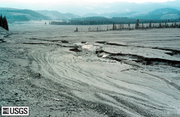
MSH80_view_downstream_from_upper_muddy_10-24-80.jpg View looking downstream from Upper Muddy. Compare with image below, showing channel erosion.
USGS Photograph taken on October 24, 1980, by Lyn Topinka.
[medium size] ...
[large size] ...
[TIF Format, 25 M]
MSH81_view_downstream_from_upper_muddy_10-10-81.jpg View looking downstream from Upper Muddy. Compare with image above, showing channel erosion.
USGS Photograph taken on October 10, 1981, by Lyn Topinka.
[medium size] ...
[large size] ...
[TIF Format, 25 M]
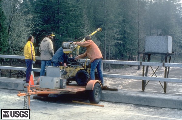
MSH81_USGS_hydrologists_measure_erosion_06-26-81.jpg U.S. Geological Survey hydrologists measured changes in erosion along
the stream channels affected by the May 18, 1980 eruption.
These measurements were used to study the erosion processes and to
estimate the severity of the sedimentation problem. The view here
is along the Muddy River drainage, approximately one mile (1.5 kilometers)
southeast of the volcano's base. Rod person (lower left) and
instrument persons (upper right) give scale.
USGS Photograph taken on June 26, 1981, by Lyn Topinka.
[medium size] ...
[large size]
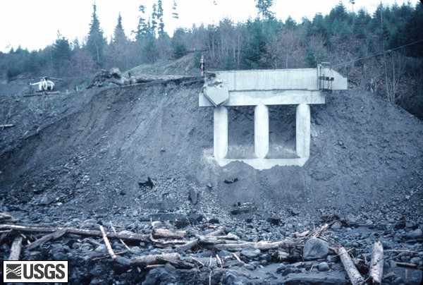
MSH80_pine_creek_bridge_remnant_10-24-80.jpg Remains of the bridge crossing the Pine Creek. Note USGS Hydrologist holding rod for cross section survey.
USGS Photograph taken on October 24, 1980, by Lyn Topinka.
[medium size] ...
[large size] ...
[TIF Format, 25 M]
MSH81_pine_creek_bridge_remnant_after_storm_03-16-81.jpg Remains of the bridge crossing the Pine Creek. The original bridge was taken out during the mudflows of May 18, 1980. The banks were further eroded during the first major floods of 1981. Compare with image above. Note USGS Hydrologist holding rod for cross section survey.
USGS Photograph taken on March 16, 1981, by Lyn Topinka.
[medium size] ...
[large size] ...
[TIF Format, 25 M]
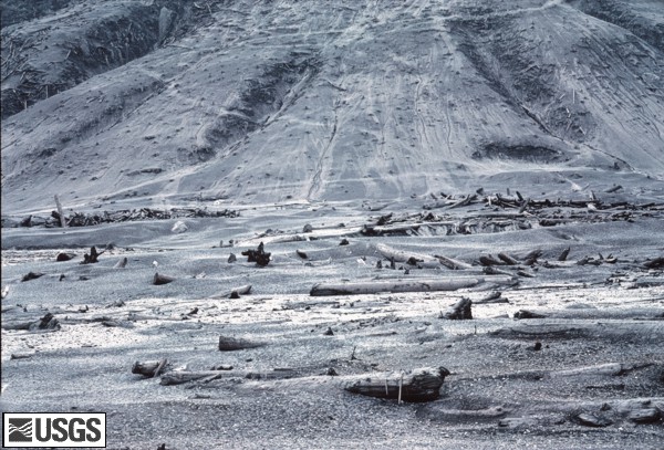
MSH80_hillslope_erosion_upper_smith_09-28-80.jpg Denuded hillslope, upper Smith Creek.
USGS Photograph taken on September 28, 1980, by Holly Martinson.
[medium size] ...
[large size] ...
[TIF Format, 25 M]
MSH81_hillslope_erosion_upper_smith_09-30-81.jpg Denuded hillslope, upper Smith Creek, one year later.
USGS Photograph taken on September 30, 1981, by Lyn Topinka.
[medium size] ...
[large size] ...
[TIF Format, 25 M]
MSH81_dredging_toutle_river_02-05-81.jpg In order to remove the May 18, 1980 sediment deposits, and to keep up with new sedimentation, the U.S. Army Corps of Engineers began a dredging program on the Toutle (shown here), the Cowlitz, and the Columbia Rivers. By 1987, nearly 140 million cubic yards (110 million meters) of material had been removed from the channels. This is enough material to build twelve lanes of highway, one-foot thick, from New York to San Francisco.
USGS Photograph taken on February 5, 1981, by Lyn Topinka.
[medium size] ...
[large size]
MSH82_bank_erosion_toutle_river_02-22-82.jpg A major problem to people living downstream of Mount St. Helens was the high sedimentation rates resulting from stream erosion of the volcanic deposits. Streams were continuously down cutting channels, eroding their banks, and eating away at the avalanche and lahar deposits. This material was eventually transported downstream and deposited on the streambeds, decreasing the carrying capacity of the channels and increasing the chances of floods.
USGS Photograph taken on February 22, 1982, by Lyn Topinka.
[medium size] ...
[large size]
MSH82_sediment_sampling_toutle_at_tower_road_12-12-82.jpg USGS hydrologists sample sediment moving down the Toutle River. View at Tower Road.
USGS Photograph taken on December 12, 1982, by Lyn Topinka.
[medium size] ...
[large size]
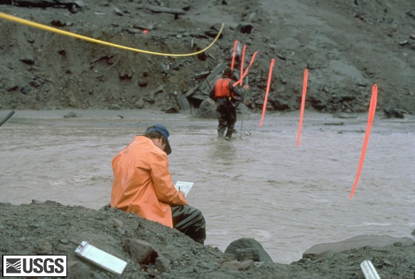
MSH85_USGS_hydrologists_sample_sediment_04-27-85.jpg Hydrologists measured stream discharge and took water samples to determine how much sediment is suspended in the stream and how much sediment is moving along the streambed.
USGS Photograph taken on April 27, 1985, by Lyn Topinka.
[medium size] ...
[large size]
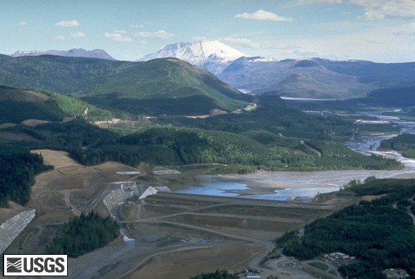
MSH89_sediment_retention_dam_toutle_river_05-89.jpg In the spring of 1987, construction of a sediment retention dam on the North Fork Toutle River began. This retention dam is designed to help stop the downstream movement of the sediment near where it begins - on the debris avalanche.
USGS Photograph taken in May 1989, by Steve Brantley.
[medium size] ...
[large size]
 Use of CVO Material and Copyright Information