click on thumbnail for "user-friendly" medium-size image ...
medium-size images are around 100 K and best for web viewing ...
large-size images are 4-8 M, scanned images, no logo, 300 dpi, 8x10 to 9x12 size, and good for printing and publication ...
MSH80_volcanic_ash_with_helicopter_08-22-80.jpg For weeks volcanic ash covered the landscape around the volcano and for several hundred miles downwind to the east. Noticeable ash fell in eleven states. The total volume of ash (before its compaction by rainfall) was approximately 0.26 cubic mile (1.01 cubic kilometers), or, enough ash to cover a football field to a depth of 150 miles (240 kilometers). In this photograph, a helicopter stirs up ash while trying to land in the devastated area.
USGS Photograph taken on August 22, 1980, by Lyn Topinka.
[medium size] ...
[large size] ...
[TIF Format, 18 M]
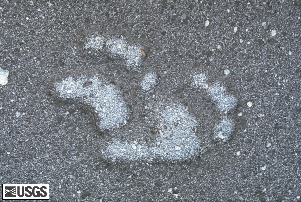
MSH80_bear_tracks_in_ash_and_pumice_october_1980.jpg Animals also made a comeback soon after the May 18, 1980 eruption. Many smaller animals, such as gophers, mice, frogs, fish, and insects were hibernating below ground or under water on May 18, 1980, and they survived the blast. Larger animals such as bear (whose tracks are shown here), elk, deer, and coyotes have been moving back into the area as their food supplies increase. A mountain goat has even been spotted high on the flanks of the volcano.
USGS Photograph taken in October 1980, by Lyn Topinka.
[medium size] ...
[large size] ...
[TIF Format, 22 M]
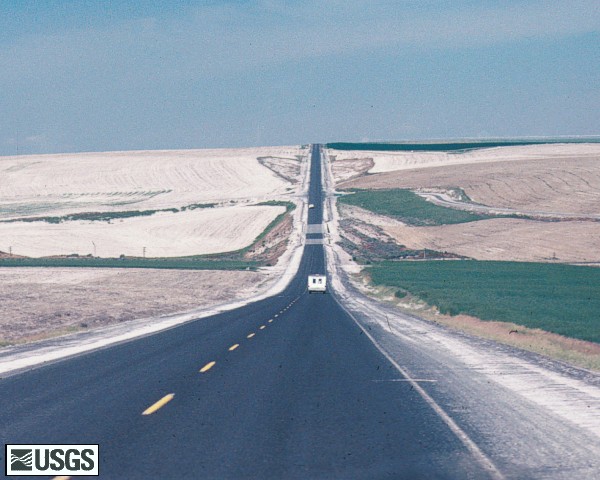
MSH80_may18_ash_road_connell_washington_06-80.jpg May 18, 1980 ash along the roadside, Connell, Washington.
USGS Photograph taken in June 1980 by Lyn Topinka.
[medium size] ...
[large size] ...
[TIF Format, 22 M]
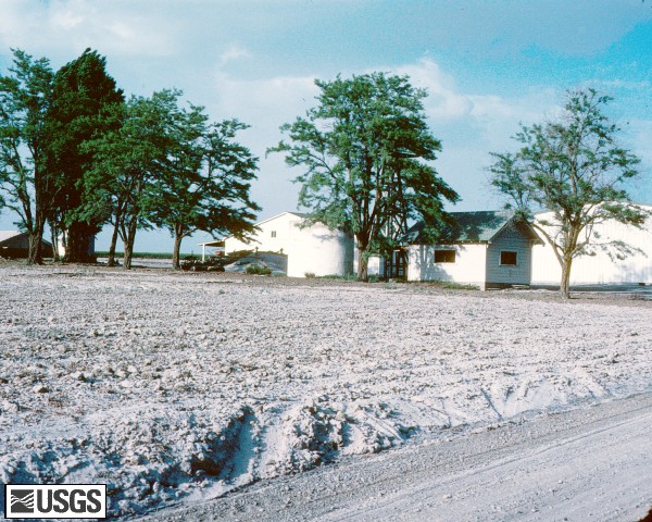
MSH80_may18_ash_connell_washington_06-80.jpg May 18, 1980 ash, Connell, Washington.
USGS Photograph taken in June 1980 by Lyn Topinka.
[medium size] ...
[large size] ...
[TIF Format, 18 M] ...
MSH80_volcanic_ash_collected_near_randle_1980s.jpg Volcanic ash collected in Randle, Washington, located about 40 km NNE of Mount St. Helens. The north edge of the May 18, 1980, eruption cloud passed over Randle and deposited between 1 and 2 centimeters of ash on the community.
USGS Photograph taken by David Wieprecht.
[medium size] ...
[large size] ...
[TIF Image, 18 M]
Miscellaneous
[Image,136K,GIF]
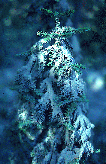
Volcanic ash blankets young evergreen.
-- USGS Photo by Lyn Topinka, 1980
 Use of CVO Material and Copyright Information


 [Image,136K,GIF]