
|
Photo Information |
 |
|
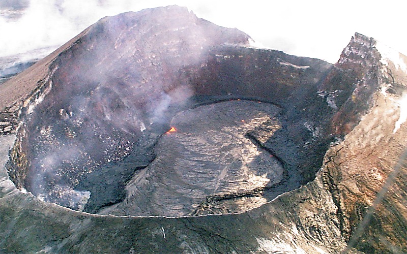
An active lava lake partially fills the crater of Pu`u `O`o. The flat terrace surrounding the
lake is about 50 m below the north rim of
the crater (right), where most ground observations of the lake are made. On September 12, magma from beneath Pu`u `O`o and the summit caldera moved into the upper east rift zone. A dike formed between Pauahi Crater and Mauna Ulu. Two days later, a small pond of lava appeared in the crater. It slowly rose, and by September 16 the lake was about 92 m below the east rim of the crater and 50-60 m in diameter. In the next week the lava rose to about 63 m below the east rim and covered much of the crater floor. The lake remained at this approximate level through October, episodically rising 10-15 m and occasionally overflowing onto the top of the adjacent terrace and resurfacing it. |
|
|
The URL of this page is http://hvo.wr.usgs.gov/gallery/kilauea/erupt/19990925-4200_caption.html