Introduction
Weather threatens surface transportation nationwide and
impacts roadway safety, mobility, and productivity. Weather affects roadway safety through increased crash risk, as
well as exposure to weather-related hazards.
Weather impacts roadway mobility by increasing travel time delay,
reducing traffic volumes and speeds, increasing speed variance (i.e., a measure
of speed uniformity), and decreasing roadway capacity (i.e., maximum rate at
which vehicles can travel). Weather events influence productivity by disrupting
access to road networks, and increasing road operating and maintenance costs.
There is a perception that transportation managers can do
little about weather. However, three
types of road weather management strategies may be employed in response to
environmental threats: advisory, control, and treatment Strategies. Advisory strategies provide information on
prevailing and predicted conditions to both transportation managers and
motorists. Control strategies alter the
state of roadway devices to permit or restrict traffic flow and regulate
roadway capacity. Treatment strategies supply resources to roadways to minimize
or eliminate weather impacts. Many
treatment strategies involve coordination of traffic, maintenance, and
emergency management agencies. These mitigation
strategies are employed in response to various weather threats including fog,
high winds, snow, rain, ice, flooding, tornadoes, hurricanes, and
avalanches.
This report contains 30 case studies of systems in 21 states that improve roadway operations under inclement weather conditions. Each case study has six sections including a general description of the system, system components, operational procedures, resulting transportation outcomes, implementation issues, as well as contact information and references.
Appendix A presents an overview of environmental sensor
technologies. Appendix B is an acronym
list. Appendix C contains online
resources, including 39 statewide road condition web sites. In Appendix D hundreds of road weather
publication titles, abstracts and sources are tabulated.
Alabama DOT Low
Visibility Warning System
In March 1995 a fog-related crash involving 193 vehicles
occurred on the seven-mile (11.3-kilometer) Bay Bridge on Interstate 10. This crash prompted the Alabama Department
of Transportation (DOT) to deploy a low visibility warning system. The warning system was integrated with a
tunnel management system near Mobile, Alabama.
System
Components: Six sensors with
forward-scatter technology are used to measure visibility distance. The visibility sensors are installed at
roughly one-mile (1.6-kilometer) intervals along the bridge. Traffic flow is monitored with a Closed
Circuit Television (CCTV) surveillance system. Video from 25 CCTV cameras is displayed on monitors in the
tunnel control room. Field sensor data
are transmitted to a central computer in the control room via a fiber optic
cable communication system. The
computer controls 24 Variable Speed Limit (VSL) signs and five Dynamic Message
Signs (DMS), which are used to display advisories or regulations to motorists.
System
Operations: Two system
operators staff the tunnel control room 24 hours a day. When fog is observed via CCTV operators
consult the central computer, which displays visibility sensor measurements by
zone. The warning system is divided
into six zones which can operate independently. Depending on visibility conditions in each zone, operators may
display messages on DMS and alter speed limits with VSL signs (as shown in
Table 1).
Table 1 – Alabama DOT Low Visibility Warning System
Strategies
|
Visibility
Distance |
Advisories
on DMS |
Other
Strategies |
|
Less than
900 feet (274.3 meters) |
“FOG
WARNING” |
Speed limit at 65 mph (104.5 kph) |
|
Less than
660 feet (201.2 meters) |
“FOG”
alternating with “SLOW, USE LOW BEAMS” |
·
“55 MPH” (88.4 kph)
on VSL signs ·
“TRUCKS KEEP RIGHT”
on DMS |
|
Less than
450 feet (137.2 meters) |
“FOG”
alternating with “SLOW, USE LOW BEAMS” |
· “45 MPH”
(72.4 kph) on VSL signs · “TRUCKS KEEP
RIGHT” on DMS |
|
Less than
280 feet (85.3 meters) |
“DENSE FOG”
alternating with “SLOW, USE LOW BEAMS” |
· “35 MPH”
(56.3 kph) on VSL signs · “TRUCKS KEEP
RIGHT” on DMS · Street
lighting extinguished |
|
Less than
175 feet (53.3 meters) |
I-10 CLOSED,
KEEP RIGHT, EXIT ½ MILE |
Road Closure by Highway Patrol |
When the speed limit is reduced, notices are automatically
faxed to the DOT Division Office, the Highway Patrol, and local law enforcement
agencies in Mobile and neighboring jurisdictions (i.e., Daphne and Spanish
Ford). If necessary, system operators
request that the Highway Patrol utilize vehicle guidance to further reduce
traffic speeds. During vehicle guidance operations a patrol vehicle with flashing
lights leads traffic across the bridge at a safe speed.
Transportation
Outcome: Although
labor-intensive, the warning system has improved safety by reducing average
speed and minimizing crash risk in low visibility conditions.
Implementation
Issues: The original
system design included a vehicle detection subsystem, backscatter visibility
sensors, and automated activation of signs.
Bridge deck construction precluded the installation of inductive loop
detectors and vibration prevented the use of microwave vehicle detectors. Thus, the vehicle detection subsystem had to
be eliminated. Visibility sensors with
backscatter technology were deployed along the bridge in Fall 1999. However, problems with accuracy and
reliability caused the DOT to replace them with forward-scatter visibility
sensors in 2000.
The tunnel control room was modified to incorporate
monitoring and control functions for the warning system, which began operating
in September 2000. By 2004, control of
the warning system will be transferred to a new Traffic Management Center that
is currently under construction.
Contact(s):
·
Gerald Criswell,
Alabama DOT, Tunnel Maintenance Supervisor, 251-432-4069, criswellg@dot.state.al.us.
·
M. R. Davis, Alabama
DOT, Division Maintenance Engineer,
251-470-8230, davisr@dot.state.al.us
Reference(s):
·
Schreiner, C., “State
of the Practice and Review of the Literature: Survey of Fog Countermeasures Planned
or in Use by Other States,” Virginia Tech Research Council, October 2000.
·
U.S. DOT, “Mobile,
Alabama Fog Detection System,” 2001 Intelligent Transportation Systems (ITS)
Projects Book, FHWA, ITS Joint Program Office.
Keyword(s): fog,
visibility, low visibility warning system, freeway management, speed
management, traffic management, law enforcement, traveler information, advisory
strategy, traffic control, control strategy, bridge, lighting, high-profile
vehicles, motorist warning system, closed circuit television (CCTV), dynamic
message sign (DMS), institutional issues, speed, safety
California DOT Motorist
Warning System
Freeways
in the Stockton-Manteca area of San Joaquin County, California are prone to low
visibility conditions. Visibility is reduced
by wind-blown dust in the summer and dense, localized fog in the winter. In the past low visibility has contributed
to numerous chain-reaction collisions in the San Joaquin Valley. To improve roadway safety on southbound
Interstate 5 and westbound State Route 120, the California Department of
Transportation (DOT)—also known as Caltrans—implemented an automated system to
warn motorists of driving hazards.
System Components: Traffic and
weather data are collected from 36 vehicle detection sites and nine
Environmental Sensor Stations (ESS) deployed along the freeways, as shown in
Figure 1. Detection sites are comprised
of paired inductive loop detectors and Caltrans Type 170 controllers, which run
software with speed measurement algorithms.
Each ESS includes a rain gauge, a forward-scatter visibility sensor,
wind speed and direction sensors, a relative humidity sensor, a thermometer, a barometer, and a remote processing unit. Traffic and environmental data are
transmitted from the field to a networked computer system in the Stockton
Traffic Management Center (TMC) via dedicated, leased telephone lines. The central computer system automatically
displays advisories on nine roadside Dynamic Message Signs (DMS).
System Operations: Three central computers
control operation of the motorist warning system. A meteorological monitoring computer records and displays ESS
data. A traffic monitoring computer
uses a program developed by Caltrans operations staff to record, process, and
display traffic volume and speed data.
Through interfaces with the monitoring computers, a DMS control computer
accesses environmental and average speed data to assess driving
conditions. Based upon established
thresholds for vehicle speed, visibility distance, and wind speed; proprietary
control software automatically selects and displays warnings on DMS as shown in
Table 2. TMC operators also have the
capability to manually override messages selected by the system.
Table 2 – California DOT Motorist Warning System Messages
|
Conditions |
Displayed Message |
|
Average speed between 11 and 35 mph
(56.3 kph) |
“SLOW TRAFFIC AHEAD” |
|
Average speed less than 11 mph (17.7
kph) |
“STOPPED TRAFFIC AHEAD” |
|
“FOGGY CONDITIONS AHEAD” |
|
|
Visibility distance less than 200
feet (61.0 meters) |
“DENSE FOG AHEAD” |
|
Wind speed greater than 35 mph |
“HIGH WIND WARNING” |
When visibility falls
below 200 feet these advisory strategies are supplemented by vehicle guidance
operations carried out by the Department of Emergency Management. On major freeway routes, California Highway
Patrol officers use flashing amber lights atop patrol vehicles to group traffic
into platoons, which are lead at a safe pace (typically 50 mph or 80.4 kph)
through areas with low visibility.
Transportation Outcome: The motorist warning system improved highway safety by
significantly reducing the frequency of low-visibility crashes. Nineteen fog-related crashes occurred in the
four-year period before the system was deployed. Since the system was activated in November 1996, there have been
no fog-related crashes. Vehicle
guidance operations improve also safety by minimizing crash risk.
Implementation Issues: Designers considered
local conditions and potential safety benefits to assess the feasibility of a
warning system. Limited sight
distances, converging traffic patterns, and frequent low visibility events
factored into the decision to deploy a motorist warning system on selected freeways. These factors also guided development of
system requirements. The system had to
have the capability to continuously and automatically collect, process, and
display information. System designers
examined historical crash data to establish a baseline for evaluation of the
motorist warning system.
System
components include commercially available products as well as hardware and
software developed by Caltrans operations staff. The meteorological monitoring system was procured as a turnkey
solution. The ESS manufacturer
installed field devices, the monitoring computer, and proprietary processing
software. Caltrans personnel designed
and installed the traffic monitoring and DMS control components using
standardized and commercial off-the-shelf products to minimize procurement
costs and deployment time. Because
display technologies had to be visible in adverse conditions, incandescent DMS
were selected based upon their readability in low visibility conditions. After system elements were procured,
installed, and calibrated operational procedures were developed, maintenance
schedules and contracts were arranged, and traffic operations personnel were
trained.
Future
system expansion was taken into account by designers. Anticipated enhancements include the integration of the
monitoring and control computers into a single workstation, incorporation of a
Closed Circuit Television surveillance system for visual verification of
roadway conditions, inclusion of a Highway Advisory Radio system to supplement
visual warning messages, and testing of Variable Speed Limits and pavement
lights. An interface to the California
Highway Patrol information system is also expected.
Contact(s):
·
Clint Gregory,
Caltrans District 10, Electrical Systems Branch Chief, 209-948-7449, clint_gregory@dot.ca.gov.
·
Ted Montez,
California Highway Patrol, Public Information Officer, 209-943-8666, tmontez@chp.ca.gov.
Reference(s):
·
Fitzenberger, J., “A
Way Through the Fog,” The Fresno Bee, January 5, 2003, http://www.fresnobee.com/local/story/5803504p-6771912c.html.
·
MacCarley, A.,
“Evaluation of Caltrans District 10 Automated Warning System: Year Two Progress
Report,” California PATH Research Report UCB-ITS-PRR-99-28, August 1999, http://www.path.berkeley.edu/PATH/Publications/PDF/PRR/99/PRR-99-28.pdf.
·
Schreiner, C., “State
of the Practice and Review of the Literature: Survey of Fog Countermeasures
Planned or in Use by Other States,” Virginia Tech Research Council, pp. 3-4,
October 2000.
·
Spradling, R.,
“Operation Fog,” Caltrans District 10 Press Release, October 2001, http://www.dot.ca.gov/dist10/pr01.htm.
·
URS BRW, “San Joaquin
Valley Intelligent Transportation System (ITS) Strategic Deployment Plan:
Working Paper #1,” January 2001 http://www.mcag.cog.ca.us/sjvits/pages/..%5CPDF%20Files%5CWorking%20Paper%20No1.pdf.
Keywords:
fog, dust,
wind, visibility, motorist warning system, freeway management, traffic management,
emergency management, law enforcement, advisory strategy, traveler information,
vehicle guidance, control strategy, vehicle detection, environmental sensor
station (ESS), dynamic message signs (DMS), safety
City of Palo Alto, California Flood Warning System
In
February 1998 several days of heavy rainfall caused the San Francisquito creek
to overflow its banks flooding the City of Palo Alto, California. City residents and emergency managers had no
advanced warning of the flood. This
event prompted the City to develop a flood warning system. This web-based system has become an integral
part of the City’s emergency management operations. When flood conditions exist, emergency managers utilize automated
surveillance techniques to supply information to the public.
System Components: Water level
sensors, a rain gauge, flood basin detectors, tide monitors, and a Closed
Circuit Television camera are used to assess field conditions. Ultrasonic sensors were installed at five
bridge locations to detect high water or flood conditions. The ultrasonic water level sensors use
acoustics or sound waves to measure the distance from a transducer to the water
surface. Water level readings are
transmitted to the water, gas, and storm drain Supervisory Control and Data
Acquisition (SCADA) system via the City's telephone and radio communication
networks. A Digital Subscriber Line
transmits still video images from one bridge site to the Emergency Operations
Center (EOC).
System Operations: Real-time and
historical water level data and video images are posted on the City’s “Creek
Level Monitor” web site for viewing at the EOC and by Palo Alto residents (see
Figure 2). Current water level, 12-hour
water level trend, 24-hour rainfall, annual rainfall, current temperature, and
tidal data are updated every minute on the SCADA system computer and posted on
the server for website updates every three minutes.
Emergency
managers access this information to plan response actions and to alert
residents. In the event of a flood
threat, an automatic telephone warning system at the EOC dials all City
residents and businesses in threatened areas to advise of potential flood
conditions.
Transportation Outcome: Prior to installation of the flood warning system,
emergency management personnel traveled to bridge locations to visually monitor
the storm drain system and physically check water levels. Drain system status and water level readings
were radioed to the EOC every 20 minutes.
By eliminating the need for field measurements, the monitoring system
has enhanced the productivity of City staff and provided timely access to
traveler information to improve public safety.
City residents may utilize information to make travel and safety
decisions.
Implementation Issues: The warning system
project was initiated due to resident complaints following the 1998 flood. The Public Works Operations department
conducted a study of the City’s bridge locations and wireline communication
systems, assessed sensor technologies, and deduced that water level sensors
could be deployed and integrated with the existing SCADA system. Non-intrusive sensors were selected over
other technologies (e.g., pressure transmitters, bubblers, floats) due to
concerns about floating or submerged debris that could damage equipment placed
in the creeks.
The original intent of the system was to furnish emergency managers with precipitation and hydrologic data, which would serve as decision support for providing information to the public. After determining hardware, software, and interface requirements system designers decided to add the web-based information dissemination feature to better serve city residents.
Contact(s):
·
John Ballard; City of
Palo Alto, California; Public Works Operations; 650-496-5935.
References:
·
Kulisch, E., “System Monitors Flood-prone Creeks”, www.civic.com/civic/articles/2001/0122/web-flood-01-26-01.asp
·
City of Palo Alto,
“Creek Level Monitor Website: How Do We Do It?” http://www.city.palo-alto.ca.us/earlywarning/how.html.
Keywords:
rain,
flooding, flood warning system, emergency management, traveler information,
advisory strategy, bridge, remote sensing, closed circuit television (CCTV),
internet/web site, safety, productivity
City of Aurora, Colorado Maintenance Vehicle Management System
In 1998 the City of Aurora, Colorado deployed a system to
monitor the operation of maintenance vehicles, including snowplows and street
sweepers. The system has facilitated
real-time communication between maintenance managers and vehicle drivers,
enhanced productivity, and improved public relations.
System Components: The maintenance vehicle management system is
comprised of in-vehicle devices, central control systems, and a wireless
communication system. Twenty snowplows
are equipped with integrated display, messaging and communication devices. With these in-vehicle devices, text messages
can be entered with a keypad, displayed to drivers, and transmitted between
maintenance vehicles and central computers via a Cellular Digital Packet Data
modem. These devices send position data to a central computer every 20 seconds. Each in-vehicle device (shown in Figure 3)
also includes an interface to vehicle systems and a Global Positioning System
receiver, which is used to automatically track equipment status and vehicle
location from control computers in two central facilities.
System Operations: Central control systems allow maintenance
managers to transmit pre-programmed or customized messages to a single plow, a
selected group of plows, or all snowplows.
Managers can monitor road treatment activities with a map display of
snowplow locations to assess which routes have been serviced, determine when a
plow is off of its designated route, and plan route diversions as needed. The status of vehicle systems may also be
monitored to ascertain plow position (i.e., plow up or down) and to determine
when treatment materials are being dispensed (i.e., spreader on or off. The management system is utilized for
treatment strategy planning, real-time operations monitoring, and post-event
analysis.
Transportation Outcome: By using the management system to track
maintenance vehicles, managers have minimized treatment costs and improved
productivity by 12 percent.
Additionally, managers can easily access the system and provide accurate
information to citizens who call the City to inquire about plowing of a
particular street.
Implementation Issues: The City contracted with a private vendor to
furnish and install in-vehicle and central components of the management
system. System deployment was expedited
by involving the City’s information systems staff in planning and design, and
by hiring a local system integrator to resolve compatibility issues related to
the various component and communications providers.
Contact(s):
·
Lynne Center; City of
Aurora, Colorado Public Works Department, 303-326-8200,
Reference(s):
·
Beneski, B.,
“Orbital’s Satellite-Based Vehicle Tracking System Selected by Aurora,
Colorado,” Orbital Sciences Corporation Press Release, July 1998,
·
Anderson, E. and
Nyman, J., “Southeast Michigan Snow and Ice Management (SEMSIM): Final
Evaluation at End of Winter Season Year 2000,” prepared for the Road Commission
of Oakland County, September 2000.
Keywords: winter storm, snow, ice, maintenance vehicle
management system, winter maintenance, treatment strategy, advisory strategy,
maintenance vehicle, productivity
Florida DOT Motorist Warning System
The
tropical climate in south Florida typically causes heavy rainfall in the
afternoon. A Florida Department of
Transportation (DOT) study of the Florida Turnpike/Interstate 595 interchange
found that 69 percent of crashes on a two-lane, exit ramp occurred when the
pavement was wet and that only 44 percent of these wet-pavement crashes
happened when it was raining. The
wet-pavement crash rate on this ramp was three times higher than the national
average and nearly four times greater than the statewide average. To demonstrate how advanced warning of the
safe travel speed under wet pavement conditions can reduce crash risk, the DOT
installed an automated motorist warning system on the ramp, which has a sharp
curve and an upgrade.
System Components: As shown in Figure
4, a sensor embedded in the road surface was used to monitor pavement condition
(i.e., dry or wet). On a pole adjacent to
the ramp, a microwave vehicle detector was installed to record traffic volume
and vehicle speed, and a precipitation sensor was mounted to verify rainfall
events. A pole-mounted enclosure housed
a remote processing unit (RPU), which was hard-wired to flashing beacons atop
static speed limit signs. A dedicated
telephone line was also connected to the RPU to facilitate data retrieval from
an Internet server in the turnpike operations center located in Pompano Beach.
System Operations: The RPU collected,
processed, and stored traffic and pavement data from the sensors. When pavement moisture was detected, the RPU
activated the flashing beacons to alert motorists that speeds should not exceed
the posted limit of 35 mph (56.3 kph).
Transportation Outcome: The warning system
improved safety by reducing vehicle speeds and promoting more uniform traffic
flow when the ramp was wet. In light
rain conditions, the 85th
percentile speed decreased by eight percent from 49 to 45 mph (78.8 to
72.4 kph). During heavy rain, there
was a 20 percent decline in 85th percentile speed from 49 to 39 mph
(78.8 to 62.7 kph). Speed variance was
reduced from 6.7 to 5.7 mph (10.8 to 9.2 kph) in light rain and from 6.1 to 5.6
mph (9.8 to 9.0 kph) in heavy rain.
Thus, speed variance decreased by eight to 15 percent, minimizing crash
risk. Four crashes occurred during the
first week of warning system activation.
Three happened when the pavement was wet and one occurred during
rainfall. After this initial week,
there were no reported crashes the during nine-week evaluation period.
Implementation Issues: The
DOT evaluated the geometry, road surface conditions, and crash history of the
ramp, which had the highest travel speeds and the highest crash rate of all the
ramps in the interchange. It was
concluded that wet pavement and excessive travel speeds were the primary
factors contributing to run-off-the-road crashes that occurred at the beginning
of the sharp ramp curve. These conditions warranted the development and demonstration
of a motorist warning system. The
demonstration project was a joint effort of the Florida DOT, the University of
South Florida, and a private vendor.
The
DOT erected a 25-foot (7.6-meter) equipment mounting pole 8 feet (2.4 meters)
from the edge of the travel lane, installed flashing beacons on two existing
ramp signs, and arranged power and telephone service connections. The pole was installed approximately 180
feet (55 meters) in advance of the speed limit signs. The vendor furnished and installed field sensors, the RPU, and
the Internet server. The pavement
sensor was installed at the lowest elevation point of the ramp.
After
installation, the project partners verified the accuracy and reliability of
system components. Vehicle detector data accuracy was validated by comparing
speed measurements with those from a hand-held radar gun. The private vendor calibrated the dry-wet
threshold of the pavement sensor. Beacon
activation by the RPU and field data downloading to the turnpike operations
center were successfully tested.
Through the server, the University retrieved pavement condition, speed,
and volume data at one-minute intervals to evaluate system performance before
and after activation.
Contact(s):
·
Michael Pietrzyk,
University of South Florida, Center for Urban Transportation Research (CUTR),
813-974-9815, pietrzyk@cutr.eng.usf.edu.
Reference(s):
·
Pietrzyk, M., “Are
Simplistic Weather-Related Motorist Warning Systems ‘All Wet’?”, University of
South Florida, presented at the Institute of Transportation Engineers (ITE)
Annual Meeting, August 2000.
·
Collins, J. and
Pietrzyk, M., ”Wet and Wild: Developing and Evaluating an Automated Wet
Pavement Motorist System,” Kimley-Horn and Associates, presented at the
Transportation Research Board (TRB) Annual Meeting, January 2001.
Keywords:
rain,
pavement condition, pavement friction, motorist warning system, freeway
management, traffic management, advisory strategy, pavement sensor, vehicle
detection, speed, driver behavior, crashes, safety
City of Clearwater, Florida Weather-Related Signal
Timing
The
City of Clearwater, Florida operates a computerized traffic control system with
145 signals. City traffic managers have
developed a unique rain preemption feature that modifies signal timing during
rain events to clear traffic from Clearwater Beach, which is a prime
destination for tourists visiting Orlando and Tampa Bay. Thunderstorms typically occur in the
afternoon, causing significant sudden increases in traffic exiting the beach
via the Memorial Causeway (i.e., State Route 60), which is shown in Figure
5.
System Components: An electric rain
gauge is mounted on top of a traffic signal
pole near the beach and
connected to the signal controller.
Vehicle detectors on the causeway are used to measure the length of
traffic queues on inbound lanes. A twisted pair cable communication system
connects the rain gauge, vehicle detectors, and controllers to a signal system
computer at the City’s Traffic Operations Center (TOC).
System Operations: During peak beach
hours, the central computer activates the rain gauge with a time-of-day
command. When
the rain gauge senses a predetermined rainfall amount, the signal system
computer issues a preemption command to 14 downtown traffic signals along the
Route 60 corridor. These signal
controllers execute new timing plans with longer green times for inbound
approaches. The computer selects the appropriate timing plan based upon traffic
volumes. When the volume returns to normal levels, the central computer
restores normal signal timing plans.
Transportation Outcome: By modifying traffic signal timing in response to rain
events, the signal system computer prevents traffic congestion and enhances
roadway mobility.
Implementation Issues: The City of
Clearwater was one of the first jurisdictions to deploy an Urban Traffic
Control System (UTCS) with the assistance of federal funds. The UTCS included preemption features for
drawbridges and railroad crossings.
City personnel assessed localized conditions, observed driver behavior
during thunderstorms, and determined that a similar feature could be
implemented for rain events affecting Clearwater Beach. The City’s signal technicians installed a
commercially available rain gauge at an intersection that is adjacent to a
parking garage used by beach visitors.
The signal system engineer modified existing UTCS preemption algorithms
to alter signal timing based upon rainfall and traffic volume data.
In 2003 the City’s central UTCS will be upgraded from a mainframe computer system to a PC-based system to support adaptive signal control as part of a county-wide, federally-funded Congestion Mitigation and Air Quality project. Closed Circuit Television cameras and Dynamic Message Signs will also be installed on the City’s primary corridors to facilitate more efficient incident management and timely dissemination of traveler information. Pinellas County will operate a TOC and utilize a Wide Area Network to facilitate data sharing between the county TOC and TOCs located in the cities of Clearwater and St. Petersburg.
Contact(s):
·
Paul Bertels; City of
Clearwater, Traffic Operations Manager; 727-562-4794; pbertels@clearwater-fl.com.
·
Glen Weaver; City of
Clearwater, Signal System Engineer; 727-562-4794.
Reference(s):
·
Andrus, D., et al, “Rain Detection for Traffic Control,”
International Municipal Signal Association (IMSA) Journal, Volume 3, Issue 4,
p. 16, July 1994.
·
City of Clearwater, Florida Web Site, http://www.clearwater-fl.com/.
·
USDOT, “ITS Improvements for the City of Clearwater,”
2002 Intelligent Transportation Systems (ITS) Projects Book, FHWA, ITS
Joint Program Office, http://www.itsdocs.fhwa.dot.gov//jpodocs/repts_te/13631/ttm-348html.
Keywords: rain, weather-related signal timing, arterial management, traffic
management, traffic control, control strategy, vehicle detection, volume,
mobility
Idaho DOT Anti-Icing/Deicing Operations
In
1996 maintenance managers with the Idaho Department of Transportation (DOT)
began an anti-icing program on a 29-mile (47-kilometer) section of US Route
12. This highway segment is located in
a deep canyon and is highly prone to snowfall and pavement frost (i.e., black
ice) due to sharp curves and shaded areas.
An anti-icing chemical is applied to road surfaces as an alternative to
spreading high quantities of abrasives.
Abrasives are thrown to the roadside by passing vehicles and only
improve roadway traction temporarily.
System Components: Winter maintenance
managers modified maintenance vehicles for use in anti-icing operations and
installed chemical storage tanks. As
shown in Figure 6A, trucks with 1,000-gallon (3,785-liter) and 1,500-gallon
(5,678-liter) tanks were equipped with spray controls to dispense liquid
magnesium chloride. A chemical storage facility with two 6,900-gallon
(26,117-liter) storage tanks and an electric pump for chemical circulation and
truck loading was located in the Orofino maintenance yard (see Figure 6B).
System Operations: Maintenance managers utilize the Internet to access
weather forecast data and identify threatening winter storms or frost
events. When an impending threat is
predicted, maintenance vehicles are deployed to spray small amounts of the
anti-icing chemical on road surfaces before snowfall begins or frost forms. Chemical application rates vary from ten to
50 gallons (37.9 to 189.3 liters) per lane mile, depending on the nature and
magnitude of the threat. Maintenance
crews regularly check four “indicator areas” along the highway to determine
when frost on shoulder lanes begins to migrate into travel lanes. The status of these areas indicates that the
road should be retreated to ensure that chemical concentrations are high enough
to prevent freezing.
Transportation Outcome: To assess the
effectiveness of anti-icing operations, winter road maintenance activities were
analyzed for five years prior to the anti-icing program and for three years
after implementation. Annual averages
of abrasive quantities, labor hours, and winter crashes are shown in Table 3.
Table 3 – Idaho DOT Winter
Maintenance Performance Measures
(Annual Averages)
|
|
1992 to 1997 (Without Anti-Icing) |
1997 to 2000 (With Anti-Icing) |
Percent Reduction |
|
1,929 cubic
yards (1,475 cubic meters) |
323 cubic
yards (247 cubic
meters) |
83% |
|
|
Labor
Hours |
650 |
248 |
62% |
|
Number
of Crashes |
16.2 |
2.7 |
83% |
Mobility,
productivity, and safety enhancements resulted from the anti-icing treatment
strategy. Mobility was improved, as a
single application of magnesium chloride was typically effective at improving
traction for three to seven days—depending on precipitation, pavement
temperature, and humidity. Faster
clearing of snow and ice reduced operation costs and enhanced
productivity. Safety improvements were realized
by reducing the frequency of wintertime crashes.
Implementation Issues: Maintenance managers selected the US Route
12 segment for their anti-icing pilot program due to the high crash rate and
high maintenance costs. Relatively mild
winter temperatures, hazardous winter road conditions, and moderate traffic
volumes also made this roadway a good candidate for anti-icing operations.
Other
Idaho DOT maintenance districts had successful anti-icing programs. By consulting other districts and assessing
existing vehicles, managers developed treatment equipment requirements. Trucks, previously used to spray
weed-killing and other chemicals, were modified to dispense liquid magnesium
chloride. After configuring the
treatment equipment, crews were trained in all aspects of anti-icing procedures. They learned about various anti-icing
chemicals and their properties, chemical application criteria and rates,
equipment operation, and progress tracking.
As a result of the successful pilot program, anti-icing was expanded to
other highways in District 2 and throughout the state.
Contact(s):
·
Bryon Breen,
Assistant Maintenance Engineer, 208-334-8417, bbreen@itd.state.id.us.
Reference(s):
·
Breen, B. D., “Anti Icing Success Fuels Expansion of the
Program in Idaho,” Idaho Transportation Department, March 2001.
Keywords:
snow, ice,
winter storm, anti-icing/deicing operations, freeway management, winter
maintenance, treatment strategy, internet/web site, forecasts, weather
information, maintenance vehicle, chemicals, crashes, mobility, productivity,
safety
Idaho DOT
Motorist Warning System
The
Idaho Department of Transportation (DOT) installed a motorist warning system on
a 100-mile (161-kilometer) section of Interstate 84 in southeast Idaho and
northwest Utah. This road segment was
highly prone to multi-vehicle crashes when blowing snow or dust reduced
visibility. From 1988 to 1993, poor
visibility contributed to 18 major crashes involving 91 vehicles, 46 injuries,
and nine fatalities. While the
proportion of trucks on this rural freeway was 33 percent, the percentage of
trucks in these crashes was 44 percent.
Traffic managers display advisory messages to motorists to influence
driver behavior under adverse conditions.
System Components: Road, weather, and
traffic condition data are collected by sensor systems and transmitted to a
central computer. Environmental Sensor
Stations (ESS) detect pavement condition (i.e., dry, wet, or snow-covered),
wind speed and direction, precipitation type and rate, air temperature, and
relative humidity. Sensors with
forward-scatter detection technology measure visibility distance (see Figure
7). Inductive loop detectors record
vehicle length (i.e., passenger car or truck), vehicle speed, and travel
lane. Warnings of adverse conditions
are posted on four roadside Dynamic Message Signs (DMS).
System Operations: The central
computer records sensor readings every five minutes. When field sensor data indicates that visibility has fallen below
a predetermined threshold or that driving conditions are deteriorating, the
computer in the Port of Entry control center alerts traffic managers. Based upon prevailing road conditions,
traffic managers decide which messages to display and manually activate DMS.
Transportation Outcome: A system
evaluation conducted from 1993 to 2000 assessed changes in driver behavior due
to road condition data displayed on DMS.
The evaluation compared traffic speeds with advisories to speeds without
warnings. When traffic managers
displayed condition data during high winds (i.e., over 20 mph or 32.2 kph),
average speed variance was reduced and average vehicle speed decreased by 23
percent from 54.8 to 42.3 mph (88.1 to 68.0 kph). When high winds occurred simultaneously with moderate to heavy
precipitation, average speeds were 12 percent lower. Under these conditions, mean speeds were 47.0 mph (75.6 kph)
without advisory information and 41.2 mph (66.2 kph) with warning
messages. A 35-percent decline in
average vehicle speed occurred when the pavement was snow-covered, wind speeds
were high, and warnings were displayed.
Average speeds fell from 54.7 to 35.4 mph (87.9 to 56.9 kph). Advisory information presented by traffic
managers prompted changes in driver behavior, improving safety and mobility.
Implementation Issues: After determining
that a motorist warning system was warranted based upon local traffic patterns,
weather conditions, and crash history; traffic managers assessed three
different types of visibility sensors.
Tests were conducted to determine the accuracy of visibility
measurements in a rural setting and to select the most reliable and cost
effective sensor. System operators used
a Closed Circuit Television (CCTV) surveillance system to evaluate visibility
sensors.
A
CCTV camera was pointed at five roadside target signs equipped with flashing
lights. The target signs were
positioned along the interstate at known distances from the camera (i.e., 250,
500, 850, 1,200, and 1,500 feet or 76, 152, 259, 366, and 457 meters). Actual roadway conditions were confirmed by
viewing video images of target signs.
After field sensors were selected, their locations were determined and
power supply and communications systems were designed. To ensure that weather and traffic data was
collected at the same location, ESS were installed within a few hundred feet of
the vehicle detection sites.
System
integration issues arose due to the various field data types and formats,
hardware and software incompatibility, as well as communication system and
power system failures. For example, the
software used to control two of the DMS was not compatible with the central
computer. Because leased telephone
lines in this rural area were not reliable for transmission of sensor data at
the desired frequency, a dedicated telephone cable was installed from the
system location to the control center.
Power supply reliability was also a concern. Numerous power outages, shortages, and surges damaged field and
central components. Uninterruptible
power supplies were installed to address these problems.
In
the future the Idaho DOT plans to upgrade obsolete field hardware (e.g., DMS
with rotating drum technology) and the central control system (e.g., replacing
DOS-based software). Other enhancements
may include the deployment of addition DMS and a Variable Speed Limit system.
Contact(s):
·
Bob Koeberlein, Idaho
Transportation Department, ITS Program Manager, 208-334-8487, rkoeberl@itd.state.id.us.
·
Bruce Christensen,
Idaho Transportation Department, District 4 Traffic Engineer, 208-886-7860, bchriste@itd.state.id.us.
·
Clyde Dwight, Idaho
Transportation Department, Information Technology Systems Coordinator,
208-886-7820, cdwight@itd.state.id.us.
Reference(s):
·
Booz-Allen &
Hamilton, “Intelligent Transportation Systems Compendium of Field Operational
Test Executive Summaries,” FHWA Turner-Fairbank Highway Research Center, http://www.its.dot.gov/new/optest.pdf.
·
Kyte, M., et al,
“Idaho Storm Warning System Operational Test - Final Report,” prepared for the
Idaho Transportation Department, ITD No. IVH9316 (601), December 2000, http://www.itsdocs.fhwa.dot.gov/jpodocs/repts_te/@cc01!.pdf.
·
Robinson, M., et al,
“Safety Applications of ITS in Rural Areas,” prepared by Science Applications
International Corporation (SAIC) for FHWA, September 2002, http://www.itsdocs.fhwa.dot.gov//JPODOCS/REPTS_TE//4_2_1.htm.
Keywords: visibility, dust, wind,
precipitation, snow, motorist warning system, freeway management, traffic
management, advisory strategy, traveler information, vehicle detection,
environmental sensor station (ESS), dynamic message signs (DMS), closed circuit
television (CCTV), driver behavior, speed, safety, mobility
Michigan Maintenance Vehicle Management System
Four road maintenance agencies and a regional transit
authority worked together to implement a management system for maintenance
vehicles in southeastern Michigan.
Partners include the City of Detroit Department of Public Works, the
Road Commission for Oakland County, the Road Commission of Macomb County, the
Wayne County Department of Public Services, and the Suburban Mobility Authority
for Regional Transportation. The four
agencies, who maintain over 15,000 road miles in the region, formed the
Southeast Michigan Snow and Ice Management (SEMSIM) partnership in 1998.
System
Components: The maintenance vehicle management system consists of
snowplow systems, a communication system, and central systems. Snowplow systems include sensors, automated
controls, and in-vehicle devices.
Environmental sensors are mounted on snowplows to record air temperature
and pavement temperature. Vehicle
status sensors monitor the position of each snowplow (i.e., location, direction
and speed), plow position (i.e., up/down), and material application (i.e., salt
on/off, application rate). Each
maintenance vehicle, shown in Figure 8, has automated application
controls. Computerized salt spreaders
automatically adjust the application rate based upon the speed of the
snowplow.
In-vehicle devices integrate display, text messaging, and
data communication capabilities. These
devices include interfaces to snowplow systems and Global Positioning System
receivers, which are used for automated vehicle location. The communication
backbone is owned and operated by the regional transit authority. The
authority’s 900 MHz radio communication system transmits environmental and
status data from in-vehicle devices to the transit management center. A Local Area Network, an Integrated Services
Digital Network and multiple dial-up telephone lines are used to transmit data
from the management center to central computers accessed by both maintenance
managers and transit dispatchers.
System
Operations: Central computers display a map-based interface that
maintenance managers view to identify weather threats, track snowplow
locations, monitor treatment activities, and plan route diversions if
necessary. Each maintenance vehicle
appears on the map with a color-coded trace indicating where plows have been
and what treatment has been applied (e.g., spreading salt, plow down). Text messages from managers, such as route
assignments, may be displayed to drivers on the in-vehicle devices. With these devices, drivers can send
messages to managers, as well as view temperature measurements and salt gauge.
The maintenance vehicle management system can be used to
plan treatment strategies, monitor real-time operations, and conduct post-event
analysis. Post-event analysis provides
maintenance managers with statistics (e.g., driver hours, truck miles, material
applied) that can help reduce the costs of future winter maintenance
operations. Environmental data from the
plows also serves as decision support for transit dispatchers, who utilize this
information to make scheduling and routing decisions during winter storms.
Transportation
Outcome: SEMSIM partners have improved agency productivity by
implementing the maintenance vehicle management system. With the system, managers can identify the
most efficient treatment routes, reduce equipment costs, and share
resources. Automated salt application
controls minimize material costs. The
system also improves roadway safety and mobility by allowing the partners to
assess changing weather conditions and quickly respond to effectively control
snow and ice.
Although each agency had different types of snowplows, with
dissimilar equipment, and diverse operational procedures, this project has
facilitated interagency communication that benefits both the public and
partners. The SEMSIM partners can
collectively procure equipment and services at lower costs than individual
agencies. Additionally, the partners
have agreed to allow snowplows to cross jurisdictional lines to assist one
another with road treatment activities when necessary.
Implementation
Issues: The SEMSIM project is funded with federal grants and
matching contributions (i.e., 20 percent) by each partner. Phase one of the project was initiated in
October 1998 and was scheduled for completion by December 1999. The partners developed specifications,
issued a request for proposals, and contracted with a private vendor to furnish
and install system components. This
vendor was familiar with the region as they supplied the automated vehicle location
system used to by the transit authority to monitor buses in the region.
The transit authority allowed the partners to use excess
capacity in their radio communication system.
Implementation problems with communication lines and devices caused delays
in system acceptance and evaluation. A
temporary dial-up telephone line was used for testing until technical
difficulties were resolved. By the end
of February 2000, the temporary system was in place and ten snowplows from each
maintenance agency were equipped with system components.
A private firm was selected to evaluate each phase of the
project. This firm conducted interviews
and collected data to assess manager and driver needs, to document technical
and institutional issues affecting operational decisions, and to determine
whether or not project goals were met.
An evaluation report of the first phase was released in June 2000. The partners then met to discuss plans for
phases two and three. In June 2001 they
contracted with the vendor to equip an additional 290 maintenance vehicles
during 2002. System hardware and
software will also be improved and the communication system will be
web-based. The University of Michigan
has enhanced central software by designing an application that will automate
snowplow routing. As conditions change,
the central software will calculate the most efficient routes and automatically
notify drivers via in-vehicle devices.
Contact(s):
·
Dennis Kolar, Road
Commission for Oakland County, Director of Central Operations, 248-858-4718, dkolar@rcoc.org.
·
Gary Piotrowicz, Road
Commission for Oakland County, FAST-TRAC Project Manager, 248-858-7250, gpiotrowicz@rcoc.org.
Reference(s):
·
Anderson, E. and
Nyman, J., “Southeast Michigan Snow and Ice Management (SEMSIM): Final
Evaluation at End of Winter Season Year 2000,” prepared for the Road Commission
of Oakland County, September 2000.
·
FHWA, “Oakland County
Michigan – Southeast Michigan Snow and Ice Management (SEMSIM),” ITS Projects
Book, January 2002, http://www.itsdocs.fhwa.dot.gov//JPODOCS/REPTS_TE/13631/ttm-225.html.
·
“SEMSIM Web Site,”
RCOC, http://www.rcocweb.org/home/semsim.asp.
Keyword(s):
winter storm, snow, ice, maintenance vehicle management system, winter
maintenance, treatment strategy, advisory strategy, decision support,
maintenance vehicle, air temperature, pavement temperature, pavement sensor,
institutional issues, productivity
Minnesota DOT Access Control
Since
1996 several Minnesota Department of Transportation (DOT) maintenance districts
have worked with the Minnesota State Patrol and county sheriffs to direct
traffic off of freeways and to restrict freeway access at ramps when winter
storms create unsafe travel conditions.
After maintenance vehicles have cleared snow and ice, freeways are
reopened to traffic.
System Components: Two types of gates are used to restrict freeway
access. One maintenance district has
installed gate arms that are positioned on the side of the road and swing into
place when needed. These arms have
amber lights. Other districts deployed
upright gate arms, with red lights, that are lowered into position. Static fold-down warning signs are located
in advance of gates to notify motorists of freeway closures.
System Operations: Traffic and
maintenance managers consider several variables to identify threats to highway
operations. Weather parameters include
winter storm duration and severity (i.e., snowfall rate), and visibility. Pavement condition, time of day, day of the
week, seasonal travel patterns, and the capacity of towns to accommodate diverted
motorists are transportation system factors. Threat information is used to
determine closure locations and times.
When
a threat is identified traffic and emergency management personnel execute a
systematic, coordinated plan to divert traffic off of freeways with mainline
gates and prohibit freeway access using ramp gates. DOT personnel travel to gate locations to open warning signs and
activate gate arm lights. As shown in
Figure 9, gate arms are then positioned in travel lanes to alert drivers that
the freeway is closed. During closure and reopening activities, uniformed law
enforcement personnel staff gate locations with patrol vehicles to prevent
motorists from interfering with clearing operations.
Transportation Outcome(s): During a severe snowstorm
on November 11, 1998 a 50-mile (80.4-kilometer) section of Interstate 90 was
closed, while 59 miles (94.9 kilometers) of US Highway 75 remained open. Plows made four passes on Interstate 90 and
ten passes on Highway 75 to clear the pavement of snow and ice. The freeways were reopened when the pavement
was 95 percent clear. Because Highway
75 was open to traffic, significant snow compaction occurred on this roadway. Delay on Interstate 90 was minimized, as it
was cleared four hours before Highway 75.
As shown in Table 4, over 24 dollars per lane mile were expended on
Highway 75, while it cost less than 20 dollars per lane mile to clear
Interstate 90.
Table 4 – Minnesota DOT Access Control and Maintenance Costs
|
|
US Highway 75 (Open to
Traffic) |
Interstate 90 (Access
Restricted) |
Percent Difference |
|
Number of Plow Passes |
10 |
4 |
60% |
|
Total Miles Plowed |
590 |
200 |
66% |
|
Labor Hours per lane mile |
0.41 |
0.38 |
7% |
|
Labor Costs per lane mile |
$9.98 |
$9.08 |
9% |
|
Material Costs per lane mile |
$4.59 |
$4.50 |
2% |
|
Equipment Costs per lane mile |
$9.54 |
$6.14 |
36% |
|
Total
Costs per lane mile |
$24.11 |
$19.72 |
18% |
The
DOT conducted a study of Interstate 90 closures in 1999. Analysis revealed that roughly 80 crashes
per year were related to poor road conditions on the freeway. Study results also confirmed that access
control operations enhanced mobility by reducing closure time and associated
vehicle delay. Examination of this
control strategy during a single storm event and over a six-month period
indicated that productivity, mobility, and safety were improved.
Implementation
Issues: The DOT contracted with a consulting firm to
analyze the costs and benefits of deploying gate arms for access control. The consultant used historical operations
and crash data to calculate benefits associated with reductions in travel time
delay and crash frequency. After
deciding to implement gate arms based upon the benefit/cost analysis, the DOT
consulted agencies in North and South Dakota.
An assessment of gates used in the Dakotas found that snowdrifts could
block swinging gates necessitating shoveling before they could be positioned in
the road. The upright gates also had
disadvantages. In some cases, the
pulley mechanism failed causing the gate arm to slam down unexpectedly. Individual maintenance districts selected
the type of arm most appropriate for their operations. Ice and high winds occasionally interfered
with the opening of warning signs.
The
DOT plans to test remote operation of gates and Closed Circuit Television
surveillance at one interchange. Remote
monitoring and control via a secure web site will be tested during the
2002/2003 winter season.
Contact(s):
·
Farideh Amiri,
Minnesota DOT, ITS Project Manager, 651-296-8602, farideh.amiri@dot.state.mn.us.
Reference(s):
·
Nookala, M., et al,
“Rural Freeway Management During Snow Events - ITS Application,” presented at
the 7th World Congress on Intelligent Transport Systems, November 2000.
·
BRW, “Documentation
and Assessment of Mn/DOT Gate Operations,” prepared for Minnesota DOT Office of
Advanced Transportation Systems, October 1999, http://www.dot.state.mn.us/guidestar/pdf/gatereport.pdf.
Keywords: winter storm, snow, ice, access control, freeway management,
treatment strategy, winter maintenance, control strategy, traffic control, law
enforcement, advisory strategy, motorist warning system, institutional issues,
gates, maintenance vehicle, safety, mobility, productivity
Minnesota DOT Anti-Icing/Deicing System
Several Minnesota Department of
Transportation (DOT) districts have installed fixed maintenance systems on
curved and super-elevated bridges that are prone to slippery pavement
conditions. On Interstate 35 an
automated anti-icing system was installed on a 1,950-foot (594-meter),
eight-lane bridge near downtown Minneapolis.
The bridge deck was susceptible to freezing due to moisture rising from
the Mississippi River below. On average
25 winter crashes occurred on the bridge each year causing significant traffic
congestion.
System Components: The automated anti-icing system is comprised of a
small enclosure, storage tanks, a pump and delivery system, environmental
sensors, four motorist warning signs with flashing beacons, and a control
computer located in the district office.
The enclosure houses the pump, a 3,100-gallon (11,734-liter) chemical
storage tank, a 100-gallon (379-liter) water storage tank, and control
mechanisms. Liquid potassium acetate is pumped through the delivery system to
38 valve bodies installed in the median barrier. The valves direct the anti-icing chemical to 76 spray
nozzles. Sixty-eight nozzles are
embedded in the bridge decks of both northbound and southbound lanes. These nozzles are installed in the center of
travel lanes at a spacing of 55 feet (16.8 meters). Eight barrier-mounted nozzles are located at the north end of the
bridge to spray approach and exit panels.
Two types of environmental sensors
that are installed on the bridge. An
Environmental Sensor Stations (ESS) is equipped with air and subsurface
temperature sensors, pavement temperature and pavement condition sensors, as
well as precipitation type and intensity sensors. The second sensor site includes only pavement temperature and
condition sensors. These environmental
sensors determine whether the pavement is wet or dry and whether the pavement
temperature is low enough for surface moisture to freeze. System components are depicted in Figure 10.
System Operations: The control
computer continuously polls the environmental sensors to gather data used to
predict or detect the presence of black ice or snow. When predetermined threshold values are met, the computer
automatically activates flashing beacons on bridge approach ramps to alert
motorists, checks the chemical delivery system for leaks, and initiates one of
13 spray programs. Each program
activates different valves, in various spray sequences, at different spray
frequencies based upon prevailing environmental conditions. An average spray cycle dispenses 34 gallons (128.7 liters) of potassium acetate (i.e., 12 gallons or 45.4 liters per lane mile) over ten
minutes. Conventional
treatment strategies (e.g., plowing,
sanding, and salting) supplement automated anti-icing when slush or snow
accumulates on the bridge deck.
At the end of each winter season the anti-icing system is
inspected and reconfigured to spray water instead of potassium acetate. Over the summer, the system is manually
activated on a monthly basis to ensure proper operation of the pump and
delivery. The system is re-inspected in
the fall before being configured for anti-icing during winter operations.
Transportation Outcome: In the first year of operation
the automated anti-icing treatment strategy significantly improved roadway
safety through a 68-percent decline in winter crashes. Mobility enhancements resulted from reduced
traffic congestion associated with such crashes. Installing the bridge anti-icing system also improved productivity
by lowering material costs and enhancing winter maintenance operations
throughout the district.
Implementation Issues: The Minnesota
DOT conducted a feasibility analysis to assess potential benefits and to
estimate the costs of deploying an automated anti-icing system on the
Interstate 35W bridge. The DOT then contracted with a private vendor to design and
install the proprietary hardware and software components, as well as to provide
system documentation, training, and support.
System installation was completed in December 1999 and calibration and
testing was conducted during the 1999/2000 winter season.
Minor hardware and software issues
precluded automatic operation until the winter of 2000. Barrier-mounted
nozzles were frequently blocked by plowed snow and other nozzles were clogged
by sand. Negligible leaking was
discovered around some valves. A filter
failure in the pump enclosure caused a chemical spill, which reacted with
galvanized metals and seeped through the building foundation. The ESS malfunctioned and had to be
replaced. Potassium acetate was
purchased and delivered in 4,400-gallon quantities necessitating the purchase
of an additional chemical storage tank.
Software issues included difficulty accessing data and modifying
operational parameters. As part of
system support, the vendor diagnosed and remedied these problems.
In order to evaluate the
anti-icing system, the DOT analyzed weather conditions to identify prior
winters that were comparable to the 2000/2001 season. The system evaluation included an analysis of environmental
detection capabilities, delivery system pressures, spray characteristics,
software alarms, and effects on traffic flow. The evaluation found that the system
was activated 501 times, dispensing over 17,000 gallons (64,000 liters) of
potassium acetate during winter 2000/2001.
Contact(s):
·
Cory Johnson, Minnesota DOT, Office of Metro Maintenance
Operations, 651-582-1431, cory.johnson@dot.state.mn.us.
Reference(s):
·
Johnson, C., “I-35W & Mississippi River Bridge
Anti-Icing Project: Operational Evaluation Report,” Minnesota DOT Office of
Metro Maintenance Operations, Report No. 2001-22, July 2001, http://www.dot.state.mn.us/metro/maintenance/Anti-icing%20evaluation.pdf.
·
Selingo, J., “Black Ice, Wise Bridge: Repelling the Foe
Before It Forms” The New York Times, Late Edition, Section G, Page 7, Column 1,
December 13, 2001, www.nytimes.com/2001/12/13/technology/circuits/13HOWW.html.
·
“High-Tech Bridge Set to Improve
Lifestyle, Support Sustainability,” Northern Intercity News, Volume 11, No. 2,
December 2000, http://www.city.sapporo.jp/somu/nic/nic11-2/11p.htm.
·
Keranen, P. F., “Automated Bridge Deicers in Minnesota,”
presented at the 5th International Symposium on Snow and Ice Control
Technology, September 2000.
Keywords:
ice, snow, winter storm, pavement condition, pavement
temperature, anti-icing/deicing system, freeway management, traveler
information, advisory strategy, winter maintenance, treatment strategy,
chemicals, bridge, environmental sensor station (ESS), crashes, safety,
mobility, productivity
Montana DOT Anti-Icing/Deicing Operations
On
December 14, 2000 a winter storm threatened State Route 200 in Montana. The Missoula Maintenance Division of the
Montana Department of Transportation (DOT) maintains the Plains section of this
route. The Thompson Falls section is
maintained by the Kalispell Maintenance Division. Although temperatures were comparable, only eight inches (20
centimeters) of snow fell on the Plains section. In the Thompson Falls area, the storm was more severe with 15
inches (38 centimeters) of snow followed by eight hours of freezing rain. The divisions applied different operational
techniques to treat snow and ice.
System Components: Winter maintenance
managers in both areas employ mobile treatment strategies in response to winter
storm threats. Maintenance vehicles
equipped with liquid chemical storage and spray systems are used to treat
roads. Liquid magnesium chloride is
applied to anti-ice and deice pavement.
Abrasives are also spread on roadways to improve traction.
System Operations: In the Plains section, maintenance vehicles applied 3,000
gallons (11,355 liters) of magnesium chloride during and after the storm,
resulting in bare pavement conditions.
On the road section in Thompson Falls, 800 gallons (3,028 liters) of
chemical were used to pre-wet abrasives before application to compacted
snow. Another 750 gallons (2,839
liters) of magnesium chloride were used for anti-icing and deicing in an air
quality non-attainment area.
Once the storm passed, numerous complaints were received from drivers due to striking differences in road surface conditions in the area separating the Plains and Thompson Falls road sections. The pavement was bare in Plains section, while the Thompson Falls section was compacted with snow and ice (see Figure 11).
Transportation Outcome: To understand what
caused the differences, the DOT’s Maintenance Review Section interviewed
maintenance managers and analyzed material usage and operating costs from 1997
to 2000. Four-year averages are listed
in Table 5. The treatment strategy
utilized in the Plains section costs 37 percent less than the approach used in
Thompson Falls, representing increased productivity. A higher roadway level of service was achieved in the Plains
section resulting in safety and mobility enhancements. Environmental outcomes were improved by minimizing
abrasive usage; which contributes to poor air quality, drainage facility
damage, and negative impacts on wildlife habitats.
Table 5 – Montana DOT Winter Maintenance Performance Measures
(Annual Averages)
|
|
Thompson Falls Section |
Plains Section |
Percent Difference |
|
73 cubic
yards (56 cubic
meters) |
43 cubic yards (33 cubic
meters) |
41% |
|
|
Sand Costs per lane mile |
$724 |
$407 |
44% |
|
MgCl Costs per lane mile |
$136 |
$233 |
N/A |
|
Material Costs per lane mile |
$860 |
$640 |
26% |
|
Equipment Costs per lane mile |
$327 |
$182 |
44% |
|
Labor Costs per lane mile |
$564 |
$273 |
52% |
|
Total
Costs per
lane mile |
$1,750 |
$1,095 |
37% |
Implementation Issues: Interviews conducted
by the DOT’s Maintenance Review Section revealed
that institutional factors impact winter maintenance operations. The review of
operational procedures and roadway impacts revealed that managers had varying
interpretations of level of service guidelines and different budgetary
concerns. A comparison of treatment
strategies demonstrated the benefits of preventive versus reactive treatment
strategies. By applying anti-icing
chemicals before or at the beginning of a storm event, compacted snow was
avoided or easily removed. Reactive
treatment required multiple material applications and only temporarily improved
traction on snow-covered roads.
Managers
in the Plains section typically ordered anti-icing chemicals for an average
winter and allowed field supervisors to order additional chemicals as
needed. Due to adequate material
supplies, anti-icing chemicals were readily dispensed and a relatively high
chemical content (i.e., 7.5 percent salt-to-sand) was used in abrasive
applications. Kalispell maintenance
managers estimated chemical quantities at the beginning of winter and did not
purchase additional materials through the season. This more conservative approach was employed to ensure that
materials were available throughout the winter. Consequently, the chemical content of abrasives applied in
Thompson Falls was only four percent salt-to-sand. Liquid magnesium chloride was used primarily for pre-wetting of
abrasives and direct application to pavement was limited to non-attainment
areas. Since the Maintenance
Review Section has shown that proactive treatment is cost effective, Kalispell managers have increased the
chemical content of salt-to-sand from four to seven percent. Maintenance managers plan to conduct further
evaluations of anti-icing strategies and to examine and modify operational
guidelines, as appropriate.
Contact(s):
·
Dan Williams, Montana
DOT Maintenance Review Section, 406-444-7604, dawilliams@state.mt.us.
Reference(s):
·
Williams, D. and
Linebarger, C., “Winter Maintenance in
Thompson Falls,” Montana Department of Transportation Maintenance
Division, December 2000.
Keywords:
snow, ice,
winter storm, anti-icing/deicing operations, winter maintenance, freeway
management, treatment strategy, institutional issues, maintenance vehicle,
chemicals, safety, mobility, productivity
Montana
DOT High Wind Warning System
When high winds blow across Interstate 90 in the Bozeman/Livingston area the Montana
Department of Transportation warns motorists and manages vehicle access. Severe wind tunnel conditions pose a safety
risk to high-profile vehicles traveling on a 27-mile (43-kilometer) section of
the freeway, shown in Figure 12.
System Components: Traffic
managers utilize an Environmental Sensor Station (ESS) to monitor wind
direction and wind speed. The ESS is
part of a statewide Road Weather Information System (RWIS), which collects and
transmits environmental data to district offices via a Wide Area Network. Four Dynamic Message Signs (DMS) are
installed on the roadway to display messages to eastbound and westbound
motorists.
System Operations: Traffic managers
employ an advisory strategy to alert motorists of high wind conditions and a
control strategy to restrict high-profile vehicle access during severe
crosswinds. Traffic and maintenance managers are alerted by the RWIS when wind
speeds in the area exceed 20 mph (32 kph).
A warning message—“CAUTION: WATCH FOR SEVERE CROSSWINDS”—is displayed on
DMS when wind speeds are between 20 and 39 mph. When severe crosswinds (i.e., over 39 mph (63 kph)) are detected,
a restriction message is posted on DMS to direct specified vehicles to exit the
freeway and take an alternate route through Livingston. A typical restriction message reads “SEVERE
CROSSWINDS: HIGH PROFILE UNITS EXIT”.
DMS may also be used to warn drivers of poor pavement conditions (i.e.,
snow or ice) during winter months.
Transportation Outcome: Before DMS were installed, maintenance
personnel had to erect barricades on the freeway to prevent high-profile
vehicles from entering the affected highway section and being blown over or
blown off of the road. Advising drivers
and restricting access under high wind conditions has improved roadway safety,
as well as the productivity and safety of maintenance staff.
Implementation Issues: Two DMS were strategically located on each
end of the affected road segment to warn motorists traveling in both
directions. The third and fourth DMS
were installed in the middle of the 27-mile segment. Wind tunnel conditions are most severe between mileposts 330 and
338. One DMS was placed at milepost 311
for eastbound traffic approaching the area. Two DMS were mounted back-to-back
at milepost 330 for both directions.
The last DMS was positioned at milepost 338 to inform westbound drivers
as they enter the threatened section.
Contact(s):
·
Ross Gammon, Bozeman
Area Maintenance Chief, 406-586-9562, rgammon@state.mt.us.
Reference(s):
·
“Message Signs
Provide Real-time Road Information in Montana,” ITS America Weather
Applications web site, January 2002,
·
“Road Weather
Informational System,” Montana DOT Traveler Information web site,
http://www.mdt.state.mt.us/travinfo/weather/rwis_frame.html.
Keywords: wind, snow, ice, high wind warning system, freeway
management, traffic management, traveler information, advisory strategy,
motorist warning system, control strategy, access control, environmental sensor
station (ESS), road weather information system (RWIS), dynamic message signs
(DMS), high-profile vehicles, safety, productivity
Nebraska Road Weather
Information for Travelers
The Nebraska Department of
Transportation (DOT) and the Nebraska State Patrol have partnered with a
private company to provide the public with road weather information. In October 2001, Nebraska became the first
state to provide statewide traveler information via 511. Information provided via 511—the national
traveler information telephone number designated by the Federal Communication
Commission—is also posted on agency web sites.
company to provide the public with road weather information. In October 2001, Nebraska became the first
state to provide statewide traveler information via 511. Information provided via 511—the national
traveler information telephone number designated by the Federal Communication
Commission—is also posted on agency web sites.
 System Components: The private company—Meridian
Environmental Technology—operates a system that ingests data from various
sources including the DOT’s roadside Environmental Sensor Stations, the
Agricultural Weather Network managed by the University of Nebraska, National
Weather Service (NWS) Doppler Radar, NWS satellite data, Federal Aviation
Administration surface weather observations, as well as field reports from DOT
and State Patrol personnel. The data
are transmitted, via various communications systems, to computers at Meridian’s
North Dakota office that perform advanced weather forecast processing. These computers generate data for 6.2-mile
(ten-kilometer) grids across the state and disseminate tailored road weather
information via an interactive telephone system and the Internet. The DOT has installed road signs, depicted
in
Figure 13, along state highways to advise
motorists of the 511 service.
System Components: The private company—Meridian
Environmental Technology—operates a system that ingests data from various
sources including the DOT’s roadside Environmental Sensor Stations, the
Agricultural Weather Network managed by the University of Nebraska, National
Weather Service (NWS) Doppler Radar, NWS satellite data, Federal Aviation
Administration surface weather observations, as well as field reports from DOT
and State Patrol personnel. The data
are transmitted, via various communications systems, to computers at Meridian’s
North Dakota office that perform advanced weather forecast processing. These computers generate data for 6.2-mile
(ten-kilometer) grids across the state and disseminate tailored road weather
information via an interactive telephone system and the Internet. The DOT has installed road signs, depicted
in
Figure 13, along state highways to advise
motorists of the 511 service.
System Operations:
When travelers dial 511, from cellular or landline telephones, the
system asks for the caller’s route of interest (i.e., highway and direction).
The information system integrates
weather analysis and forecast data with road attribute data to provide the
caller with a customized, route-specific pavement condition report and six-hour
weather forecast extending roughly 60 miles (or one hour) in their direction of
travel.
Traveler
information provided via 511 is also available on the Internet (www.safetravelusa.com, soon to be www.511bystate.com). Users can view a state map and detailed
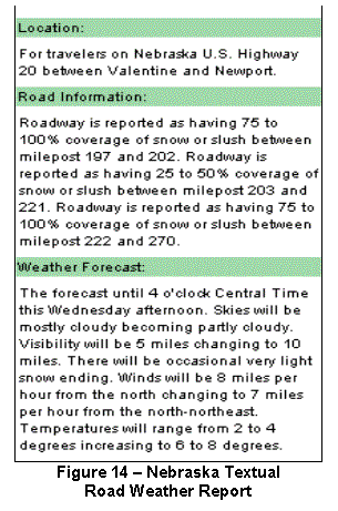
regional maps with color-coded highways.
When a colored freeway segment is selected, a textual road condition and
weather report is displayed, as shown in Figure 14. This information can also
be accessed via links on the State Patrol and DOT web sites (www.nebraskatransportation.org).
Travelers can also access road weather data for neighboring states
including Minnesota, Montana, North Dakota, and South Dakota.
Transportation Outcome: This advisory strategy allows the
public to make more informed travel decisions (e.g., departure time, route
selection) than can be made with less specific road weather information. Decision support provided by the road
weather information system can enhance roadway safety. On July 6-7, 2002 usage of the
system peaked due to a flash flood that washed out bridge approaches on
Interstate 80.
The system
improved productivity by replacing labor-intensive condition reporting
procedures. In the past, State Patrol
officers in the field visually observed and reported road weather conditions,
which were compiled for voice recording at least five
times per day. Condition reports were then made available
to the public via a toll-free telephone number. During severe weather events, the 511
service relieves officers of reporting duties and allows them to focus on
public safety and law enforcement activities.
Implementation Issues: Nebraska's Department of Administrative Services is monitoring
implementation of the 511 service. The
state has negotiated cooperative agreements with local telephone companies and
cellular service providers in order to provide the service free of charge to
the public. The state’s Public Service Commission advertised the 511 service
with announcements placed in local telephone directories.
Contact(s):
·
Jaimie
Huber, Nebraska Department of Roads, 511 Operations Manager, 402-471-1810, jhuber@dor.state.ne.us.
·
Bryan
Tuma, Nebraska State Patrol, Major, Administrative Services, 402-479-4950, btuma@nsp.state.ne.us.
·
Leon
Osborne, Meridian Environmental Technology, Chief Executive Officer,
701-787-6044, leono@meridian-enviro.com.
Reference(s):
·
FHWA,
“511 America’s Traveler Information Telephone Number,” December 2002, www.fhwa.dot.gov/trafficinfo/511.htm.
·
FHWA, “New 511 Traveler Information System
Operational October 1,” http://www.fhwa.dot.gov/nediv/511pr.htm.
·
Nebraska
Department of Roads, “New Info on 511 More Precise,” News Release, January 15,
2003, http://www.dor.state.ne.us/news/news%20releases/jan-2003/new511-1-15.pdf.
·
Meridian
Environmental Technology, “Safe Travel USA Web Site”, State of Nebraska, 2002, http://www.safetravelusa.com/process.pl?state=ne.
·
Osborne
Jr., L. and Owens, M., “Evaluation of the Operation and Demonstration Test of
Short-Range Weather Forecasting Decision Support within an Advanced Rural
Traveler Information System,” University of North Dakota, 2000, http://www.itsdocs.FHWA.dot.gov/jpodocs_te/@9301!.pdf.
Keyword(s): adverse weather, road weather information system (RWIS),
freeway management, law enforcement, advisory strategy, traveler information,
pavement condition, weather information, decision support, environmental sensor
station (ESS), internet/web site, institutional issues, safety
Nevada DOT High Wind Warning System
The
Nevada Department of Transportation (DOT) operates a high wind warning system
on a seven-mile (11-kilometer) section of US Route 395. This highway segment, which is located in
the Washoe Valley between Carson City and Reno, often experiences very high
crosswinds (up to 70 mph or 113 kph) that pose risks to high-profile
vehicles. The system provides drivers
with advanced warning of high wind conditions and prohibits travel of
designated vehicles during severe crosswinds.
System Components: An Environmental
Sensor Station (ESS) is installed on the highway to collect and transmit
environmental data to a central control computer in the Traffic Operations
Center. The ESS measures wind speed and
direction, precipitation type and rate, air temperature and humidity, as well
as pavement temperature and condition (i.e., wet, snow or ice). During high
wind conditions advisory or regulatory messages are displayed on Dynamic
Message Signs (DMS) located at each end of the valley, as shown in Figure 15.
Traffic managers may also broadcast pre-recorded messages via three Highway
Advisory Radio transmitters in the area.
System Operations: The central
control computer polls the ESS every ten minutes to compare average wind speeds
and maximum wind gust speeds to preestablished threshold values. If the average speed exceeds 15 mph (or 24
kph) or the maximum wind gust is over 20 mph (or 32 kph) the computer prompts
display of messages as shown in Table 6 below.
This is accomplished through an interface with a DMS computer, which
runs proprietary software to control the roadside signs. Roadway access to high-profile vehicles is
restricted when winds are extreme.
Static signs identify critical vehicle profiles and direct specified
vehicles to exit the highway and travel on an alternate route when “PROHIBITED”
messages are displayed.
Table 6 – Nevada DOT High Wind Warning System Messages
|
Average Wind Speeds |
Maximum Wind Gust Speeds |
Displayed
Messages |
|
15
mph to 30 mph |
20
mph to 40 mph |
|
|
Greater
than 30 mph (48 kph) |
Greater
than 40 mph (or 64 kph) |
High-profile
vehicles “PROHIBITED” |
Transportation Outcome: Dissemination of traveler information
and access control have enhanced safety by significantly reducing high-profile
vehicle crashes caused by instability in high winds.
Implementation Issues: In the early 1980s the first high wind
warning system was constructed on US Route 395. It was comprised of an anemometer (or wind speed sensor), message
signs, a relay, and a timer. Because
this legacy system needed extensive repairs, it was replaced in the 1990s. A solar-powered ESS was installed in place
of the anemometer and relay components, and each message sign was substituted
with a DMS.
While
developing equipment requirements and operational procedures for the system
upgrade, the DOT worked with the University of Nevada to determine warning
threshold values. The University
analyzed the stability of various vehicle profiles, configurations, and
loadings to calculate critical wind speeds (i.e., sufficient speeds to blow
vehicles over).
In
1996 the DOT’s statewide telephone communication system and Very High Frequency
radio network were replaced with a digital, wireless radio communication
system. A Wide Area Network (WAN)
facilitated the integration of voice, video, and data using open system
protocols. The WAN also allowed
dissemination of traveler information via the Internet (www.nvroads.com) and through telephone systems (1-877-NVROADS) with interactive voice
response technologies. The computing
and communication networks were designed with the flexibility to easily
incorporate new technologies or components.
Contact(s):
·
Richard Nelson;
District Engineer, Nevada DOT District 2, 775-834-8344, rnelson@dot.state.nv.us.
·
Denise Inda, Traffic
Engineer (ITS), Nevada DOT District 2, 775-834-8320, dinda@dot.state.nv.us.
Reference(s):
·
Blackburn R.R., et
al, “Development of Anti-Icing Technology,” Report SHRP-H-385, National
Research Council, Washington, DC, 1994.
·
Magruder, S., “Road
Weather Information System (RWIS),” Nevada DOT News Release, December 6, 1999, http://www.nevadadot.com/about/news/news_00045.html.
·
Nelson, R., “Weather
Based Traffic Management Applications in Nevada,” presented at Institute of
Transportation Engineers (ITE) Annual Meeting, August 2002.
Keywords: wind, high-profile vehicles, high wind warning system, freeway
management, traffic management, control strategy, access control, advisory
strategy, traveler information, internet/web site, environmental sensor station
(ESS), dynamic message signs (DMS), highway advisory radio (HAR), safety
New Jersey Turnpike Authority Speed Management
The New Jersey Turnpike Authority (NJTA) operates an Advanced Traffic Management System (ATMS)
to control 148 miles (237.9 kilometers) of the turnpike, which is one of the
nation’s most heavily traveled freeways. Various subsystems
are employed to monitor road and weather conditions, manage traffic
speeds, and notify motorists of hazardous conditions. Speed management and traveler information techniques have
improved roadway safety in the presence of fog, snow, and ice.
System Components: ATMS control computers are located at the
turnpike Traffic Operations Center (TOC) in New Brunswick. Data transmission between field components
and central control systems is accomplished via a wireless communication system
using Cellular Digital Packet Data technology.
A vehicle detection subsystem, which is comprised of inductive loop
detectors and Remote Processing Units, is utilized to collect speed and volume
data and to detect traffic congestion.
A Closed Circuit Television subsystem may also be used to visually
verify road conditions.
The turnpike’s Road Weather Information System (RWIS)
includes 30 Environmental Sensor Stations (ESS). Three types of environmental sensors are deployed along the
turnpike to gather road weather data.
Nine ESS detect wind speed and direction, precipitation type and rate,
barometric pressure, air temperature and humidity, as well as visibility distance. Pavement temperature and condition data are
collected at 11 sites, while ten ESS simply monitor visibility distance.
Traveler information is conveyed to motorist through 113
Dynamic Message Signs (DMS), 12 Highway Advisory Radio (HAR) transmitters, and
a Variable Speed Limit (VSL) subsystem.
Over 120 VSL sign assemblies are positioned along the freeway at
two-mile (3.2-kilometer) intervals.
Sign assemblies include VSL signs and speed warning signs, which display
“REDUCE SPEED AHEAD” messages and the reason for speed reductions (i.e., “FOG”,
“SNOW”, or “ICE”).
System Operations: Traffic and
emergency management personnel in the TOC monitor environmental data to
determine when speed limits should be lowered.
When reductions are warranted, sign assemblies are manually activated to
decrease speed limits in five-mph (eight-km) increments from 50, 55, or 65 mph
(80.4, 88.4, or 104.5 kph) to 30 mph (48.2 kph) depending on prevailing
conditions. System operators may also disseminate regulatory and warning
messages via DMS and HAR. State police
officers enforce the lower speed limits by issuing summonses to drivers
exceeding the posted limit. When the
vehicle detection and RWIS subsystems indicate that traffic and weather
conditions have returned to normal, the original speed limits are restored.
Transportation Outcome: This control strategy effectively decreases
traffic speeds in adverse conditions.
Speed management and traveler information dissemination have improved
safety by reducing the frequency and severity of weather-related crashes.
Implementation Issues: The turnpike’s VSL subsystem is one of the
oldest in the country. In the 1950s,
before the system was installed, state police officers would patrol the freeway
in inclement weather and temporarily nail up plywood signs to reduce speed
limits. The VSL system was originally
installed in the 1960s and upgraded in the 1980s.
Contact(s):
·
Solomon Caviness,
NJTA Operations Department, 732-247-0900, caviness@turnpike.state.nj.us.
Reference(s):
·
“2000 Annual Report
of the New Jersey Turnpike Authority,” NJTA Board of Commissioners, http://www.state.nj.us/turnpike/00arfull.pdf.
·
Malinconico, Joe, “If
an Ill Wind Blows, Turnpike Staff Will Know,” The Star Ledger, August 09, 2001,
http://www.nj.com/starledger/.
·
“Roadway Weather
Station Debuts on the New Jersey Turnpike,” NJTA News Release, August 2001, http://www.state.nj.us/turnpike/01news89.htm.
·
“Welcome to the New
Jersey Turnpike,” NJTA, http://www.state.nj.us/turnpike/tpbook.pdf.
·
Science Applications
International Corporation (SAIC), “Examples of Variable Speed Limit
Applications,” presented at the Transportation Research Board (TRB) Annual
Meeting, January 2000, http://safety.fhwa.dot.gov/fourthlevel/ppt/vslexamples.ppt.
·
Sisiopiku, V.,
“Variable Speed Control: Technologies and Practice,” Michigan State University,
presented at the 2001 Annual Meeting of ITS America.
·
Zarean, M., et al,
“Applications of Variable Speed Limit Systems to Enhance Safety,” SAIC,
presented at the 7th World Congress on ITS, September 2000.
Keywords: fog, visibility, adverse weather, snow, ice,
winter storm, speed management, freeway management, traffic management,
emergency management, law enforcement, traffic control, control strategy,
motorist warning system, advisory strategy, traveler information, vehicle
detection, environmental sensor station (ESS), road weather information system
(RWIS), dynamic message sign (DMS), variable speed limit (VSL), highway
advisory radio (HAR), crashes, safety
City of New York, New
York Anti-Icing/Deicing System
The New York
City Department of Transportation (DOT) developed a fixed anti-icing system
prototype for a portion of the Brooklyn Bridge. The system sprays an anti-icing chemical on the bridge deck when
adverse weather conditions are observed.
Anti-icing reduces the need to spread road salt, which has contributed
to corrosion of bridge structures.
System Components: The anti-icing system is comprised of a control
system, a chemical storage tank containing liquid potassium acetate, a pump, a network of PVC pipes installed in roadside barriers, check valves with
an in-line filtration system, 50 barrier-mounted spray nozzles, and a Dynamic
Message Sign (DMS). The DMS displays
warnings to alert motorists during spray operations. A Closed Circuit Television (CCTV) camera allows operators to
visually monitor the anti-icing system.
Each self-cleaning nozzle delivers
up to three gallons (11.4 liters) of chemical per minute at a 15-degree spray
angle. This angle minimizes misting
that could reduce visibility. Two nozzle
configurations were implemented to investigate different spray
characteristics. On both sides of one
bridge section, nozzles were installed 20 feet (6.1 meters) apart for
simultaneous spraying. On another
section, sequential spray nozzles were mounted on only one side of the bridge.
System
Operations: System
operators consult television and radio weather forecasts
to make road treatment decisions. When anti-icing is deemed necessary,
“ANTI-ICING SPRAY IN PROGRESS” is posted on the DMS and the system is manually
activated to spray potassium acetate on the pavement for two to three seconds,
delivering a half-gallon per 1,000 square feet (1.9 liters per 92.9 square
meters).
Operators then review forecasts and view CCTV video images to monitor
weather and pavement conditions. If
there is a 60 percent or greater chance of precipitation and pavement
temperatures are predicted to be lower than the air temperature, maintenance
crews are mobilized to supplement anti-icing operations with plowing to remove
snow and ice. The operational sequence
is depicted in Figure 16.
Transportation Outcome: An analysis of
maintenance operations found that bridge sections treated with the anti-icing
system had a higher level of service than segments treated by snowplows and
truck-mounted chemical sprayers. Road
segments treated by the anti-icing system have less snow accumulation than
sections treated conventionally.
Pavement conditions during a snow event in January 1999 are depicted
below in Figures 17A and 17B.
 Evaluation results indicated that
the anti-icing system improves roadway mobility and safety in inclement
weather. The system was most effective
when chemical applications were initiated at the beginning of weather
events. If potassium acetate was
sprayed more than an hour before a storm, vehicle tires dispersed the chemical
necessitating subsequent applications.
The system also improves productivity by extending the life of bridges
and minimizing treatment costs associated with mobilizing maintenance crews,
preparing equipment, and traveling to treatment sites on congested roads.
Evaluation results indicated that
the anti-icing system improves roadway mobility and safety in inclement
weather. The system was most effective
when chemical applications were initiated at the beginning of weather
events. If potassium acetate was
sprayed more than an hour before a storm, vehicle tires dispersed the chemical
necessitating subsequent applications.
The system also improves productivity by extending the life of bridges
and minimizing treatment costs associated with mobilizing maintenance crews,
preparing equipment, and traveling to treatment sites on congested roads.
Implementation Issues: Corroded steel
grid members were observed in the concrete bridge deck during routine repaving operations in the summer of 1998. The anti-icing
system prototype was designed to apply a less corrosive chemical than salt and
to minimize the need for road infrastructure repairs. During system design and testing various chemical delivery
configurations were examined to determine the appropriate spray pattern, angle,
and pressure. Due to concerns about bridge deck integrity, nozzles were barrier-mounted
rather than embedded in the road surface.
System performance was
evaluated over the 1998/1999, 1999/2000, and 2000/2001 winter seasons. The evaluation included an assessment of the
capabilities and reliability of system
components, documentation of spray area coverage, a review of road treatment
procedures and results, and a cost analysis comparing the anti-icing system to
conventional treatment techniques.
The
DOT would like to expand the anti-icing system by integrating a Road Weather Information System (RWIS) with the
control system, the CCTV camera, and the DMS to improve treatment
decision-making. A wireless or fiber
optic cable communication network is envisioned for connectivity of these
elements. Deployment of the system on
the entire Brooklyn Bridge and on other local bridges is also anticipated.
Contact(s):
·
Brandon Ward, New York City DOT,
Project Manager, 212-788-1720, bward2@dot.nyc.gov.
Reference(s):
·
Ward, B., “Evaluation of a Fixed Anti-Icing Spray Technology
(FAST) System,” New York City DOT,
Division of Bridges, presented at the Transportation Research Board (TRB) Annual
Meeting, January 2002.
Keywords: snow, ice,
winter storm, anti-icing/deicing system, freeway management, winter
maintenance, bridge, forecasts, treatment strategy, chemicals, maintenance
vehicle, air temperature, pavement temperature, pavement condition, traveler
information, advisory strategy, dynamic message sign (DMS), closed circuit
television (CCTV), safety, mobility, productivity
City of Charlotte, North Carolina Weather-Related
Signal Timing
In North
Carolina, the City of Charlotte Department of Transportation (DOT) manages the
operation of 615 traffic signals with a computerized control system. In the central business district weather-related
signal timing plans are utilized at 149 signals to reduce traffic speeds during
severe weather conditions.
Weather-related signal timing can also be employed at over 350
intersections controlled by closed-loop signal systems.
System Components: The traffic signal control system is comprised of signal
controllers located at City intersections, a Closed Circuit Television (CCTV)
surveillance system, twisted pair cable and fiber optic cable communication
systems, and a signal system control computer in the Traffic Operations Center
(TOC). Images from over 25 CCTV cameras
on major arterial routes are transmitted to the TOC and displayed on video
monitors. Various timing plan patterns,
which are stored in the computer, can be selected and downloaded to field
controllers via the communication systems.
System Operations: System
operators assess traffic and weather conditions by viewing CCTV video images
and receiving weather forecasts.
Forecast data is available through radio and television broadcasts, the
National Weather Service (NWS) website, and a private weather service
vendor. When heavy rain, snow, or icy
conditions are observed operators access the signal computer and manually
implement weather-related timing plans.
To slow the progression speed of traffic these signal timing plans
increase the cycle length—which is typically 90 seconds—while offsets and
splits remain the same. During off-peak
periods operators may also select peak period timing patterns, which are
designed for lower traffic speeds.
System
operators monitor roadway operations after weather-related signal timing plans
have been executed. If warranted by
field conditions, operators can increase cycle lengths to further reduce
traffic speeds. When road weather conditions
return to normal, operators access the central computer to restore normal
time-of-day/day-of-week timing plans.
Transportation Outcome: By selecting signal timing plans based upon
prevailing weather conditions traffic managers have improved roadway safety by
reducing speeds and minimizing the probability and severity of crashes. Travel speeds decrease by five to ten mph
(eight to 16 kph) when weather-related signal timing is utilized.
Implementation Issues: The City’s
TOC is typically staffed during AM and PM peak periods. However, traffic managers may extend the
hours of operation when adverse weather is predicted or observed. System operators may be required to come in
early or stay late depending upon the timing and nature of a storm event.
The signal
operations staff is very experienced.
Most system operators have worked for the City of Charlotte for over ten
years. Decisions to execute
weather-related signal timing are based upon operator observations, knowledge,
and judgment. Road weather conditions
are closely monitored to determine the type of storm and its area of
influence. Operators modify signal
timing only when weather impacts are widespread and affect a significant
portion of the City’s intersections.
Renovation
of the TOC is expected to be complete by the end of 2002. The signal system control computer will be
replaced, a new projection screen and new video monitors will be installed, a
six-workstation control console will be positioned in the control room, and a
fiber optic cable communication link will be established with the North
Carolina DOT Traffic Management Center.
This link will allow the City to access video from roughly 30
state-owned CCTV cameras as well as facilitate data sharing and coordination
between the city and the state.
Contact(s):
·
Art Stegall; City of Charlotte DOT, Signal System Supervisor;
704-336-3914, astegall@ci.charlotte.nc.us.
·
Bill Dillard; City of Charlotte DOT, Chief Traffic Engineer;
704-336-3912, wdillard@ci.charlotte.nc.us.
Reference(s):
·
City of Charlotte, “The Charlotte Department of Transportation Website,” http://www.ci.charlotte.nc.us/citransportation/cdot.html.
·
USDOT, “Charlotte, North Carolina Integration
Project,” 2002 Intelligent Transportation Systems (ITS) Projects Book, FHWA, ITS
Joint Program Office, http://www.itsdocs.fhwa.dot.gov//jpodocs/repts_te/13631/ttm-374.html.
·
USDOT, “Charlotte ITS Integration,” 2002 Intelligent
Transportation Systems (ITS) Projects Book, FHWA, ITS Joint Program
Office, http://www.itsdocs.fhwa.dot.gov//jpodocs/repts_te/13631/ttm-359.html.
Keywords: rain,
snow, ice, weather-related signal timing, arterial management, traffic
management, traffic control, control strategy, forecasts, weather information,
closed circuit television (CCTV), speed, crashes, safety
Oklahoma Environmental Monitoring System
Public
safety officials with various agencies utilize OKlahoma’s First-response
Information Resource System using Telecommunications (OK-FIRST) to accurately
identify weather threats and make effective public safety decisions. OK-FIRST is a decision support system that
facilitates data sharing and provides emergency managers with web-based,
real-time environmental data.
 System
Components: Through the information system, emergency
managers obtain agency-specific, county-level weather data from the Oklahoma
mesoscale environmental monitoring network (i.e., mesonet) and various radar
systems. The mesonet includes over 110
Environmental Sensor Stations (depicted in Figure 18). The OK-FIRST web site
and electronic bulletin board system also foster communication and information
sharing among various public safety agencies in different jurisdictions. The
Oklahoma Department of Public Safety maintains a leased-line, digital
communication network named the Oklahoma Law Enforcement Telecommunications
System (OLETS). Over 200 participants
access OK-FIRST through OLETS including law enforcement, emergency management,
and fire service agencies.
System
Components: Through the information system, emergency
managers obtain agency-specific, county-level weather data from the Oklahoma
mesoscale environmental monitoring network (i.e., mesonet) and various radar
systems. The mesonet includes over 110
Environmental Sensor Stations (depicted in Figure 18). The OK-FIRST web site
and electronic bulletin board system also foster communication and information
sharing among various public safety agencies in different jurisdictions. The
Oklahoma Department of Public Safety maintains a leased-line, digital
communication network named the Oklahoma Law Enforcement Telecommunications
System (OLETS). Over 200 participants
access OK-FIRST through OLETS including law enforcement, emergency management,
and fire service agencies.
System Operations: Mesonet data is packaged into five-minute observations and transmitted via OLETS and a radio communication system to the University of Oklahoma for quality assurance, integration with National Weather Service data, and dissemination via the web. Emergency managers access OK-FIRST to identify and respond to severe storms, tornadoes, flooding, and wild fires.
Transportation Outcome: On May 3, 1999
over 50 tornadoes impacted northern and central Oklahoma damaging nearly 10,000
buildings, and causing 44 fatalities and over 700 injuries. In Seminole County emergency response
vehicles were traveling to the Oklahoma City area on Interstate 40. With information from OK-FIRST the county’s
emergency manager identified a developing tornado that would cross the freeway
in front of the emergency vehicle convoy.
When responders were notified they stopped near Shawnee, Oklahoma and
closed the interstate to prevent response and passenger vehicles from driving
into the tornado’s path.
Emergency
managers in Logan County spotted a tornado in the path of an ambulance
transporting a critically injured victim from Crescent to a hospital in
Guthrie, Oklahoma. Ambulance personnel
were instructed to halt the vehicle until the tornado had passed. These decisions ensured the safety of both
response personnel and the traveling public.
Emergency
managers have also used OK-FIRST to respond to flood events. In one county, emergency managers monitored
rainfall amounts during a storm, and closed a susceptible bridge before it was
washed away. In another county,
emergency managers observed water levels within six inches (15.2 centimeters)
of flood stage, but decided to do nothing.
Information from OK-FIRST indicated that the threat had passed as waters
were receding. In addition to enhancing
safety OK-FIRST results in productivity improvements by decreasing the number
of storm spotters and by minimizing overtime for winter road maintenance
personnel.
Implementation Issues: In 1996 OK-FIRST was funded by a grant from the Technology
Opportunities Program (formerly the Telecommunications Information and
Infrastructure Assistance Program), sponsored by the US Department of
Commerce. The DPS has provided support
funding since that time. After system
components were installed, integrated, and tested all participating agencies
were offered training on the Oklahoma Mesonet to learn how access to
environmental information could enhance their operations. An independent evaluation found that the knowledge
and skills of OK-FIRST users were significantly enhanced.
Contact(s):
·
Dale Morris, Oklahoma Climatological
Survey, University of Oklahoma, dmorris@ou.edu.
Reference(s):
·
Crawford, K. and
Morris, D., “The Killer Tornado
Outbreak of 3 May 1999: Applications of OK-FIRST in Rural Communities,”
presented at the 16th International Conference on Interactive Information and
Processing System for Meteorology, Oceanography, and Hydrology; January 2000; http://okfirst.ocs.ou.edu/press/preprints/16iips/1_2.pdf.
·
James, T., et al, “An
Independent Evaluation of the OK-FIRST Decision-Support System,” University of
Oklahoma, http://okfirst.ocs.ou.edu/press/preprints/2envapps/1_11.pdf.
·
Morris, D., et al,
“OK-FIRST: A Meteorological Information System for Public Safety,” Bulletin of
the American Meteorological Society: Vol. 82, No. 9, pp. 1911-1923, 2001, http://ams.allenpress.com/amsonline/?request=get-pdf&file=i1520-0477-082-09-1911.pdf.
·
Morris, D., et al,
“OK-FIRST: An Example of Successful
Collaboration between the Meteorological and Emergency Response Communities on
3 May 1999,” Weather and Forecasting, Vol. 17, No. 3, pp. 567-576, 2002, http://ams.allenpress.com/amsonline/.
·
Oklahoma
Climatological Survey, “OK-FIRST Website,” 2000, http://okfirst.ocs.ou.edu/.
·
Oklahoma
Climatological Survey, “Oklahoma Mesonet Website,” 2002, http://okmesonet.ocs.ou.edu/.
Keywords: adverse weather, tornado, flooding, environmental monitoring
system, emergency management, law enforcement, decision support, advisory
strategy, institutional issues, weather information, environmental sensor
station (ESS), internet/web site, safety
South Carolina Hurricane Evacuation Operations
In September 1999 roughly three
million people were evacuated from coastal areas in Florida, Georgia, North
Carolina, and South Carolina prior to landfall of Hurricane Floyd. Over 500,000 South Carolinians evacuated
from six coastal counties. Because
managers with the South Carolina Department of Transportation (DOT) and the
South Carolina Department of Public Safety had not agreed on a lane reversal
plan prior to Hurricane Floyd, contraflow (i.e., lane reversal) was not
employed during the evacuation.
Consequently, there was severe congestion on Interstate 26 between
Charleston and Columbia. Traffic and
emergency managers quickly developed a contraflow plan for reentry operations
after the hurricane.
System Components:
Managers utilized storm track, wind speed, and precipitation forecast
data in combination with population density and topographic information to
identify areas threatened by storm surge and inland flooding. Emergency managers consulted various
information sources including the National Weather Service, the National
Hurricane Center, the Federal Emergency Management Agency, as well as decision
support applications such as HURREVAC (www.hurrevac.com)
and HurrTrak (www.weathergraphics.com/ht/).
Traffic managers monitored traffic flow with two permanent vehicle detection
sites along the highway and portable detection equipment on other road
facilities. During reentry operations,
portable Dynamic Message Signs (DMS) and Highway Advisory Radio (HAR)
transmitters were positioned along the interstate to alert drivers of
contraflow operations.
 System Operations:
DOT managers worked closely with Highway Patrol personnel during
evacuation and reentry operations.
Traffic and emergency managers also coordinated with other local, state,
and federal agencies. Before traffic
flow on westbound lanes could be reversed for reentry (i.e., contraflowed from
Columbia to Charleston as shown in Figure 19), DOT and DPS personnel were
mobilized and equipment was prepositioned.
Lanes to be reversed were cleared of all traffic, and traffic control
devices and barricades were erected.
Access ramps to westbound lanes and some minor interchanges were closed.
Highway Patrol personnel staffed all closed ramps and patrol vehicles were
stationed along the 95-mile (152.7-kilometer) contraflow route to manage
incidents. Traffic managers
continuously polled vehicle detectors to monitor traffic operations.
System Operations:
DOT managers worked closely with Highway Patrol personnel during
evacuation and reentry operations.
Traffic and emergency managers also coordinated with other local, state,
and federal agencies. Before traffic
flow on westbound lanes could be reversed for reentry (i.e., contraflowed from
Columbia to Charleston as shown in Figure 19), DOT and DPS personnel were
mobilized and equipment was prepositioned.
Lanes to be reversed were cleared of all traffic, and traffic control
devices and barricades were erected.
Access ramps to westbound lanes and some minor interchanges were closed.
Highway Patrol personnel staffed all closed ramps and patrol vehicles were
stationed along the 95-mile (152.7-kilometer) contraflow route to manage
incidents. Traffic managers
continuously polled vehicle detectors to monitor traffic operations.
Transportation Outcome: On Tuesday, September 14th
the Governor issued a voluntary evacuation order at 7:00 AM followed by a
mandatory evacuation order at noon. In
response, over 350,000 people evacuated on Tuesday and roughly 160,000 departed
on Wednesday. The timing of evacuation
orders, the public’s response to the orders, the lack of lane reversal
operations, and unmanned traffic signals in small towns contributed to severe
congestion on Interstate 26 between Charleston and Columbia. Travel time, which is normally 2½ hours,
ranged from 14 to 18 hours during the evacuation. The maximum per lane volume on the interstate was 1,445 vehicles
per hour.
The Governor ordered contraflow
operations to minimize travel times during reentry. Traffic and emergency managers quickly developed a contraflow
plan to accommodate reentry traffic in reversed westbound lanes. DMS and HAR were deployed to notify
travelers of closures and alternate routes.
As a result of contraflow, the maximum volume during reentry was 2,082
vehicles per hour per lane—a 44 percent increase over evacuation volumes. Contraflow operations and dissemination of
traveler information significantly improved mobility by increasing roadway
capacity and traffic volumes.
Implementation Issues: When planning contraflow
operations managers must designate routes, determine initiation and termination
points, select a contraflow strategy, establish criteria for implementation,
arrange enforcement and incident management, promote institutional
coordination, as well as communicate with political officials and the
public. Geometric modifications to the
roadway or special traffic control patterns may be required at contraflow
initiation and termination points. After
Hurricane Floyd, the South Carolina DOT constructed and X-shaped median crossover
with a 45-mph (72-kph) design speed.
During normal traffic operations, a water-filled barrier prevents
vehicles from crossing into the wrong lanes.
The barrier can be drained and removed by two people when lanes are
reversed. Short connecting roads may
have to be constructed between ramps and freeway lanes to facilitate access in
the opposite direction. In Charleston,
the DOT constructed a short road segment between a ramp from Interstate 526 to
Interstate 26 in order to provide outbound traffic access to inbound
lanes.
Other geometric and operational
considerations include the condition and width of shoulder lanes, bridge
widths, guardrail treatments, and separating traffic flows at termination
points to prevent congestion caused by merging normal and reversed lanes. Where contraflow terminates in Columbia,
traffic in normal lanes will be detoured onto Interstate 77. After the Interstate 26/Interstate 77 interchange,
traffic in reversed lanes will cross the median to access the normal westbound
lanes of Interstate 26.
After initiation and termination
points are designed, one of four contraflow strategies must be selected. The first strategy reverses all coast-bound
lanes. The second contraflow strategy
reverses all but one coast-bound lane for use by emergency and patrol vehicles
involved in incident management. In
addition to emergency and patrol vehicles, the third contraflow strategy allows
passenger vehicles to use the single coast-bound lane. The fourth strategy
utilizes an inbound shoulder lane for evacuating traffic and reverses all but
one coast-bound lane.
Traffic control devices and law
enforcement officers should be positioned at initiation points, termination
points, and closed facilities to ensure roadway safety. The National Guard may be activated to
assist with these duties. Construction
work zones should also be removed and shoulders should be cleared of debris
before contraflow operations begin.
Traffic volumes and speeds should
be monitored throughout contraflow operations.
This information may be useful in determining when lane reversal should
be terminated or when alternate routes should be considered. Vehicle detection devices on reversed lanes
and processing software must to be capable of counting vehicles and calculating
speeds in the opposite direction.
Criteria and procedures for
implementing and terminating contraflow must be established prior to hurricane
season. Implementation criteria may
include mobilization time, minimum traffic volumes, and daylight hours. Contraflow must be terminated in time to
clear the route of all traffic prior to landfall, secure or remove susceptible
equipment, and ensure the safety of personnel in the field. Lane reversal operations typically end two
hours before hurricane landfall is expected.
Dissemination of pre-trip and
en-route traveler information, as well as institutional coordination are other
considerations. Emergency and traffic
managers at county and state levels must communicate effectively. Multi-state coordination is also
critical. During the Hurricane Floyd
evacuation managers in South Carolina worked with managers in Georgia to
facilitate smooth traffic flow across the state boundary.
Contact(s):
·
Harry Stubblefield, South Carolina Highway Patrol, 803-896-4786,
stubblefield_harrya@scdps.state.sc.us.
·
Brett Harrelson, South Carolina DOT, 803-737-1623, harrelsodb@dot.state.sc.us.
Reference(s):
·
PBS&J, “Reverse Lane Standards and ITS Strategies
Southeast: Southeast United States Hurricane Study Technical Memorandum No. 1
Final Report,” June 2000, http://www.fhwaetis.com/etis/ITS.htm.
·
Wolshon, B., et al, “National Review of Hurricane Evacuation
Plans and Policies,” Louisiana State University Hurricane Center, 2001, http://www.hurricane.lsu.edu/.
·
Cutter, S., et al, “South Carolina’s Evacuation Experience
with Hurricane Floyd: Preliminary Report #1,” University of South Carolina
Hazards Research Lab, March 2000, http://www.cla.sc.edu/geog/hrl/Floyd2.html.
Keywords:
hurricane, wind, precipitation, flooding, hurricane evacuation
operations, freeway management, emergency management, law enforcement, traffic
management, institutional issues, control strategy, traffic control, access
control, advisory strategy, traveler information, forecasts, weather
information, decision support, vehicle detection, dynamic message sign (DMS),
highway advisory radio (HAR), volume, mobility
South Carolina DOT Low Visibility Warning System
As a
result of a federal court decision the South Carolina Department of Transportation
(DOT) was required to incorporate fog mitigation technologies during
construction of the Interstate 526 Cooper River Bridge. The DOT deployed a low visibility warning
system on seven miles (11.3 kilometers) of the freeway to inform drivers of dense
fog conditions, reduce traffic speeds, and guide vehicles safely through the
fog-prone area.
System Components: Warning system components include an
Environmental Sensor Station (ESS), five forward-scatter visibility sensors spaced at 500-foot (152.4-meter)
intervals, pavement lights installed at 110-foot spacing (33.5-meter),
adjustable street light controls, eight Closed Circuit Television (CCTV)
cameras, eight Dynamic Message Signs (DMS), a Remote Processing Unit
(RPU), a central control computer, and a fiber
optic cable communication system. The
ESS measures wind speed and direction, air temperature, and
humidity. The on-site RPU transmits
field sensor data to the control computer, which is located in a DOT district
office.
System Operations: The central computer’s decision support
software predicts or detects foggy conditions, correlates environmental data
with predetermined response strategies, and alerts traffic managers in the district office. When alerted by the computer, system
operators view images from the CCTV cameras to verify reduced visibility
conditions. Operators may accept or
decline response strategies recommended by the computer system. Potential advisory and control strategies
include displaying pre-programmed messages on DMS, illuminating pavement lights
to guide vehicles through the fog, extinguishing overhead street lights to
minimize glare, and closing the freeway and detouring traffic to Interstate
26 and US Highway 17. When warranted, Highway Patrol officers
erect barricades to close the freeway.
Response strategies for various visibility ranges are shown in Table 7.
Table 7 – South Carolina DOT Low Visibility Warning System
Strategies
|
Visibility
Conditions |
Advisory Strategies |
ControlStrategies
|
|
700 to 900
feet (213.4 to
274.3 meters) |
“POTENTIAL
FOR FOG” and “LIGHT Fog CAUTION”
on DMS |
|
|
450 to 700
feet |
“FOG
CAUTION” and “FOG REDUCE
SPEED” on DMS |
Pavement
lights illuminated |
|
“FOG REDUCE SPEED
45 MPH” and “TRUCKS KEEP
RIGHT” on DMS |
||
|
300 to 450
feet |
“FOG
CAUTION” on DMS |
|
|
N/A |
Pavement
lights illuminated and overhead
street lighting extinguished |
|
|
“DENSE FOG
REDUCE SPEED 25 MPH” and “TRUCKS KEEP RIGHT” on DMS |
||
|
If
warranted, “PREPARE TO STOP”, “I-526
BRIDGE CLOSED AHEAD USE I-26/US 17”, and “ALL TRAFFIC MUST EXIT” on DMS |
Transportation Outcome: The low visibility warning system enhances mobility
by providing traveler information and clearly delineating travel lanes with
pavement lights. Regarding safety, no
fog-related crashes have occurred since the system was deployed.
Implementation Issues: The owner of a paper mill near the Cooper River Bridge site
filed a lawsuit against the South Carolina DOT as they planned construction of
the bridge in the mid-1980s. The bridge
was to be built at the same height as the paper mill’s smoke stacks. After reviewing various fog mitigation
techniques recommended by a consulting firm, a federal judge required that a
low visibility warning system be included in the bridge construction project.
The
warning system began operating in 1992.
Initially, there were several system reliability problems related to the
harsh, outdoor environment. In order to
prevent unnecessary activations system software was calibrated to average
visibility distance observations and disregard low readings caused by smoke
plumes from the paper mill. Components
of the microwave communication system, which was originally deployed, were
struck by lightning and ultimately replaced by the fiber optic cable
communication system. The DOT permitted
the installation of privately owned communication cables in the state’s
right-of-way in exchange for dedicated fibers from the project site to the
district office.
Contact(s):
·
Robert Clark, South Carolina DOT, District 6 Engineer and
Administrator, 843-740-1665 ext. 114, clarkrt@dot.state.sc.us.
Reference(s):
· Center for Urban Transportation Research, “Evaluation of Motorist Warning Systems for Fog-Related Incidents in the Tampa Bay Area,” University of South Florida, p. 25, June 1997, http://www.cutr.eng.usf.edu/research/fog.pdf.
· Clark, R., “Fog Hazard Mitigation on Interstate 526,” South Carolina DOT, District 6.
·
Schreiner, C., “State of the Practice and Review of the
Literature: Survey of Fog Countermeasures Planned or In Use by Other States,” Virginia Tech Research Council, October 2000.
· Transportation Research Board (TRB) Freeway Operations Committee Meeting, FHWA Field Office Report, January 1998, http://depts.washington.edu/trba3a09/status/jan1998/fhwa.htm.
·
Werts, R., “ITS In South Carolina,” South Carolina
Department of Transportation, www.nawgits.com/aashto/ats2k/scdot.doc.
Keywords:
fog, visibility, low visibility warning system, freeway management,
traffic management, advisory strategy, motorist warning system, traveler
information, control strategy, speed management, access control, decision
support, environmental sensor station (ESS), closed circuit television (CCTV),
dynamic message sign (DMS), vehicle guidance, lighting, high-profile vehicles,
safety, mobility
Tennessee Low Visibility Warning System
On
December 11, 1990 the visibility distance on a segment of Interstate 75 in
southeastern Tennessee was less than 10 feet (3.1 meters). In both northbound and southbound lanes
extremely low visibility contributed to chain-reaction collisions involving 99
vehicles, 42 injuries, and 12 fatalities.
This crash prompted the design and implementation of a low visibility
warning system on the interstate freeway.
The system covers 19 miles (30.6 kilometers) including a three-mile
(five-kilometer), fog-prone section above the Hiwassee River and eight-mile
(13-kilometer) road sections on each side of the river.
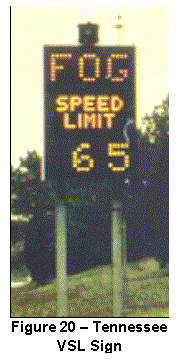
System Components: Managers with the
Tennessee Department of Transportation (DOT) and the Tennessee Department of
Safety access a central computer system that collects field data from two Environmental Sensor Stations, eight
forward-scatter visibility sensors, and 44 vehicle detectors. Underground fiber optic cables transmit
sensor data from the roadway to an on-site computer for processing. Data from the on-site computer is relayed
via a microwave communication system to the central computer in the Highway
Patrol office in Tiftonia.
Traffic
and emergency managers employ both advisory and control strategies. Motorists are notified of prevailing
conditions via flashing beacons atop six static signs, two Highway Advisory
Radio (HAR) transmitters, and ten Dynamic Message Signs (DMS). Roadside delineator posts with highly
reflective stripping are spaced roughly 80 feet (24.4 meters) apart throughout
the project area for visual observation of visibility conditions. Speed management is accomplished by
controlling ten Variable Speed Limit (VSL) signs, shown in Figure 20. When necessary, access to the affected
highway section is restricted with eight gates located on interchange
ramps.
System
Operations: By continually monitoring sensor data, the
on-site computer predicts and detects conditions conducive to fog formation and
detects significant reductions in traffic speed. The central computer sounds an audible alarm in the Highway
Patrol office when established threshold criteria are met. When alerted dispatchers post a reduced
speed message on DMS and notify Highway Patrol troopers. Troopers are stationed in the project area
from 5:00 AM to 10:00 AM when most fog events occur. Within five minutes of an alarm troopers verify conditions by
counting the number of visible delineator posts.
Control
software provides decision support by correlating field sensor data with
pre-determined response scenarios. When
troopers confirm low visibility conditions, managers select pre-programmed DMS
messages, pre-recorded HAR messages, and appropriate speed limits based upon
scenarios proposed by the central computer.
The system also allows the display or broadcasting of customized
messages.
Managers
are notified if visibility distance is less than 1,320 feet (402.3 meters) or
if average speed falls below 45 mph (74 kph). The speed limit is reduced from 65 to 50 mph
(105.4 to 80.4 kph) when visibility is between 480 feet (146.3 kph) and 1,320 feet.
The limit is lowered to 35 mph (56.3 kph) for visibility distances
between 240 and 480 feet. Managers also
notify local media when the warning system is activated.
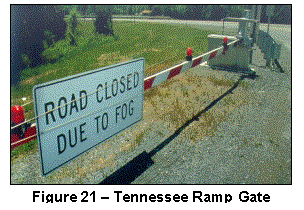
Under
the worst-case scenario—visibility less than 240 feet or 73.2 meters—Highway
Patrol troopers activate automatic ramp gates to close the interstate and
detour traffic to US Highway 11 (see Figure 21). Low visibility has caused freeway closures twice since the warning
system was deployed; once due to fog and once due to smoke from a nearby
fire. Advisory and control strategies
are summarized in Table 8.
Table 8 – Tennessee
Low Visibility Warning System Strategies
|
Conditions |
Advisories on
DMS |
Other Strategies |
|
“CAUTION”
alternating with “SLOW
TRAFFIC AHEAD” |
N/A |
|
|
Fog
Detected |
“CAUTION”
alternating with “FOG
AHEAD TURN ON LOW BEAMS” |
·
“FOG” displayed on VSL signs |
|
Speed
Limit Reduced |
“FOG
AHEAD” alternating with “ADVISORY
RADIO TUNE TO XXXX AM” |
·
“FOG” & Reduced Speed Limits displayed on VSL signs ·
HAR messages broadcasted |
|
“FOG
AHEAD” alternating with “REDUCE
SPEED TURN ON LOW BEAMS” |
||
|
“FOG”
alternating with “SPEED
LIMIT XX MPH” |
||
|
Roadway
Closed |
“DETOUR
AHEAD” alternating with “REDUCE
SPEED MERGE RIGHT” |
·
“FOG” displayed on VSL signs ·
HAR messages broadcasted ·
Ramp Gates closed |
|
“I-75
CLOSED” alternating with “DETOUR” |
||
|
“FOG
AHEAD” alternating with “ADVISORY
RADIO TUNE TO XXXX AM” |
Transportation Outcome: From October to
March, the low visibility warning system is typically activated about once a
week. Ninety-five percent of system
activations result in a speed limit reduction to 50 mph. Approximately 13 percent of activations
required further reduction to 35 mph.
There have been over 200 crashes, 130 injuries and 18 fatalities on this
highway section since the interstate opened in 1973. Safety improved significantly after deployment of the warning
system in 1994, as only one crash has occurred in fog.
Implementation Issues: After the multi-vehicle crash in 1990, a DOT and Department of Safety task force investigated fog-related
crashes on the affected freeway segment, which was near settling ponds owned by
a local paper mill, and recommended deployment of a fog warning system. When planning the Interstate 75 system,
managers assessed another low visibility warning system in Charleston, South
Carolina.
Field
device technologies, system components, and operational procedures were
evaluated to assist Tennessee managers with system design. After developing requirements for equipment,
communications, and power supply DOT managers determined system scope (i.e.,
coverage of the most fog-prone area), field equipment locations, and warning
messages. To ensure system reliability,
backup radio and telephone communication systems, as well as an emergency power
system were designed. Construction was
completed in 1992 and the system began operating in 1993.
Some
system integration problems were experienced during implementation. There were minor complications associated
with hardware failures due to the harsh outdoor environment. Lightning protection systems were installed
to prevent hardware damage.
Communication failures were minimized by mounting stabilization devices
on microwave antennas to prevent misalignment in high winds. Traffic
managers have been unable to observe system status or receive alerts due to
trouble with data transmission from the project site to the regional DOT
office.
System
designers addressed system maintenance and expandability. Both routine and emergency maintenance are
performed regularly on all system
components. The system was planned to
accommodate future integration of new technologies or components, including an
upgrade to the microwave communications system and a new digital Closed Circuit Television surveillance system.
Contact(s):
·
Don Dahlinger,
Tennessee DOT, Engineering Manager, 615-741-3033, ddahlinger@mail.state.tn.us.
·
John Savage,
Tennessee Department of Safety, Chattanooga District Supervisor, 423-634-6898.
Reference(s):
·
Dahlinger, D. “Tennessee Fog Detection and Warning System,”
Public Works, presented at the Southern Rural Transportation Workshop, May
2001.
·
Dahlinger, D. and
McCombs, B., “Fog Warning System
Provides a Safety Net for Motorist,” Public Works, December 1995.
·
Tennessee ITS State
Status Report, “Fog Project on I-75
between Chattanooga and Knoxville,” October 2000, www.its.dot.gov/staterpt/tn.htm.
·
Clayton, R., “10 Years After Tragedy, Fog Warnings are
Heeded,” the Chattanooga Times and Free Press, December 2000;
·
National
Transportation Safety Board (NTSB), “Multiple-Vehicle Collisions and Fire
During Limited Visibility (Fog) on Interstate 75 near Calhoun, Tennessee,“
Highway Accident Report NTSB No. HAR-92/02, NTIS No. PB92-916202, September
1992.
·
Schreiner, C., “State
of the Practice and Review of the Literature: Survey of Fog Countermeasures
Planned or in Use by Other States,” Virginia Tech Research Council, pp. 21-23,
October 2000.
Keywords: fog, visibility, low visibility warning system, freeway management,
traffic management, emergency management, law enforcement, advisory strategy,
motorist warning system, traveler information, control strategy, speed
management, access control, decision support, vehicle detection, environmental
sensor station (ESS), variable speed limit (VSL), dynamic message signs (DMS),
highway advisory radio (HAR), gates, crashes, safety
City of Dallas, Texas Flood Warning System
In
May 1995 a rain event caused widespread flooding in the City of Dallas, Texas
resulting in seven roadway fatalities.
The City deployed an automated system to monitor water levels at over 40
stream locations near roads and warn motorists of high water until maintenance
personnel can barricade dangerous roads.
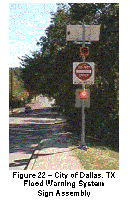 System Components: The flood warning system consists of stilling
wells, Remote Processing Units (RPUs), Dynamic Message Signs (DMS), a radio
communication system, and a central computer system. A stilling well is comprised of a 3-foot (0.9-meter) long pipe, a pressure
transducer, and a float switch to measure stream levels. When high water is detected, RPUs activate
sign assemblies and report stream levels to the central computer. Each RPU—which is housed in a pole-mounted
enclosure—includes radio communication devices, solar or electrical power
systems, and controls to reset sign assemblies. At each monitoring site, one to four sign assemblies are
installed near the road to alert motorists.
Sign assemblies include electromechanical DMS, two flashing beacons,
radio communication devices, and power systems.
System Components: The flood warning system consists of stilling
wells, Remote Processing Units (RPUs), Dynamic Message Signs (DMS), a radio
communication system, and a central computer system. A stilling well is comprised of a 3-foot (0.9-meter) long pipe, a pressure
transducer, and a float switch to measure stream levels. When high water is detected, RPUs activate
sign assemblies and report stream levels to the central computer. Each RPU—which is housed in a pole-mounted
enclosure—includes radio communication devices, solar or electrical power
systems, and controls to reset sign assemblies. At each monitoring site, one to four sign assemblies are
installed near the road to alert motorists.
Sign assemblies include electromechanical DMS, two flashing beacons,
radio communication devices, and power systems.
System Operations: When water reaches
the roadway edge RPUs automatically activate flashing red beacons and change
sign messages from “HIGH WATER WHEN FLASHING” to “DO NOT ENTER HIGH
WATER”. Sign assemblies, shown in
Figure 22, send a message back to the RPU to verify proper operation. Remote processing units transmit water level
and sign status to the central computer every hour via the radio communication
system. When high water is detected by
field components, the central computer is immediately alerted and sends
alphanumeric pages to maintenance staff who then erect barricades on threatened
roads. The central computer also posts
road closures on the City’s “Flooded Roadway Warning System” web site (www.ci.dallas.tx.us/sts/html/frws.html). When the water recedes, maintenance staff
are paged again to notify them that barricades can be removed and signs
assemblies can be reset.
Transportation Outcome: The flood warning system improves roadway safety, as most
motorists heed sign warnings and avoid hazardous conditions. Further, since the system was installed in
April 2000 no claims related to flooded roads have been filed against the City.
Implementation Issues: During system design
the City identified sites warranting motorist notification. Locations with a history of flooding or
where drowning deaths had occurred were selected. After field equipment locations were selected, system
requirements were established. The City
desired a cost effective warning system that could be integrated with existing
hydrologic monitoring systems, including the Automated Local Evaluation in
Real-Time (ALERT) system and the Supervisory Control and Data Acquisition
(SCADA) system.
System designers considered using gate arms to restrict roadway access. Gate configurations were eliminated due to their high costs and history of damage by vehicles attempting to circumvent them. To reduce deployment costs, solar power supply systems were designed for most monitoring sites. Electric power service was arranged for a few sites in shaded areas. Incorporating RPUs that technicians were familiar with further minimized deployment costs associated with training.
Because
the City could be held liable if warning signs do not activate during flooding,
all field equipment is serviced and tested frequently. All field components are inspected, cleaned,
and calibrated every six months. Once a
month, maintenance personnel travel to each monitoring site and manually activate
sign assemblies to ensure proper operation.
Contact(s):
·
Don Lawrence, City of Dallas Flood Control District, 214-670-6523, dlawren@ci.dallas.tx.us.
Reference(s):
·
Lawrence, D., “Innovations in
Flood Warning: What’s Happening in Dallas?”, presented at the 12th Conference
and Exposition of the Southwest Association of ALERT Systems, 2000, http://www.udfcd.org/saas2000/abstracts/Don%20Lawrence%20abstract.html.
Keywords: rain, flooding, flood
warning system, arterial management, traffic management, advisory strategy,
motorist warning system, dynamic message signs (DMS), control strategy, access
control, safety
Houston, Texas Environmental Monitoring System
Four agencies in the Greater Houston area have partnered to
provide transportation management and emergency management services to the
region. The Houston TranStar consortium
includes the Texas Department of Transportation (DOT), City of Houston Traffic
Operations, Harris County (i.e., Traffic Operations and the Office of Emergency
Management (OEM), and the Metropolitan Transit Authority of Harris County. TranStar partners—who are collocated in a
combined management center—utilize an environmental monitoring system to
identify and respond to weather threats (e.g., flooding, ice, high winds). Partners also disseminate environmental data
to the traveling public.
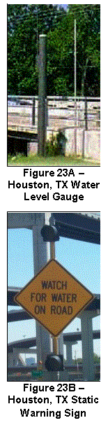 System Components: The monitoring system includes 164
Environmental Sensor Stations (ESS), 314 Closed Circuit Television (CCTV)
cameras, as well as communication and central control systems. The Harris County OEM owns 127 ESS that
measure rainfall rate, rainfall accumulation, and water levels (see Figure 23A). The DOT’s ESS detect these
same conditions as well as wind speed and direction, pavement temperature, air
temperature, humidity, ice and/or roadway water depth (i.e., flooding). The CCTV cameras are used to visually
monitor environmental and traffic conditions on freeways.
System Components: The monitoring system includes 164
Environmental Sensor Stations (ESS), 314 Closed Circuit Television (CCTV)
cameras, as well as communication and central control systems. The Harris County OEM owns 127 ESS that
measure rainfall rate, rainfall accumulation, and water levels (see Figure 23A). The DOT’s ESS detect these
same conditions as well as wind speed and direction, pavement temperature, air
temperature, humidity, ice and/or roadway water depth (i.e., flooding). The CCTV cameras are used to visually
monitor environmental and traffic conditions on freeways.
Video from CCTV cameras is sent to the TranStar management
center via fiber optic cable. A
low-frequency radio communication system transmits ESS data from the field to
central systems. Data from DOT and
county ESS are stored in a database and posted on the TranStar website (www.hcoem.org), which can be viewed by
maintenance personnel and travelers.
Four static warning signs with flashing beacons (see Figure 23B), 13 Highway Advisory Radio (HAR) transmitters, and 153 Dynamic Message
Signs (DMS) may also be used to notify motorists of prevailing conditions.
System Operations: Traffic and emergency managers use
central computers to monitor CCTV video, ESS data, and information from the
National Weather Service and private vendors (e.g., radar, river
forecasts). When established threshold
criteria are met, the Emergency Operations Center (EOC) in the TranStar
facility is activated and computers send alarms to maintenance managers (via
email and pager). Managers from each
agency coordinate to plan appropriate responses and to warn motorists. The transit authority uses ESS data to
manage operations in High Occupancy Vehicle (HOV) lanes, which are prone to
icing and flooding. If warranted,
maintenance personnel will erect barricades to close flooded roadways.
Transportation Outcome:
The environmental monitoring system enhances agency productivity by
eliminating trips to bridge locations, by providing decision support to
managers, by fostering interagency coordination, and by facilitating efficient
transportation management in inclement conditions. Roadway safety is improved by controlling access to flooded roads
and through the provision of weather-related advisories that allow travelers to
make informed decisions.
Implementation Issues: Researchers with
the Texas Transportation Institute evaluated the operation of the monitoring
system and designed a survey to determine how motorists access and interpret
road weather information. Survey
results indicated that 43 percent of respondents utilize the Internet to obtain
hazard information.
Contact(s):
·
David
Fink, Texas DOT, Transportation Operations Engineer, 713-881-3064, dfink1@houstontranstar.org.
·
Frank
Gutierriuz, Harris County OEM, Operations Manager, 713-881-3083, fguiterr@houstontranstar.org.
·
Robert
Benz, Texas Transportation Institute, Associate Research Engineer,
713-686-2971, r-benz@tamu.edu.
Reference(s):
·
“Environmental
Roadway Monitoring Survey Web Site,” http://www.hcoem.org/txdot_survey.htm.
·
FHWA,
“Houston ITS Priority Corridor,” ITS Projects Book, January 2002, http://www.itsdocs.fhwa.dot.gov//JPODOCS/REPTS_TE/13631/pcp-02.html.
·
Harris
County OEM, “Flood Alert System Web Site,” http://www.hcoem.org/flood_alert_system.htm.
·
“Harris
County OEM and TxDOT Road Gages Web Site,” www.hcoem.org/txdot/.
·
“Houston
TranStar Web Site,” http://traffic.tamu.edu/.
·
Texas
Transportation Institute, “What’s the Weather Like?,” Texas Transportation Researcher,
Volume 38, Number 2, 2002, http://tti.tamu.edu/researcher/v38n2/monitor_roadways.stm.
Keyword(s): rain, precipitation,
flooding, ice, wind, environmental monitoring system, freeway management,
traffic management, emergency management, decision support, institutional
issues, traveler information, weather information, advisory strategy, control
strategy, environmental sensor station (ESS), closed circuit television (CCTV),
dynamic message sign (DMS), highway advisory radio (HAR), road weather
information system (RWIS), internet/web site, safety, productivity
Utah DOT Fog Dispersal Operations
In northern Utah widespread, super-cooled fog (i.e., less than 32 degrees F) can persist in
mountain valleys for
weeks. Utah Department of
Transportation (DOT) maintenance personnel use liquid carbon dioxide to
disperse fog and improve visibility along segments of Interstates 15, 70, 80,
and 84; US Highways 40, 89, and 91; as well as secondary roads in Cache Valley
and Bear Lake Valley. This treatment
strategy includes the application of anti-icing chemicals as fog is dispersed
to prevent moisture from freezing on the pavement.
System Components: Fog dispersal equipment, comprised of commercially
available products, is installed on roughly 70 maintenance vehicles or 15
percent of the fleet. As shown in
Figure 24, each truck is equipped with a compressed gas cylinder, a manual
valve assembly, mounting brackets, copper pipe, and a dispensing nozzle. Each cylinder holds liquid carbon dioxide at
a pressure of 2,000 pounds per square inch.
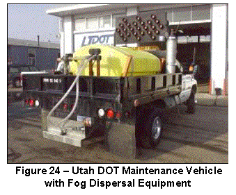 System Operations: Before vehicles
leave the maintenance yard for normal patrol duties, the cylinder and valve
assembly are attached. Dispensers are
turned on when maintenance vehicles leave the yard and turned off when they
return. As the vehicles travel through super-cooled fog, very small
amounts of liquid carbon dioxide are sprayed into the slipstream of the truck. The carbon dioxide
quickly evaporates removing
heat from water droplets in the fog.
The droplets form ice crystals and precipitate as fine
snow or ice.
System Operations: Before vehicles
leave the maintenance yard for normal patrol duties, the cylinder and valve
assembly are attached. Dispensers are
turned on when maintenance vehicles leave the yard and turned off when they
return. As the vehicles travel through super-cooled fog, very small
amounts of liquid carbon dioxide are sprayed into the slipstream of the truck. The carbon dioxide
quickly evaporates removing
heat from water droplets in the fog.
The droplets form ice crystals and precipitate as fine
snow or ice.
To prevent the precipitate from freezing on the road
surface, anti-icing chemicals are simultaneously applied. If the air temperature is below 20 degrees F
(-6.7 degrees C), common road salt is prewetted with liquid magnesium chloride
and applied to pavements. Road salt or sodium chloride brine is spread when the
air temperature is above 20 degrees F.
Transportation
Outcome: The fog dispersal
treatment strategy improves roadway mobility and safety. This strategy can increase visibility
distance behind the maintenance vehicle from 33 feet (10 meters) to 1,640 feet
(500 meters) in
less than 30 minutes. The treatment
remains effective for 30 minutes to 4 hours, depending upon air temperature and
wind speed. Improved visibility has
significantly reduced rear-end crashes into maintenance vehicles, enhancing the
safety of DOT personnel and the public.
Implementation
Issues: In 1990 the DOT’s Research Division sponsored a University of Utah research grant
to investigate fog control at a bridge location. During the study university researchers noticed that a tunnel of clear visibility formed in
the fog as carbon dioxide was dispensed.
In 1992 DOT and university researchers developed a prototype with customized hardware components and began the
field testing of mobile fog dispersal techniques. The Research Division published field trial results
in 1993.
Based upon
recommendations in the field trial report and lessons learned from
anti-icing operations near Salt Lake International Airport, maintenance personnel configured a truck with fog
dispersal equipment composed of commercial-off-the-shelf products. This configuration was more cost effective than the customized
configuration developed by the University, which was prohibitively
expensive.
Before fog
dispersal equipment was deployed in 2000, the DOT developed a
two-hour training course to ensure employee safety when working with compressed
liquid carbon dioxide. Training course
topics included oxygen-displacement properties of the chemical, chemical
handling techniques, and operation of the high-pressure dispenser.
Contact(s):
·
Lynn J. Bernhard,
Utah DOT Maintenance Planning Division, Methods Engineer, 801-964-4597, lynnbernhard@utah.gov.
·
Norihiko Fukuta,
University of Utah, Department of Meteorology, 801-581-8987, nfukuta@met.utah.edu.
Reference(s):
·
Covington, A., “UDOT
Maintenance Crews Are Fighting Fog,” Utah Department of Transportation Press
Release, January 2001, www.dot.state.ut.us/public/press_rel/Release%2000/Aug%20-%20Dec/R_283_00.htm.
·
“Utah’s Latest Weapon
Against Fog,” Deseret News, December 2000, http://deseretnews.com/dn/print/1,1442,245011048,00.html.
Keywords: fog,
visibility, air temperature, wind, fog dispersal operations, freeway
management, winter maintenance, treatment strategy, maintenance vehicle,
chemicals, anti-icing/deicing, crashes, safety, mobility
Utah DOT Low Visibility
Warning System
Due
to high traffic volumes and local conditions conducive to dense fog formation,
the Utah Department of Transportation (DOT) deployed a low visibility warning
system on Interstate 215 to notify motorists of safe travel speeds and to
promote more uniform traffic flow. The
warning system was installed on a low-lying, two-mile (three-kilometer) highway
segment above the Jordan River in Salt Lake City where several multi-vehicle, fog-related crashes have
occurred. In 1988 there was a
66-vehicle crash and in 1991 ten crashes, with three fatalities, occurred on
one day.
System Components: Four
forward-scatter visibility sensors and six vehicle detection sites are
installed on the freeway to collect data on prevailing conditions. Visibility distance is measured in real-time
and inductive loop detectors record the speed, length, and lane of each
vehicle. Through Ultra-High Frequency
radio modems these data are transmitted to a central computer system that
records field data in a database, processes field data, and posts advisories on
two roadside Dynamic Message Signs (DMS).
System Operations: The central
computer identifies threats by using visibility distance, vehicle speed, and
vehicle classification data in a weighted average algorithm to determine when
conditions warrant motorist warnings.
When visibility distance falls below 820 feet (250 meters), the computer
automatically displays a warning on DMS.
Based on stopping sight distances, safe travel speeds are posted on DMS
when visibility is less than 656 feet (200 meters). Messages displayed for various visibility ranges are shown in
Table 9.
Table 9 – Utah DOT Low
Visibility Warning System Messages
|
Visibility Conditions |
Displayed Messages |
|
656
to 820 feet (200 to 250 meters) |
“Fog Ahead” |
|
492
to 656 feet (150 to 200 meters) |
“DENSE
FOG” alternating with “ADVISE 50 MPH” |
|
328
to 492 feet (100 to 150 meters) |
“DENSE
FOG” alternating with “ADVISE 40 MPH” |
|
197
to 328 feet (60 to 100 meters) |
“DENSE
FOG” alternating with “ADVISE 30 MPH” |
|
Less
than 197 feet (60 meters) |
“DENSE
FOG” alternating with “ADVISE 25 MPH” |
Transportation Outcome: An evaluation of
the warning system indicated that overly cautious drivers sped up when advisory
information was displayed, resulting in a 15 percent increase in average speed
from 54 to 62 mph (86.8 to 99.7 kph).
This increase caused a 22 percent decrease in speed variance from 9.5 to
7.4 mph (15.3 to 11.9 kph). Reducing
speed variance enhanced mobility and safety by promoting more uniform traffic
flow and minimizing the risk of initial, secondary, and multi-vehicle crashes.
Implementation Issues: In 1993 DOT researchers responded to a federal solicitation
to prototype a low visibility warning system.
The DOT contracted with a consultant in 1994 to design and install the
system on Interstate 215 due to recurring fog.
During winter 1995/1996 the DOT collected visibility distance and
traffic data before DMS were deployed to assess driver behavior in fog without
advisories. By the end of 1997 field,
central, and communication equipment was installed, calibrated, and
integrated. DMS calibration and
verification was carried out with the assistance of the Utah Highway
Patrol.
The system was operational by winter 1999/2000 and traffic managers began collecting traffic speed data, vehicle classification data, visibility data, as well as displayed messages. The DOT partnered with the University of Utah to conduct an evaluation of system effectiveness. The University analyzed traffic speeds by time-of-day, lane and direction, vehicle classification, and visibility distance with data collected over four winter seasons. Based on positive results, it was recommended that speed and pavement condition data be incorporated into control logic, that the warning system be integrated with the DOT’s Advanced Traffic Management System, and that further evaluation be conducted. The DOT plans to enhance the system by deploying an Environmental Sensor Station to detect weather and pavement conditions, upgrading the DMS, and replacing the radio communication system with fiber optic cable.
Contact(s):
·
Sam Sherman, Utah
DOT, ITS Division, 801-965-4438, ssherman@utah.gov
Reference(s):
·
Perrin Jr., J., et
al., “Effects of Variable Speed Limit Signs on Driver Behavior During Inclement
Weather,” presented at Institute of Transportation Engineers (ITE) Annual
Meeting, August 2000.
·
Utah DOT Research
News, “Utah’s Fog Warning System - ADVISE,” No. 2000-4, http://www.dot.state.ut.us/res/research/Newsletters/00-4.pdf.
·
Perrin, et al.,
“Testing the Adverse Visibility Information System Evaluation (ADVISE) – Safer
Driving in Fog,” presented at the Transportation Research Board (TRB) Annual
Meeting, January 2002.
·
Schreiner, C., “State
of the Practice and Review of the Literature: Survey of Fog Countermeasures
Planned or in Use by Other States,” Virginia Tech Research Council, pp. 23-24,
October 2000.
Keywords:
fog, low
visibility warning system, freeway management, traffic management, control
strategy, speed management, advisory strategy, motorist warning system,
traveler information, vehicle detection, dynamic message sign (DMS), driver
behavior, safety, mobility
Virginia DOT Weather-Related Incident Detection
The
Virginia Department of Transportation (DOT) operates an Advanced Traffic
Management System (ATMS) to control the highway network in Northern
Virginia. The ATMS includes an Incident
Detection subsystem and a Closed Circuit Television (CCTV) subsystem, which are
used for traffic and road condition surveillance on 27 miles (43.4 kilometers)
of Interstate 66 and nearly 29 miles (46.6 kilometers) of Interstate 395. Traffic managers are able to modify incident
detection parameters based upon observed weather conditions.
System Components: The Incident Detection subsystem is comprised of
inductive loop detectors, Type 170 controllers housed in roadside cabinets, and
a central incident detection computer.
Traffic flow data is collected at over 120 vehicle detection sites
installed every half mile (0.8 kilometers) along the freeways. The CCTV subsystem includes over 50 cameras,
video transmission devices, and three monitor walls for display of video
images. Fiber optic cable and coaxial
cable communication systems transmit data and video from the field to control
computers in the Smart Traffic Center (STC) located in Arlington.
System Operations: Incident detection computer software contains
statistical algorithms that continuously analyze field data to identify traffic
flow disruptions caused by incidents.
Traffic managers may select databases containing detection algorithms
for “clear”, “rainy” or “snowy” conditions.
When rain or snow events are observed on the monitor walls traffic
managers access the incident detection computer and select the detection
database most appropriate for prevailing conditions. The CCTV subsystem is also used to visually verify detected
incidents and support incident management activities.
Transportation Outcome: Use of algorithms
tailored to specific weather events improves roadway mobility and safety by
facilitating incident detection under non-ideal conditions. Weather-related incident detection enhances
mobility by minimizing response time and traffic delays associated with
temporary capacity reductions. Safety
is improved through expedited incident response and clearance, which reduce the
risk of secondary crashes.
Implementation Issues: The Virginia DOT contracted with a consulting firm to
design, install, and integrate ATMS components and subsystems. In 1985 system integration and testing
efforts were completed and the STC began operating. The ATMS was expanded in 1999 through the deployment of additional
monitoring, control, and communication devices along Interstates 66 and 95.
Hardware
and software components in the STC were upgraded in 2000. The original mainframe computer was replaced
with redundant servers. New operator
workstations and video walls were also installed. In the future, the DOT plans to expand weather-related incident
detection capabilities to Interstate 495 (i.e., the Capital Beltway) and plans
to integrate the ATMS with research facilities at the University of Virginia.
Contact(s):
·
Marlowe Dixon,
Virginia DOT, 703-383-2601, dixon_mk@vdot.state.va.us.
·
Jimmy Chu, Virginia
DOT, 703-383-2621, chu_tf@vdot.state.va.us.
Reference(s):
·
Turochy, R. and
Smith, B., “Alternative Approaches in Condition Monitoring in Freeway
Management Systems,” Virginia Transportation Research Council, VTRC 02-R8, http://www.virginiadot.org/vtrc/main/online_reports/pdf/02-r8.pdf.
·
Tang, A., “Northern
Virginia District (NOVA) Smart Travel Program: Summary of 1999 Activities,”
Virginia DOT, December 1999, http://www.virginiadot.org/infoservice/resources/smart-nova-summary-program-act.pdf.
·
Tang, A., “Northern
Virginia District (NOVA) Smart Travel Program: Summary Report,” Virginia DOT,
December 1999, http://www.virginiadot.org/infoservice/resources/smart-nova-program-plan.pdf.
Keywords: rain,
snow, pavement condition, weather-related incident detection, freeway
management, control strategy, incidents, vehicle detection, closed circuit
television (CCTV), safety, mobility
Washington State DOT Road Weather Information for Travelers
The Washington State Department of Transportation (DOT) has collaborated
with the University of Washington to provide travelers with comprehensive,
integrated road weather information. The
DOT maintains one of the most advanced traveler information web sites, which
allows users to access current and predicted road weather conditions on an
interactive, statewide map.
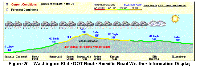 System Components:
The DOT owns 50 Environmental Sensor Stations (ESS) that collect air
temperature, atmospheric pressure, humidity, wind speed, wind direction,
visibility distance, precipitation, pavement temperature and subsurface
temperature. Some stations are equipped
with Closed Circuit Television (CCTV) for visual monitoring of pavement and
traffic flow conditions. The DOT is
also a member of the Northwest Weather Consortium, which collects and
disseminates real time data from an extensive environmental monitoring network. This network gathers and disseminates data
from over 450 ESS owned by nine local, state and federal agencies. A statewide communication network transmits
this ESS data to the Seattle Traffic Management Center (TMC) and to a computer
at the University’s Department of Atmospheric Sciences for data fusion and
advanced modeling.
System Components:
The DOT owns 50 Environmental Sensor Stations (ESS) that collect air
temperature, atmospheric pressure, humidity, wind speed, wind direction,
visibility distance, precipitation, pavement temperature and subsurface
temperature. Some stations are equipped
with Closed Circuit Television (CCTV) for visual monitoring of pavement and
traffic flow conditions. The DOT is
also a member of the Northwest Weather Consortium, which collects and
disseminates real time data from an extensive environmental monitoring network. This network gathers and disseminates data
from over 450 ESS owned by nine local, state and federal agencies. A statewide communication network transmits
this ESS data to the Seattle Traffic Management Center (TMC) and to a computer
at the University’s Department of Atmospheric Sciences for data fusion and
advanced modeling.
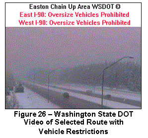 System Operations:
A sophisticated computer model developed by the university ingests ESS
data to determine prevailing and predicted pavement temperatures and generate
high-resolution, numerical weather forecasts for the entire state. Observed environmental data is integrated
with other information including
National Weather
Service (NWS) forecasts, satellite and radar images, video from 350 CCTV cameras, traffic
flow data from inductive loop detectors, incident and construction data, ten
mountain pass reports, and audio broadcasts from four Highway Advisory Radio
(HAR) transmitters. As shown in Figures 25 and 26, route-specific traveler information
is disseminated through the DOT’s Traffic and Weather web site (www.wsdot.wa.gov/traffic) and via an
interactive voice response telephone service (800-695-ROAD).
System Operations:
A sophisticated computer model developed by the university ingests ESS
data to determine prevailing and predicted pavement temperatures and generate
high-resolution, numerical weather forecasts for the entire state. Observed environmental data is integrated
with other information including
National Weather
Service (NWS) forecasts, satellite and radar images, video from 350 CCTV cameras, traffic
flow data from inductive loop detectors, incident and construction data, ten
mountain pass reports, and audio broadcasts from four Highway Advisory Radio
(HAR) transmitters. As shown in Figures 25 and 26, route-specific traveler information
is disseminated through the DOT’s Traffic and Weather web site (www.wsdot.wa.gov/traffic) and via an
interactive voice response telephone service (800-695-ROAD).
To make travel decisions, the public may access the web site to view
state, regional and local maps with environmental observations, weather and
pavement condition forecasts, video from freeway CCTV cameras, information on
road maintenance operations, and travel restrictions on mountain passes (e.g.,
reduced speed limits, prohibited vehicle types).
Transportation Outcome:
Road weather data available through the web site and telephone service
allows users to avoid hazardous conditions, modify driving behavior, and reduce
crash risk. A user survey found that
travelers feel safer when they have access to real-time road weather information. The survey also revealed that users
frequently access the web site to prepare for prevailing conditions along a
selected route (i.e., 90 percent of respondents), for general weather
conditions (i.e., 86 percent), to check weather for a specific recreational
activity (i.e., 66 percent), and to determine travel routes or travel time.
Usage logs from the web site indicate that travelers access condition
data more frequently during adverse weather events. On average, there were over 3,700 user sessions per day in
February 2001. During a snowstorm on
Friday, February 16th (before a three-day weekend) site usage
increased to nearly 13,000 user sessions.
The interactive telephone service typically receives one million calls
each winter (i.e., an average of 8,000 calls per day) with call volumes
increasing during inclement conditions or major incidents.
Maintenance managers also benefit from access to detailed road weather
data. This data serves as support for
operational decisions, such as resource allocation and treatment planning. More effective and efficient resource
decisions reduce labor, equipment and material costs. The ability to employ proactive road treatment strategies, such
as anti-icing, also improves roadway mobility.
Implementation Issues:
The web site project was funded by a grant from U.S. Department of
Transportation and a 20 percent match from Washington State DOT. To collect environmental data for the site,
the DOT wanted to procure ESS from different vendors and display field data on
a single user interface. Project managers
developed functional
specifications and issued a request for proposals to furnish ESS capable of communicating
with an existing server using National Transportation Communications for ITS
Protocol (NTCIP) standards. After
resolving technical issues related to object definitions, one vendor
successfully demonstrated that their sensor stations could communication with
another vendor’s server.
This simplified management of environmental data and avoided the need
for additional hardware, software and communications infrastructure. By using the open communication standard the
DOT encouraged competition among vendors that reduced ESS procurement costs by
nearly 50 percent. The NTCIP will also
facilitate future expansion of the environmental monitoring system.
The Washington State DOT has initiated a project to deliver traveler
information via 511, the national traveler information telephone number. The agency is developing a program with
natural language speech recognition to read web site data and disseminate
tailored information. The DOT is in
negotiation with local cellular telephone companies to offer 511 free of
charge. The toll-free telephone number
will be phased out as the 511 implementation project proceeds.
Contact(s):
·
Larry
Senn, Washington State DOT, Olympia Traffic Operations Office, 206-543-6741, larsenn@u.washington.edu.
·
Eldon
Jacobson, Washington State DOT, 511 Project Manager, 206-685-3187, eldon@u.washington.edu.
Reference(s):
·
Boon,
C. and Cluett, C., “Road Weather Information Systems (RWIS): Enabling Proactive
Maintenance Practices in Washington State,” University of Washington,
Washington State Transportation Center (TRAC) and Washington State DOT (WSDOT),
Research Report for Project T1803 Task 39, Report No. WA-RD 529.1, March 2002, http://www.wsdot.wa.gov/PPSC/Research/CompleteReports/WARD529_1RWISEval.pdf.
·
Schuman,
R. and Sherer, E., “ATIS U.S. Business Models Review,” prepared by PBS&J
for the U.S.DOT ITS Joint Program Office, November 2001, http://ops.fhwa.dot.gov/Travel/Atis-bm.htm.
·
Sauer,
G., et al, “Analysis of Web-Based WSDOT Traveler Information: Testing Users’
Information Retrieval Strategies,” University of Washington TRAC and Dept of
Technical Communication, Final Research Report for Project T2695 Task 15,
Report No. WA-RD 552.1, September 2002, http://depts.washington.edu/trac/bulkdisk/pdf/552.1.pdf.
·
Washington
State DOT, “rWeather Real-time Statewide Traveler Information Website,” http://www.wsdot.wa.gov/Rweather/about/project.htm.
·
U.S.
DOT, “Environmental Monitoring Application Area,” ITS Standards Program Web
Site, March 2003, http://www.its-standards.net/AA-Environmental%20Monitoring.htm.
·
U.S.
DOT, “Leading the Way: Profile of an Early ESS Deployer,” ITS Standards
Program, FHWA-OP-02-014, 2002, http://www.its-standards.net/Documents/Early%20Depl-%20SENN.pdf.
Keyword(s): adverse weather, road
weather information for travelers, traveler information, advisory strategy,
weather information, pavement temperature, environmental sensor station (ESS),
closed circuit television (CCTV), Internet/web site, decision support,
institutional issues, road weather information system (RWIS), safety,
productivity
Washington State DOT Speed Management
Interstate
90, which is the primary east-west route across Washington State, experiences
rain and fog in summer months and snow and ice in the winter. This freeway crosses the Cascade Mountains
through Snoqualmie Pass, which is a popular tourist destination. Roadway geometry, the volume of truck
traffic (i.e., 22 percent), and recreational travelers unfamiliar with local
conditions contributed to a winter crash rate that was four times the annual
average. The Washington State
Department of Transportation (DOT) employs a speed management technique on a
40-mile (64-kilometer) segment of the freeway to improve roadway safety in the
presence of fog, snow, and ice.
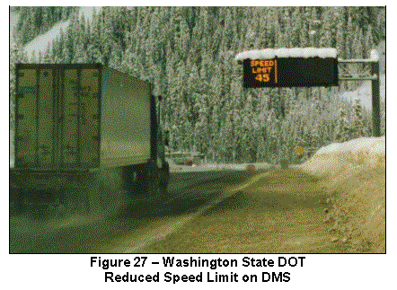 System
Components: The speed management system is comprised of
six Environmental Sensor Stations (ESS), 22 radar vehicle detectors, Remote
Processing Units (RPUs) housed in roadside cabinets, 13 Dynamic Message Signs
(DMS), Variable Speed Limit (VSL) signs, a central control system, as well as
digital radio and microwave communication systems. The ESS are installed along the interstate to detect air
temperature and humidity, precipitation, wind speed, pavement temperature and
condition (e.g., dry, wet, icy), and pavement chemical concentration. ESS data and vehicle speed data are
collected by RPUs and transmitted to a control computer in the maintenance
office located in Hyak. Advisory
messages and reduced speed limits are posted on the DMS and VSL signs, as shown
in Figure 27.
System
Operations: The
central control computer provides decision support by utilizing software
algorithms to process field data, calculate safe speeds, and suggest speed
limit reductions during adverse conditions.
If system operators agree with the recommendations DMS and VSL signs are
activated to display road weather advisories, reduced speed limits, and the
reasons for lower speeds. The control
computer allows system operators to modify speed limits by direction and by
road section. DMS may also be used to
alert drivers of roadway closures necessitated by winter maintenance and
avalanche control activities.
When warranted, the speed limit is reduced in 10-mph
(16-kph) increments from 65 mph (104.5 kph) to 35 mph (56.3 kph) based upon
prevailing road, weather, and traffic conditions. Vehicle equipment (e.g., tire
chains) may be regulated to improve vehicle traction. Control strategies for various road weather conditions are shown
in Table 10.
Table 10 – Washington State DOT
Speed Management Control Strategies
|
Weather Conditions |
Pavement
Conditions |
ControlStrategies |
|
·
Light to moderate rain ·
Visibility distance greater than 0.5 mi. (0.80 km) |
·
Dry ·
Wet |
Speed limit at 65 mph (104.5 kph) |
|
No tire regulations |
||
|
·
Heavy rain ·
Fog ·
Visibility distance less than 0.2 mi. (0.32 km) |
·
Slushy ·
Icy |
Speed limit reduced to 55 mph (88.4 kph) |
|
Traction tires
advised |
||
|
·
Heavy rain or snow ·
Blowing snow ·
Visibility distance less than 0.1 mi. (0.16 km) |
·
Shallow standing water ·
Compacted snow/ice ·
Deep slush |
Speed limit reduced to 45 mph (72.4 kph) |
|
Traction tires required |
||
|
·
Freezing rain ·
Heavy rain or snow ·
Blowing snow ·
Visibility distance less than 0.1 mi. (0.16 km) |
·
Deep standing water ·
Deep snow/slush |
Speed limit reduced to 35 mph (56.3 kph) |
|
Tire chains required |
Transportation Outcome: Speed management has improved roadway safety by
prompting drivers to significantly decrease
speed in inclement conditions. A
University of Washington study found that although speed variance increased
slightly, speed management reduced average speed by up to 13 percent.
Implementation
Issues: An examination of historical crash
statistics determined that the winter crash rate was significantly higher than
the annual average. Crash frequency in
the presence of snow was five times the rate under clear conditions. The crash rate in January was 12 times
higher that the July crash rate. High
travel speeds and speed variance were found to contribute to winter crashes,
which were primarily rear-end, sideswipe, and run-off-the-road type. Based upon these findings, the Washington
State DOT decided to employ speed management to enhance roadway safety under
low visibility or slippery pavement conditions.
The DOT
hired a consultant to provide design, integration, and support services for
system components. The DOT selected
field equipment locations, designed sign support structures, assessed communication
system options, and purchased DMS hardware.
The DOT’s Radio Operations department considered the licensing,
installation, and maintenance issues associated with telephone, radio,
microwave, and satellite communications technologies. The cost of installing 40 miles (64 kilometers) of telephone
cable through the mountainous terrain of the Snoqualmie Pass was
prohibitive. High costs and topography
also precluded utilization of satellite communications. Thus, multiple microwave and radio
communication links were designed to transmit data from the roadway to the
mountaintop and from the mountaintop to the Hyak maintenance office. The DOT chose a DMS with light-emitting
diode technology for high visibility in adverse weather conditions and procured
the signs under a separate contract to ensure that performance criteria were
met.
After
system components were deployed in winter 1997, the Washington State DOT
established policies and procedures to guide system operation. Traffic managers, system operators,
maintenance personnel, state police, and others involved with the system were
consulted during development of these policies. Policies and procedures covered
staffing and training requirements, the reporting structure, message sets, and
various response scenarios.
Contact(s):
·
Larry Senn, Washington State DOT, Olympia Traffic
Operations Office, 206-543-6741, larsenn@u.washington.edu.
Reference(s):
·
Booz-Allen & Hamilton, “Compendium of Field Operational
Test Executive Summaries,” http://www.itsdocs.fhwa.dot.gov/jpodocs/repts_pr/32301!.pdf.
·
Jasper, K., “Cross-Cutting Study of Advanced Rural
Transportation System ITS Field Operational Tests,” Booz-Allen & Hamilton,
presented at the 1998 Transportation Conference, http://www.ctre.iastate.edu/pubs/crossroads/245cross.pdf.
·
Robinson, M., et al,
“Safety Applications of ITS in Rural Areas,” prepared by Science Applications
International Corporation (SAIC) for FHWA, September 2002, http://www.itsdocs.fhwa.dot.gov//JPODOCS/REPTS_TE//13609.html.
·
Science Applications International Corporation (SAIC),
“Examples of Variable Speed Limit Applications,” presented at the
Transportation Research Board (TRB) Annual Meeting, January 2000, http://safety.fhwa.dot.gov/fourthlevel/ppt/vslexamples.ppt.
·
Senn, L., ”Variable Speed Limit And In-Vehicle Signing
Operational Test,” Washington State DOT, http://www.wsdot.wa.gov/eesc/atb/atb/html/TA.html.
·
Senn, L. and Bjorge, E., ”ITS Field Operational Test
Contracting: Avoiding Surprises,” Washington State DOT, http://www.wsdot.wa.gov/eesc/atb/atb/html/ITSA.html.
·
Ulfarsson, G., et al, “TRAVELAID,” Final Report, prepared by
Washington State Transportation Center (TRAC) in cooperation with Washington
State DOT, December 2001, http://www.itsdocs.fhwa.dot.gov//jpodocs/repts_te//13610.html.
·
Ulfarsson, G., et al, “Summary: TRAVELAID,” Summary Report,
prepared by Washington State TRAC in cooperation with Washington State DOT,
February 2002, www.wsdot.wa.gov/ppsc/research/CompleteReports/WARD511_2TravelAidSummary.pdf.
·
Ulfarsson, G., et al, “The Effect of Variable Message Signs
on the Relationship between Mean Speeds and Speed Deviations,” prepared by
Washington State TRAC in cooperation with Washington State DOT, presented at
the Transportation Research Board (TRB) Annual Meeting, July 2001.
Keywords: fog, visibility, snow, ice, winter storm, speed management, freeway management, traffic management, traffic control, law enforcement, access control, control strategy, motorist warning system, traveler information, advisory strategy, decision support, high-profile vehicles, vehicle detection, environmental sensor station (ESS), pavement condition, dynamic message sign (DMS), variable speed limit (VSL), driver behavior, speed, crashes, safety
Wyoming DOT Avalanche
Warning System
US
Highway 189 near Jackson, Wyoming is a steep, mountain road that winds through
Hoback Canyon (see Figure 28). Along
the highway, there is an avalanche path with a 35-degree slope that poses a
threat to the traveling public and to Wyoming Department of Transportation
(DOT) personnel engaged in snow and ice control activities. In the past, maintenance personnel have been
caught in avalanches while clearing snow and debris from a prior slide. The DOT has deployed a warning system on the
highway to detect avalanches, warn approaching motorists, and alert maintenance
personnel working in the area.
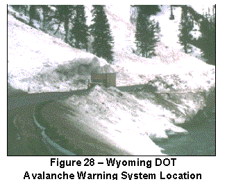 System
Components: The avalanche warning system is comprised of
a sensor assembly, a radio communication system, a controller, two static
warning signs equipped with flashing beacons, and audible alarms in maintenance
vehicles. The sensor assembly includes
tilt switch sensors enclosed in galvanized steel pipes. The pipes are hung on weighted wire ropes
attached to a ¾-inch (19-mm) diameter cable, which is strung across the slide
path. The cable is suspended roughly 8 feet (2.5 meters) above the ground and
anchored to steel posts embedded in concrete.
The sensor assembly is installed 980 feet (298.7 meters) above the
roadway.
System
Components: The avalanche warning system is comprised of
a sensor assembly, a radio communication system, a controller, two static
warning signs equipped with flashing beacons, and audible alarms in maintenance
vehicles. The sensor assembly includes
tilt switch sensors enclosed in galvanized steel pipes. The pipes are hung on weighted wire ropes
attached to a ¾-inch (19-mm) diameter cable, which is strung across the slide
path. The cable is suspended roughly 8 feet (2.5 meters) above the ground and
anchored to steel posts embedded in concrete.
The sensor assembly is installed 980 feet (298.7 meters) above the
roadway.
The
controller monitors sensor status, records sensor data, and activates warning
systems via radio when the onset of an avalanche is detected. The roadside warning signs are located 1,300
feet (396.2 meters) in advance of the affected highway segment. Batteries with solar panel chargers supply
power to all field sensors, control devices, and communications hardware. Portable alarm devices are placed in
maintenance vehicles—primarily rotary snowplows and front-end loaders—operating
in the area.
System Operations: Controller software is programmed to continuously monitor
the sensor assembly and detect switch closure based upon established threshold
values. When an avalanche is detected,
warning devices are instantly activated.
Tilt switches within the steel pipes pivot from vertical to horizontal
positions when impacted by a slide causing a circuit to close. The controller automatically prompts a radio
to transmit a modulated tone to activate beacons atop motorists warning signs
and to sound 97-decibel sirens in maintenance vehicles. The audible alert gives maintenance
personnel about ten seconds to move out of the slide path.
Transportation Outcome: The avalanche warning
system improves roadway safety by minimizing risks to drivers and to
maintenance personnel. The system also
facilitates timely inspection of the roadway after an avalanche, snow and
debris removal activities, and road closure or rescue operations.
Implementation Issues: The warning system project was initiated as a
multi-state, pooled fund study involving Colorado, Idaho, Utah, Washington
State, and Wyoming. After developing equipment requirements, designers of the
Wyoming system decided where the sensor assembly should be installed based upon
starting zones and slide speeds of prior avalanches. If sensors were located too far above the highway, the system
could initiate warnings for avalanches that did not reach the road. If placed too close to the road, there
would not be sufficient time for the system to warn those in danger.
Designers
considered system expandability through the integration of new components. A preliminary test of non-invasive avalanche
sensors is underway. Two geophones,
which measure ground motion, were installed adjacent to the slide path roughly
98 and 197 feet (30 and 60 meters) below the tilt switch sensor assembly. When the tilt switch sensors are activated,
the controller simultaneously samples the geophones. By detecting the time lag in the arrival of an avalanche
waveform, the controller can distinguish avalanches from other events and
determine slide velocity. Further
experimentation is necessary to establish criteria for warning system
activation.
In
a coordinated effort, local winter maintenance managers and emergency managers
plan to examine hardware and communication interface reliability, document
system operation, and assess roadway impacts.
Evaluation results will be used to optimize the system and supplement
training.
Contact(s):
·
Leroy “Ted” Wells,
Wyoming DOT District 3, 307-352-3000, leroy.wells@dot.state.wy.us.
·
Rand Decker,
University of Utah, 801-581-3403, rdecker@civil.utah.edu.
Reference(s):
·
Rice, Jr., R., et al,
“Avalanche Hazard Reduction for Transportation Corridors Using Real-Time Detection
and Alarms”, http://www.sicop.net/annals-paper%20total.pdf.
·
Rice, Jr., R., and Decker,
R., “A Rural Intelligent Transportation System for Snow Avalanche
Detection and Warning,” Transportation
Research Record, No. 1700, p. 17-23, 2000.
·
Thirumalai, K.,
“Rural ITS Applications for Snow Maintenance and Winter Hazard Mitigation”,
presented at the 5th World Congress, http://152.99.129.29/cdrom/1006.pdf.
Keywords:
snow,
avalanche warning system, freeway management, winter maintenance, advisory
strategy, traveler information, motorist warning, maintenance vehicle, safety