Hydrology and Remote Sensing Laboratory Site Logo
ARS Home About Us Helptop nav spacerContact Us En Espanoltop nav spacer
Printable VersionPrintable Version     E-mail this pageE-mail this page
Agricultural Research Service United States Department of Agriculture
Search
  Advanced Search
Directions and Sign-in Procedures
In-Depth Program Review, Feb 21-23
HRSL Anonymous FTP Site


Remote Sensing Research at BARC
headline bar
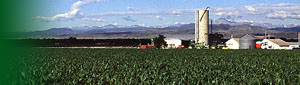
Remote sensing is the science and art of obtaining information about an object, area, or phenomenon via analysis of data acquired by a device that is not in contact with the target of investigation. ARS is conducting research on remote sensing technologies of benefit to agriculture, forestry, environmental quality and global climate change concerns. The research includes topics of interest to a wide range of managers, from individual producers, agribusinesses, and regional planners to strategic decision makers at the national and international levels. Some examples are presented here.

text breaking bar

Energy flux thumbnail  Using satellite and aircraft sensors to compute spatially distributed energy fluxes
USDA-ARS-Hydrology and Remote Sensing Lab
soil moisture thumbnail Mapping soil moisture using an L-band microwave radiometer
USDA-ARS-Hydrology and Remote Sensing Lab
ndvi thumbnail Assessing crop yield across the US using the NDVI index on AVHRR data
USDA-ARS-Hydrology and Remote Sensing Lab
airborne laser thumbnail Using an airborne laser profiler to measure surface features and properties of the landscape
USDA-ARS-Hydrology and Remote Sensing Lab
spatial variablity thumbnail Determining the spatial variablity of cropland using remotely sensed data
USDA-ARS-Hydrology and Remote Sensing Lab
BOREAS experiment thumbnail Helicopter remote sensing during the BOREAS experiment in Canada
USDA-ARS-Hydrology and Remote Sensing Lab
HAPEX-Sahel thumbnail Airborne bidirectional reflectance studies during the HAPEX-Sahel experiment in Niger, Africa
USDA-ARS-Hydrology and Remote Sensing Lab
crop residue thumbnail Estimating crop residue by remote sensing
USDA-ARS-Hydrology and Remote Sensing Lab

text breaking bar

Continue on the tour by following the arrow: Next. You can return to this page when you see this arrow: Remote Sensing at BARC Home


These pages compiled by Rob Parry who may be contacted at rparry@hydrolab.arsusda.gov


Last Modified: 08/19/2005
ARS Home | USDA.gov | Site Map | Policies and Links 
FOIA | Accessibility Statement | Privacy Policy | Nondiscrimination Statement | Information Quality | USA.gov | White House