|
|
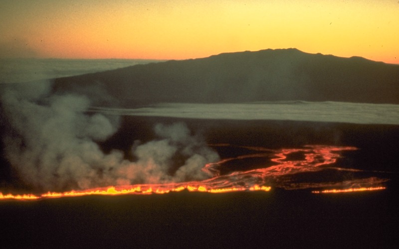
Lava erupts from fissures high on the northeast rift zone of Mauna Loa in the early morning hours of July 6, 1975. These fissures fed several lava flows, the longest of which traveled 5.2 km northward toward Mauna Kea (in background). Although the eruption ended before nightfall, elevated earthquake activity continued through July 12 as magma kept moving into the northeast rift zone without reaching the surface. As long as magma threatened to erupt again, scientists worked 24 hours a day to monitor the volcano. This eruption began less than 2 hours after strong volcanic tremor was first recorded by three seismic stations near the summit caldera. Like most eruptions of Mauna Loa, lava first erupted in the caldera; the eruption started just before midnight on July 5, about 6 hours before this photo was taken. Prior to 1975, the most recent eruption of Mauna Loa was in 1950. |