 |
||
|
Strategic Objective 3.2
Enhance the conservation and management of coastal and marine resources to meet America’s economic, social, and environmental needs
The Department works to protect, restore, and manage ocean and coastal resources. To meet this mandate, the Department maintains a world-class expertise in oceanography, marine ecology, fisheries management, conservation biology, and risk assessment. To achieve balance among ecological, environmental, and social influences, the Department has adopted an ecosystem approach to management—an approach that is deliberate, incremental, and collaborative. Within the Department, NOAA’s mission “to protect, restore, and manage fisheries and coastal and ocean resources” is critical to the health of the U.S. economy. To the extent it is possible to balance sustainable economic development and healthy functioning marine ecosystems, the Department seeks to provide an example for the rest of the world in how to protect, restore, and manage resources of the world’s oceans and coasts.
Performance Objective: Protect, restore, and manage the use of coastal and ocean resources through an ecosystem approach to management (NOAA)
|
||||||||||||||||||||||||||||||||||||||||||||||||||||||||||||||||||||||||||||||||||||||||||||||||||||||||||||||||||||||||||||||||||||||||||||||||||||||||||||||||||||||||||||||||
| Rating | Results |
|---|---|
| Exceeded Target | 0 |
| On Target | 8 |
| Slightly Below Target | 0 |
| Below Target | 0 |
| See Appendix A: Performance and Resource Tables for individual reported results. | |
Coastal areas are among the most developed in the Nation, with over half the population living on less than one-fifth of the land in the contiguous United States. At over 230 persons per square mile, the population density of the near shore is three times that of the Nation as a whole. That portion of the U.S. economy that depends directly on the ocean is also large, with 2.3 million people employed and over $117 billion in value added to the national economy in 2000. Approximately 89 million people vacation and recreate along U.S. coasts every year. The amount added annually to the national economy by the commercial and recreational fishing industry alone is over $43 billion with an additional $1 billion of marine and freshwater aquaculture sales. With its Exclusive Economic Zone of 3.4 million square miles, the United States manages the largest marine territory of any nation in the world. Within this context, NOAA works with its partners to achieve a balance between the use and protection of these resources to ensure their sustainability, health, and vitality for the benefit of this and future generations and their optimal contribution to the Nation’s economy and society.
In FY 2007, NOAA provided national and international leadership for the U.S. Ocean Action Plan by participating in the development of the U.S. Ocean Research Priorities Plan and Implementation Strategy and by supporting the establishment of the coordinated Ocean Governance Structure. NOAA continued rebuilding fisheries and reducing capacity to improve food security, increase economic benefits, and improve stability of marine ecosystems. NOAA also promoted greater use of market-based systems for fisheries management and regional collaboration on Oceans, Coasts, and Great Lakes Policy in partnership with leadership of states, local, and tribal leadership.
Some highlights from FY 2007 include:
A team of scientists from NOAA and the University of Maryland Center for Environmental Science released the most comprehensive assessment of estuarine eutrophication to date, Effects of Nutrient Enrichment in the Nation’s Estuaries: A Decade of Change, National Estuarine Eutrophication Assessment Update, which clearly indicates linkages between upstream activities and coastal ecosystem health. The report shows that the majority of U.S. estuaries assessed have moderate to high levels of nutrient related impairments, are highly influenced by human-related activities (i.e., agricultural activities, sewage effluent, urban runoff, atmospheric deposition), and most are expected to worsen in the future. The report also offers recommendations to reduce future problems.
Sounds from the Southern Ocean is a joint project between NOAA’s Pacific Marine Environmental Laboratory, Oregon State University, and the Korea Polar Research Institute. Defined as the waters pole ward of roughly 60 degrees south latitude, the Southern Ocean surrounds Antarctica and serves as a conduit between the Atlantic, Pacific, and Indian oceans. Constant severe weather makes the Southern Ocean a difficult place to work; so much of this ocean basin remains unexplored. When completed, NOAA plans to have characterized parts of this relatively unknown ecosystem through activities such as conducting the first long-term, microseismic survey of seafloor tectonic and volcanic activity in Antarctica. To meet the challenge for continuous monitoring in this extreme environment, during early FY 2006 NOAA deployed an array of autonomous underwater hydrophones (AUH), which act as “ears” in the ocean, recording sounds generated by moving ice sheets, undersea earthquakes, and volcanoes; even vocalizations from large baleen whales. In early FY2007, NOAA recovered and redeployed the AUH array and its initial data review indicates the hydrophones recorded hundreds of earthquakes from the seafloor spreading centers and submarine volcanoes within the Bransfield Strait, as well as events from the subduction zone off the South Shetland Islands and from throughout the Scotia Sea. Moreover, NOAA has observed harmonic tremors produced by the movement of large icebergs, and detected the vocalizations of several critically endangered cetacean species.
During FY 2007, NOAA continued to exercise strong international leadership and achieved results that advanced broad U.S. objectives for effective conservation and management of living marine resources. NOAA officials led U.S. delegations to meetings of international fisheries organizations and arrangements, such as the Inter-American Tropical Tuna Commission, the Western and Central Pacific Fisheries Commission, the Northwest Atlantic Fisheries Organization, and the North Atlantic Salmon Commission. NOAA staff served as chair of important international groups: Dr. William Hogarth, assistant administrator for Fisheries, served as Chairman of the International Whaling Commission and as chairman of the International Commission for the Conservation of Atlantic Tunas; and Greg Schneider served as Chairman of the Organization for Economic Development Committee on Fisheries. At the first ever joint meeting of the world’s five Tuna Regional Fisheries Management Organizations (RFMO) in January 2007, U.S. leadership resulted in agreement to improve RFMO effectiveness and coordination. At the 2007 Conference of Parties to the Convention on International Trade in Endangered Species, a U.S. proposal to list all species of sawfish was adopted. At the 27th Meeting of the Food and Agriculture Organization Committee on Fisheries, U.S. leadership resulted in the advancement of a number of significant U.S. objectives, including addressing the effects of fishing on the marine environment and deterring illegal, unregulated, and unreported fishing. At the May 2007 meeting of the International Whaling Commission, NOAA leadership resulted in the renewal of U.S. five-year aboriginal subsistence whaling catch limits for bowhead and gray whales. NOAA was also instrumental in ongoing efforts to create non-tuna conservation and management regimes in the Northwest Pacific and South Pacific regions.
NOAA’s National Marine Sanctuary Program established the federal portion of the marine reserves and conservation area network within the Channel Islands National Marine Sanctuary. This action will help to maintain the natural biological communities, and to protect, restore, and enhance natural habitats, populations, and ecological processes. This action complements the State of California’s establishment of a network of marine reserves and conservation areas within the state waters of the sanctuary in 2003. This is the largest network of marine reserves in federal waters in the continental United States.
  Images of marine debris removed from Calcasieu Lake, LA, in January 2007.
 |
On February 20, 2007, NOAA and the Louisiana Sea Grant College Program teamed with state and local agencies, businesses, and organizations to help boaters and the environment through the Calcasieu Lake Marine Debris Marking and Mapping Program. With aid from the NOAA Marine Debris Program and a tremendous volunteer effort, the team identified and in January facilitated the removal of nearly 100 pieces of marine debris in Calcasieu Lake, LA, a vital shipping channel and significant estuary for the southwestern Louisiana economy.
Heavily damaged by Hurricane Rita in September 2005, Calcasieu Lake became a settling point for debris from nearby industries, homes, and wooded areas, pushed northward by hurricane-force winds and an unrelenting storm surge. Calcasieu Lake, a 67-square-mile brackish estuary, is shared by commercial and recreational fishermen and boaters and supports finfish, oyster, crab, and shrimp harvesting.
The program enlisted volunteers with boats to mark and report any debris they encountered. Louisiana Sea Grant personnel verified the location of reported debris and logged coordinates into a global positioning system (GPS) database. To compliment identification efforts, the Calcasieu Parish Sheriff’s Office Marine Division volunteered the services of its side scan sonar-equipped boat that allows operators to view submerged debris that may otherwise be missed by visual inspections.
NOAA funded and conducted a number of activities aimed at helping Gulf Coast fisheries recover from the devastating impacts of Hurricanes Katrina, Rita, and Wilma, which struck the Gulf Coast in 2005. Through two cooperative agreements with the Gulf States Marine Fisheries Commission (GSMFC), NOAA awarded the Gulf Coast states about $85.0 million in emergency supplemental funds for fishery-related hurricane recovery activities. This is in addition to the $127.3 million provided to the GSMFC for hurricane recovery efforts in 2006. The states are using these funds to restore and rehabilitate oyster, shrimp, and other marine fishery habitats damaged or destroyed by hurricane events, and to conduct cooperative research and monitoring and other activities designed to recover and rebuild Gulf of Mexico fisheries and fishing communities.
NOAA in collaboration with seagrass experts from around the world have found that 65 percent of seagrass abundance investigations worldwide show declines in the resource, with an accelerating rate of decline in more recent studies. Seagrass is an important organism in the marine environment as it is a major source of oxygen in the water and serves as habitat for juvenile fish. The research will further examine regional trends to evaluate the correlation between seagrass change and environmental and human stressors, and also inform resource managers and the public. The project will utilize access to the largest data set ever compiled on global distribution and abundance of seagrasses.
NOAA Fisheries Service scientists led a team of world-renowned taxonomists on a three-week expedition in the Hawaiian Islands that found several potentially new species of crabs, corals, sea cucumbers, sea quirts, worms, sea stars, snails, and clams. From this expedition, well over 100 new species records will likely be identified for French Frigate Shoals in the Papahãnaumokuãkea Marine National Monument. The expedition was part of the international Census of Marine Life’s Census of Coral Reef Ecosystems (CReefs), and was the first in a series of proposed coral reef surveys to take place around the globe, led jointly by Scripps Institution of Oceanography at the University of California-San Diego, Australian Institute of Marine Science, and NOAA. The goal of the expedition was to conduct biodiversity surveys, with a focus on small marine organisms (i.e., invertebrates, algae, and microbes). Over 50 sites were surveyed throughout the atoll using a variety of ingenious collection methods, including baited traps, brushing of rubble, underwater vacuuming with gentle suction, plankton tows, light traps, and sediment and water sampling. These methods were meticulously developed over the course of a year to minimize impact to the environment.
NOAA’s Chaland Island project in Louisiana’s Plaquemines Parish was recently named one of America’s “Top Restored Beaches” by the American Shore and Beach Preservation Association. Despite delays caused by Hurricane Katrina, NOAA is on schedule to complete the first phase of an 800-acre barrier island project that will help protect Louisiana’s coastal communities from the devastating effects of wind, waves, and flooding associated with these types of storms. In the largest island restoration project ever done by NOAA, workers are dredging and performing major earth-moving activities on Chaland Island to create beach and marsh habitat. Over the years, the shoreline has eroded severely due to human and natural factors, and recent storms breached the shoreline and segmented the 2.6-mile island into three smaller fragments. Left unaddressed, these breaches threaten the integrity of several major natural gas pipelines. Rebuilding and maintaining the extensive system of wetlands historically nourished by the Mississippi Delta are essential for the future health of estuarine-dependent fish populations.
 NOAA image of NOAA Great Lakes Research vessels LAURENTIAN, SHENAHON, and HURON EXPLORER. |
NOAA’s three Great Lakes research vessels were honored by the Office of the Federal Environmental Executive for the conversion from petroleum-based fuels and lubricants to bio-based products. The NOAA Great Lakes Environmental Research Laboratory (GLERL) in Ann Arbor, MI, was awarded a White House Closing-the-Circle Award in the green purchasing category. In 2006, the initiative won an award from the Department of Energy (DOE).
The conversion was a result of a call for “greening” of government agencies through waste reduction, recycling, and the use of environmentally friendly and sustainable products, including bio-products. GLERL’s approach to this federal program was to focus on the use of bio-products with a goal of demonstrating the environmental and operational benefits.
NOAA Fisheries Service approved a far-reaching plan to recover threatened Chinook salmon in the Puget Sound region of Washington State. This salmon recovery plan, required under the Endangered Species Act (ESA), is one of the largest and most comprehensive ever approved by the federal government. Although recovery plans for threatened and endangered species are typically written by federal officials, the Recovery Plan for Puget Sound Chinook Salmon was developed during more than five years of cooperative efforts by local stakeholder groups. NOAA is conducting recovery planning in conjunction with Shared Strategy for Puget Sound, a coalition of local citizens, tribes, technical experts, and policymakers engaged in building a practical, cost-effective recovery plan endorsed by the people living and working in the watersheds of Puget Sound. This plan sets the course for bringing salmon back to a healthy population size in Puget Sound, and integrates the management of habitat, harvest, and hatcheries—the “three Hs” considered key to salmon recovery.
NOAA Fisheries Service developed a technical memorandum to provide guidance to the Regional Fishery Management Councils on the design and implementation LAP programs for federally managed fisheries. The philosophy underlying the document is that the councils should have as much latitude as possible in the design of fishery management plans. This flexibility pertains to the choice of whether to use a LAP approach, and if so, to the type and the construction of that program. This document provides information on the important issues that must be addressed for each of the allowable types of LAPs, and discusses the pros and cons of various options for addressing those issues. The document was developed in a transparent and collaborative process by NOAA and the councils. The statutory basis is the recently reauthorized Magnuson-Stevens Act.
NOAA Fisheries Service signed the 2007 Saco River Fisheries Assessment Settlement Agreement, an ecosystem approach to river management with coastal community participation that protects habitat and NOAA trust resources from priority threats. The settlement provides upstream and downstream fish passage measures for several species, creates studies evaluating fish passage and management needs, and enhances Atlantic salmon stocking efforts throughout the Maine watershed. In addition, the settlement eliminates a previous challenge to fishway prescriptions and resolves similar issues that might be subject to future trial-type challenges at five other dams.
A team of scientists from NOAA, the Louisiana Universities Marine Consortium, and Louisiana State University is forecasting that the “dead zone” off the coast of Louisiana and Texas this summer—an area of low or no oxygen which can threaten or kill all marine life in it—has the potential to be the largest since shelf wide measurements began in 1985, and significantly larger than the average size since 1990. This NOAA-supported modeling effort, led by R. Eugene Turner of Louisiana State University, predicts this summer’s dead zone may be as large as 8,500 square miles, an area about the size of New Jersey. Since 1990, the average annual hypoxia-affected area has been approximately 4,800 square miles. The dead zone measured 6,662 square miles in 2006. Tropical storms and hurricanes are capable of disrupting the physical structure of the water column and aerating the bottom layer. While NOAA has predicted an active hurricane season for 2007, if no strong storms appear this year’s dead zone could equal the largest recorded in 2002 and stretch into Texas’s continental shelf waters. The forecast is based on nitrate loads from the Mississippi and Atchafalaya rivers in May and incorporates the previous year’s conditions. The nitrogen data are provided by the U.S. Geological Survey. NOAA also funds research cruises to track development of hypoxia.
In January 2007, White House Council on Environmental Quality Chair Jim Connaughton helped open the Florida Keys Eco-Discovery Center. Located in the heart of Key West, the free visitor center offers visitors and residents alike the opportunity to spend an afternoon learning about the significance of south Florida’s natural and historic resources and how they can both enjoy and protect them. Located in NOAA’s Dr. Nancy Foster Florida Keys Environmental Complex, the center features more than 6,400 square feet of interactive exhibits, which interpret the resources and management efforts of Florida Keys National Marine Sanctuary, two national parks, and four national wildlife refuges. In March 2007, The Mariners’ Museum and NOAA opened the doors to one of the Nation’s premier maritime Civil War attractions, the new USS Monitor Center. Visitors of all ages and backgrounds have an unparalleled opportunity to learn about one of the most revolutionary vessels in naval history. The opening of the USS Monitor Center is the result of 30 years of a highly successful public-private partnership involving NOAA, The Mariners’ Museum, the U.S. Navy, Northrop Grumman Newport News and many others.
NOAA Fisheries Service, in cooperation with Green Diamond Resource Company and the U.S. Fish and Wildlife Service, developed and approved a habitat conservation plan to conserve ESA-listed salmon and steelhead trout on Green Diamond’s timberlands in northern California that minimizes and mitigates the effects of Green Diamond’s commercial timber management practices, providing the company with regulatory assurances that enhance its ability to make long-term investments, thus allowing the company to remain competitive while becoming a better environmental steward. A local newspaper editorialized that with the plan “the relationship between the timber industry and environmentalists has entered a new era.” The 50-year plan covers 416,000 acres critical to the support and recovery of these species. It focuses on enhancing and extending habitat by protecting streamside areas, avoiding surface erosion and land sliding, accelerating improvement of old and poorly designed roads, and opening access to spawning and rearing habitat that was previously blocked or naturally inaccessible.
In the past year, NOAA Fisheries Service researchers described a new kind of dolphin communication. The sound consists of repeated patterns of “burst pulses” of varying lengths. A burst pulse is a series of echo-location clicks that are so close together that they make a continuous buzzing sound. The repeated patterns of these clicks are closer to Morse code than they are to any previously described type of dolphin call. So far, this type of sound appears to be made only by northern right whale dolphins. It is still not clear how the dolphins use this sound, but the sound is likely to be useful to NOAA researchers in acoustically identifying this species at sea. A paper describing this discovery was published in the Journal of the Acoustic Society of America.
The first-ever inventory and assessment of U.S. marine protected areas (MPA) managed by state and territory governments was released this year by NOAA, as called for by the National Action Plan of the U.S. Coral Reef Task Force. The publication, Report on the Status of Marine Protected Areas in Coral Reef Ecosystems of the United States Volume 1: Marine Protected Areas Managed by U.S. States, Territories, and Commonwealths, was funded by the Coral Reef Conservation Program and coordinated by the Coastal Programs Division, both housed in NOAA’s Office of Ocean and Coastal Resource Management. The report utilizes data collected in the National Marine Managed Inventory as well as the expertise of NOAA and state and territory co-authors to explore the management status of 207 MPAs located across the seven jurisdictions. The report also identifies major challenges to effective MPA management and offers a series of recommendations both at the national and local levels to improve MPA success.
In partnership with fishermen, NOAA Fisheries Service has developed a non-lethal surveying technique to assess the habitat and stocks of selected rockfish species in two marine conservation areas recently created in the Southern California Bight. Because this method involves collaboration with the fishing industry, the industry is supportive of the results, making management less contentious. Marine sportfishing in Southern California is a huge industry, in excess of $200 million annually, and non-lethal fish surveying techniques are key to maintaining rockfishes and other overfished species because they are estimated at or below 25 percent of their pristine levels. The new survey method combines the information obtained from multi-frequency echo sounders mounted on commercial passenger fishing vessels with images captured by video and still cameras deployed from a remotely operated vehicle, exploiting the advantages of each measurement technology.
NOAA’s Antarctic Marine Living Resources (AMLR) Program is charged with providing the scientific information needed to conserve and manage the marine living resources in the oceans surrounding Antarctica. The United States is the leading consumer of Antarctic marine resources, including 80 percent of the imported Patagonian and Antarctic toothfish (Chilean sea bass). AMLR data are valuable to the Nation’s commitment to the international treaty to preserve the Antarctic as its 21-year long-term data stream can be used to provide a unique historical perspective to International Polar Year research. AMLR has become a most comprehensive research program that utilizes land, sea, and space-based platforms to gather information on the environment and ecology from the northern end of the Antarctic Peninsula, and through cooperation with NOAA’s international partners, relates this to the well being of the Southern Ocean. The program’s mission of tracking the food web relationships between Antarctic krill and its predators as well as collecting environmental data under changing sea ice conditions is critical to managing these resources wisely. Completing its 21st year of land-based and ship-based research in the Antarctic, an AMLR-chartered vessel traveled approximately 3,250 nautical miles, allowing researchers to document population distribution patterns of finfish and crab species and place tracking tags on marine mammals to investigate annual survival rates. From these data, researchers can get an idea of what’s occurring in the animals’ environment over long distances and time periods.
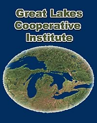 Great Lakes Cooperative Institute conducts collaborative research through a consortium of universities and institutions in the Great Lakes region. Great Lakes Cooperative Institute conducts collaborative research through a consortium of universities and institutions in the Great Lakes region. |
On June 12, 2007, NOAA announced the establishment of a new Great Lakes Cooperative Institute to conduct collaborative research through a consortium of universities and institutions in the Great Lakes region. Research efforts will focus on forecasting; invasive species, control, impact, and assessment; the Great Lakes Observing System; protection and restoration of resources; and Great Lakes education and outreach.
The Cooperative Institute for Limnology and Ecosystems Research is comprised of a consortium of academic institutions, including the Grand Valley State University, Michigan State University, Ohio State University, Penn State University, State University of New York-Stony Brook, University of Illinois of Urbana-Champaign, University of Michigan, University of Minnesota, University of Toledo, and University of Wisconsin.
NOAA currently supports 21 Cooperative Institutes in 17 states focusing on research ranging from satellite climatology and fisheries biology to atmospheric chemistry and coastal ecology. Cooperative Institutes are located at parent institutions whose geographic expanse extends from Hawaii to Massachusetts and from Alaska to Florida.
The new Cooperative Institute for Limnology and Ecosystems Research will replace the current Great Lakes Cooperative Institute at the University of Michigan and will include an expanded partnership. Joining NOAA’s other cooperative and joint institutes across the country, these institutes are NOAA-supported, non-federal organizations that have established an outstanding research program in one or more areas that are relevant to NOAA’s mission. The Cooperative Institute collaborates with NOAA scientists on long-term research topics and provides significant coordination of resources among all non-government partners and promotes the involvement of students and postdoctoral scientists in NOAA-funded research.
Researchers from the University of Puerto Rico Sea Grant Program, in collaboration with the Disaster Research Center (DRC) at the University of Delaware, have developed a storm surge flood model that assesses individual and community vulnerability on the coasts of Puerto Rico. New Geographic Information Systems maps were prepared by incorporating current coastal flood maps with satellite images and census data. The census data include socio-economic and demographic information that produces a more accurate representation of which, and to what degree, coastal community members are at risk. These maps will be available to planners, managers, and public officials throughout the island via a new interactive software program that will allow them to click on census blocks and view pertinent information about who lives in these vulnerable coastal areas. The data from this research contributed to the efforts of the Puerto Rico Tsunami Warning and Mitigation Program, which led to Mayagüez, the ninth-largest city in Puerto Rico, being certified as the first TsunamiReady city on the island. These maps will greatly benefit the approximately 1.4 million people in Puerto Rico who live in flood-sensitive zones. As a result of this work, members of University of Delaware’s Coastal Community Development Initiative have met with DRC and University of Puerto Rico researchers to explore possibilities on how the project can be developed and implemented for coastal communities in Delaware.
NOAA researchers in collaboration with scientists at the North Carolina College of Veterinary Medicine have developed a sensitive and specific method to detect and help manage a parasite responsible for 20 percent of aquaculture losses of warm water fishes. The disease, Amyloodiniosis, is caused by a dinoflagellate. The new method can detect the parasite’s DNA from a single cell, whereas previous microscopic methods could not detect the parasite until later stages of infestation.
Shellfish growers in the Pacific Northwest can now more closely monitor the safety of their oysters, mussels, and clams thanks to the Web-based availability of near-real-time regional water quality information. The Web site displays up-to-date water temperature, salinity, oxygen, turbidity, pH, and chlorophyll data from the Kachemak Bay, AK; Padilla Bay, WA; and South Slough, OR, National Estuarine Research Reserves, and from four buoys in Hood Canal operated by the University of Washington’s ORCA (Oceanic Remote Chemical-Optical Analyzer) project. The data are available thanks to telemetering capabilities in the reserve system’s System-wide Monitoring Program which strengthens the burgeoning IOOS. Water quality and weather data are transmitted every 30 minutes via satellite from monitoring stations at all 27 National Estuarine Research Reserves. The Web site is jointly sponsored by NOAA’s National Estuarine Research Reserve System (NERRS) and the Northwest Association of Networked Ocean Observing Systems (NANOOS). The project received funding support from NOAA’s CSC, the National Estuarine Research Reserve Association, and NANOOS. Technical assistance was provided by the Pacific Coast Shellfish Growers Association and the Pacific Shellfish Institute.
Reports that examine the status of everything from water quality in the sanctuary system to endangered whale populations were released this year. These sanctuary condition reports provide a wealth of information about the complex marine resources and archaeological treasures found in sanctuary waters in straightforward, easily understandable documents. The reports will help set the stage for management plan reviews at each site and help sanctuary staff identify monitoring, and research priorities for day-to-day management needs and new threats to the sanctuaries. National marine sanctuaries reporting in 2007 are: Stellwagen Bank, Fagatele Bay, and others.
|
||||||||||||
|
||||||||||||
Some highlights from this performance objective in FY 2007 include:
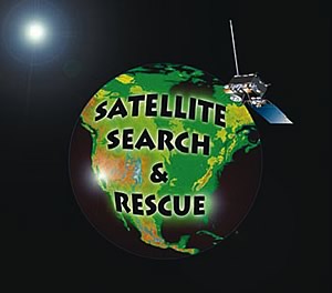
In FY 2007, through July 13, Search and Rescue Satellite-Aided Tracking System (SARSAT) has led to the rescue of 347 people surpassing the previous year’s total where NOAA satellites helped save 272 people from potentially life-jeopardizing emergencies throughout the United States and its surrounding waters. With over two months remaining in the fiscal year, SARSAT is fast approaching the 1999 10-year high of 294 rescues. One possible explanation for the high totals this year is the increase in beacon population. NOAA currently has over 182,000 406 MHz emergency beacons in its registration database and is currently registering record numbers each month. Older emergency beacons operating on the 121.5 MHz and 243 MHz frequency will cease to be monitored as of February 1, 2009. Mariners, aviators, and individuals using emergency beacons will need to switch to those operating at 406 MHz if they want to be detected by satellites. Emergency beacon owners can register their 406 MHz beacons online at www.beaconregistration.noaa.gov.
2007 marked the landmark 200th anniversary of the U.S. Coast and Geodetic Survey, the Nation’s first federal science agency. Created in 1807 to implement Thomas Jefferson’s vision for a stable maritime economy, the survey has a long history of service mapping U.S. shores and waterways, and establishing the positioning infrastructure across the United States. To celebrate, NOAA launched a poster exhibit designed by the Smithsonian Institution on World Hydrography Day (June 21st) in 200 venues nationwide. The 20 colorful posters, illustrated with photos, charts, and artwork from the survey’s archives, were displayed in maritime museums, ports, aquaria, nature centers, schools, libraries, and lighthouses around the country to promote science and technology.
 On May 14 NOAA representatives joined other federal, state, and local officials in Mobile, AL, to officially mark the installation of the Agency’s 200th National Water Level Observation Network station at the Port of Alabama State Docks. On May 14 NOAA representatives joined other federal, state, and local officials in Mobile, AL, to officially mark the installation of the Agency’s 200th National Water Level Observation Network station at the Port of Alabama State Docks. |
An economics benefits study was released in May 2007 on the Houston Galveston Physical Oceanographic Real-Time System (PORTS®) showing that the program brings the Houston-Galveston area significant annual economic benefits and has helped achieve a 50 percent reduction in groundings. The study is based upon a standard methodology and was prepared for the Ports of Houston and Galveston and facilitated by the Houston Galveston Navigation Safety Advisory Committee. Knowledge of the currents, water levels, winds, and density of the water allow mariners to utilize every inch of dredged channel depth, which can increase the amount of cargo moved safely through a port and harbor. Secretary Gutierrez announced the study at the 25th World Ports Conference in Houston, saying: “Trade is a key part of America’s economy, boosting jobs, expanding consumer choice and helping keep inflation in check and the Port of Houston is a major gateway for U.S. trade. The federal government can facilitate that trade by providing the key mapping information our seaborne trade needs to navigate our ports,” said Secretary Gutierrez. “Indeed, NOAA’s PORTS® program is estimating to bring $14 to $15 million in direct benefits to the Houston-Galveston economy.
The Office of Coast Survey recently verified that deeper depths dredged in a channel leading to an oil transfer terminal in South Portland, ME were correctly surveyed and charted so that deeper-draft tankers could safely transit into port. To accommodate deeper-draft tanker vessels to its facility, the Portland Pipe Line Corporation (PPLC) acquired a U.S. Army Corps of Engineers permit to dredge the existing 45-feet deep federally-authorized channel leading to its terminal by an additional three feet. It is unusual for a private corporation to dredge a federally-maintained channel, which made coordination between PPLC, NOAA, the U.S. Army Corps of Engineers, and the U.S. Coast Guard essential to ensure that chart and survey standards were met, and that questions regarding liability and future maintenance were addressed to the satisfaction of the U.S. Coast Guard Captain of the Port. NOAA examined and combined three separate surveys into one cohesive product, and applied it to Chart 13292 for immediate publication. The greater depths reflected in NOAA’s revised chart allowed the Captain of the Port to authorize harbor traffic to operate at the deeper depth. Adding three feet to a deep-draft petroleum port is a considerable undertaking; this activity showcases NOAA’s ability to work with constituents and federal partners to address the needs of private industry and promote safe maritime commerce. Today’s economy demands that companies like PPLC accommodate larger ships to remain competitive.
A central NOAA mission is promoting public safety and preparedness, and NOAA’s new, accurate elevations contribute significantly. After Hurricanes Katrina and Rita, NOAA supported rebuilding and restoration efforts in Louisiana by providing accurate benchmarks made possible through cooperative agreement with the Federal Emergency Management Administration (FEMA). In March, NOAA’s NGS with the University of New Orleans and the U.S. Geological Survey measured coastal wetland elevations in southeastern Louisiana. The project promoted the integration of ecosystem observations through Height Modernization techniques and will provide baseline data to help researchers differentiate between potential causes of relative sea-level change in coastal areas, including subsidence, accretion, erosion, and local sea level rise. NOAA announced that new elevations for more than 340 benchmarks in southern Louisiana have been published. The published values provide official elevations in 27 parishes across the southern part of Louisiana that experienced hurricane damage. NOAA also worked closely with the Louisiana Spatial Reference Center at Louisiana State University located in Baton Rouge, LA.
To help improve marine forecasts, NOAA embarked upon a multi-year program to expand the limited Alaska marine weather data buoy network from only five weather buoys to a comprehensive network of 19 marine weather buoys. On May 4, 2007, the final buoy was deployed in the central Gulf of Alaska. In addition, two Coastal Marine Automated Network stations have also been deployed in Alaska’s treacherous maritime waters. The expansion of the Alaska Data Buoy Network has improved wind speed and wave height verification by 25 percent and 32 percent, respectively. This improvement is the largest since the beginning of electronic verification in the mid-1990s.
Marine transportation and exports are a key driver of the Alaskan economy with 46 million tons of cargo exported from the state in 2005. Oil accounts for approximately $26 billion worth of exports, and commercial fishing is a $4 billion-a-year industry providing half of the seafood consumed in the United States. Providing the Alaska maritime industry with timely and accurate marine weather forecasts is crucial to the operations and safety of the fleet. At the same time, providing marine forecasts is a significant challenge because no other marine system in the United States has such extreme weather and climate, vast geographic distances (larger than the combined marine systems in the rest of the United States), and length of coastline (44,000 miles).
“Weather buoys provide not only marine forecasts and warnings, but they also play a significant role in science and research programs,” said Senator Ted Stevens. “The expansion of the Alaska Data Buoy Network will help ensure mariners and the United States Coast Guard have the critical information they need to safely navigate our state’s waters.”
Consistent with the U.S. Ocean Action Plan and U.S. Commission on Ocean Policy Report, the Department has adopted an ecosystem approach to management that will evolve over time in collaboration with its partners. The Department uses several strategies in the NOAA strategic plan to carry out this approach.
NOAA is implementing the call by its stakeholders to move towards an ecosystem approach to managing uses of coastal and marine resources. NOAA is integrating the application of its multiple ecosystem mandates in partnership with universities; industry; non-governmental organizations; and local, state, and federal agencies by developing and implementing ecosystem approaches to management of coastal and marine resources.
NOAA is seeking improved understanding of ecosystems; identification of regional ecosystems; development of ecosystem health indicators; and new methods of governance to establish the necessary knowledge, tools, and capabilities to fully implement ecosystem approaches to managing coastal, ocean, and Great Lakes resources.
The Department helps transportation information users and stakeholders reach their goals with the following strategies identified in the five-year NOAA strategic plan:
In the future, NOAA plans to enhance the intermodal transportation network by improving available products and services and investing in transportation related observing systems. For example, NOAA will continue to build and maintain its suite of electronic navigational charts (ENC) to supply commercial and recreational mariners with the digital navigation data they need to navigate safely in the 21st century. Additionally, NOAA will focus on equipping all 195 National Water Level Observation Network (NWLON) stations with real-time operational capability at the top 175 U.S. seaports. Enhanced ice forecasts and refinements to aviation, marine, and surface weather predictions will also contribute to NOAA’s role in saving lives, property, and critical infrastructure. NOAA will continue to survey and chart U.S. waters, maintain the highly accurate positioning infrastructure the Nation relies on each day, support Satellite Search and Rescue incidents, respond to hazardous material events, and support U.S. national interests in commercial remote sensing licensing. It is through these and other important activities that NOAA strives to improve and deliver information crucial to safe and efficient transportation.
The Department will continue to address the challenges associated with delivering timely and accurate ecosystem data, information, and forecasts to stakeholders in useful formats. Ecosystem approaches to management will be an area of intense focus. Tradeoffs to address the highest priorities must continue to be made to achieve the right balance among NOAA’s core natural resource and coastal management responsibilities with new and emerging needs. Navigating our increasingly complex and, at times, competing missions will be a test of NOAA’s ability to effectively manage ecosystems using new tools in the years to come. NOAA will face challenges in developing unique and useful relationships with academia, non-governmental, and private sector partners to satisfy a large and growing demand for credible scientifically-based information products and management as we carry out our responsibilities across Great Lakes, coastal, and marine ecosystems.
The Department’s response to addressing the transportation challenges facing the Nation include building on the foundation of expertise, research, and technology development to deliver the information, tools, and services essential to safe, efficient, and environmentally sound transport on water, land, and in the air. Impacts to the system, particularly at vulnerable choke points, affect transit time, delivery reliability, efficiency, cost of goods transported, and the environment. To improve service delivery, NOAA consults with its stakeholders to identify valid user needs that cannot be met with existing information; enhance products that support transportation systems; work with partners to conduct research and development in weather, modeling, and geopositioning; and improve the translation of research into operational value. NOAA must also focus on connecting and strengthening its observations systems that gather data for transportation information.
Provide critical support for NOAA’s mission
| FY 2000 | FY 2001 | FY 20021 | FY 2003 | FY 2004 | FY 2005 | FY 2006 | FY 2007 | |
|---|---|---|---|---|---|---|---|---|
| Fiscal Dollars | $0.0 | $0.0 | $313.5 | $250.5 | $1,217.6 | $1,354.5 | $1,584.0 | $1,564.1 |
| FTE – Full-Time Equivalent | 0.0 | 0.0 | 1,716 | 1,996 | 2,178 | 2,437 | 2,880 | 3,048 |
| 1. In IFY 2002, NOAA created a Mission Support goal that covered activities spanning both objectives and all four performance goals. The Mission Support goal does not currently have performance measures. Funding and FTE were split off from the other performance goals. Consequently, the funding and FTE for objectives 3.1 and 3.2 began to decline in FY 2002, with those amounts appearing in the Mission Support goal. (back) | ||||||||
There are no Government Performance Results Act (GPRA) measures for the Mission Support objective since the activities of this objective support the outcomes of the Mission objectives. NOAA is developing new and improving existing internal management performance measures for the Mission Support objective.
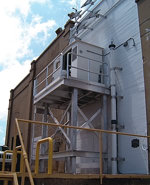
 NOAA image of the ribbon-cutting ceremony for the new NOAA Satellite Operations Facility in Suitland, MD. |
The new home for NOAA’s around-the-clock, environmental satellite operations, which provides data critical for weather and climate prediction, was officially opened on June 11, 2007 at a ribbon-cutting ceremony in Suitland, MD. Top leaders from NOAA, the General Services Administration (GSA) and several Congressional representatives from Maryland, said the NOAA Satellite Operations Facility (NSOF) signifies America’s solid commitment to providing the best possible environmental satellite services.
“The NOAA Satellite Operations Facility is a first-class center, with first-class technology and operations that supply essential satellite data to forecasters in order to produce the most accurate projections possible. Such a facility has a significant role in, for example, predicting where hurricanes will form, and when and where they will strike,” said NOAA Administrator Conrad C. Lautenbacher.
At a total cost of $81 million, including both NOAA and GSA funding, NSOF houses 549 employees consisting of personnel from NOAA, DOD, the U.S. Coast Guard, the National Aeronautics and Space Administration (NASA), and government contractors. Each day, NSOF processes more than 16 billion bytes of environmental satellite data from NOAA’s geostationary and polar-orbiting spacecraft and DOD’s Meteorological Satellite Program (DMSP). NWS uses these data for the constant tracking of severe weather, as inputs into models for medium to long-range weather forecasts, and for tracking climate change. NSOF, which spans 208,271 gross square feet, supports more than $50 million of high technology equipment, including 16 antennas that control more than $4.7 billion worth of environmental spacecraft.
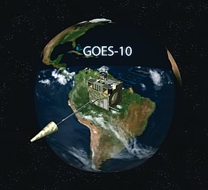 NOAA image of the NOAA GOES-10 satellite monitoring South America. |
South Americans, and millions more in the Western Hemisphere, are benefiting from the reposition of NOAA’s geostationary operational environmental satellite (GOES-10) spacecraft, a move designed to lessen the effects of natural disasters in the region. The satellite’s successful shift from a position above the equator in the west, to a new spot in orbit, was announced on April 10, 2007 during a news conference at the Embassy of Brazil in Washington, D.C.
“Repositioning GOES-10 provides a constant vigil over atmospheric conditions that trigger severe weather, and I am pleased that the United States can strengthen the quality and quantity of data available to our Latin American partners,” said NOAA Administrator Lautenbacher.
Shifting GOES-10 is part of the emerging GEOSS in the Americas, a Western Hemisphere initiative designed to advance GEOSS. Through this endeavor, NOAA is exploring partnerships with countries and scientific organizations in the Americas and Caribbean to share Earth observations and develop and strengthen data networks. Western Hemisphere nations will work together to ensure the satellite data are disseminated and training is available to enable full use of the new information.
The new satellite coverage is already having an impact in South America. On March 8, Argentina was able to trace a low pressure development and accurately issue a high-rainfall alert that helped save lives in Buenos Aires and other highly-populated areas. The new coverage also is contributing to improved fire detection in the Amazon rainforest of western Brazil. History has proven that there is a vital need for the advanced warning this additional information may provide. During the1990s, natural disasters caused nearly 70,000 deaths in South America, more than half of which came from flooding. In May 2003, the largest flooding in 500 years hit Argentina’s north-central region, displacing more than 100,000 people and causing $1 billion in damage. Storms, cyclones, hurricanes, and mudslides caused another 20 percent of the deaths.
“The satellite is functioning well and ready for hurricane season,” said Gilberto Câmara, Ph.D., director of Brazil’s National Space Research Institute (Instituto Nacional de Pesquisas Espaciais). “In the past, coverage has been interrupted during hurricanes and other severe weather events in the United States. Now, South Americans will have continuing satellite coverage. We will no longer be left in the dark.”
 Collage representing new NOAA ships, including the Small Water-Plane-Area Twin Hull (SWATH) Coastal Mapping Vessel (top) and the HENRY B. BIGELOW - launched on July 8, 2005. |
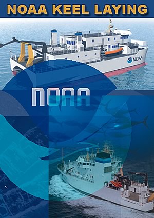
On June 15, 2007 VT Halter Marine Inc. Shipyard and NOAA celebrated a construction milestone—the keel laying—for two new vessels at VT Halter’s Moss Point, MS shipyard. A combined ceremony was held for NOAA coastal mapping vessel FERDINAND R. HASSLER and fisheries survey ship BELL M. SHIMADA. Both ships were named by student teams through regional NOAA ship-naming contests. The two teams are actively participating in today’s ceremony.
“Although these ships will have very different missions, they are equally important to NOAA’s success in meeting our strategic goals,” said Lautenbacher. “Their state-of-the-art technologies will help NOAA more efficiently chart our waters and better assess the health of fish stocks and ecosystems on the West Coast. Celebrating this first important construction milestone together represents a great leap forward in NOAA’s fleet modernization program.”
Once completed, FERDINAND R. HASSLER will collect hydrographic data along the eastern seaboard of the United States for use in the creation and updating of NOAA’s nautical charts, promoting safe navigation into and out of some of the Nation’s busiest ports and recreational waterways. BELL M SHIMADA will collect fish stock data to support critical management decisions for some of the Nation’s most economically important fisheries off of the West Coast.
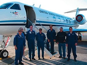 NOAA image of the crew of the NOAA Gulfstream-IV high-altitude jet taking part in the 2007 Winter Storms Reconnaissance Program. |
In an effort to improve forecasts released 24 to 96 hours before a winter storm, NOAA deployed its high-altitude Gulfstream-IV jet from a temporary base in Honolulu. The jet acquired atmospheric data from severe winter storms originating over the Pacific Ocean that will affect the continental United States, Hawaii, and Alaska. The flights are in support of the winter storms reconnaissance program of the NOAA NCEP, part of NWS.
While conducting the winter storms project, the aircraft flew extended patterns over the North Pacific launching dropwindsonde atmospheric profiling devices to more accurately characterize the environment of developing winter cyclones and snowstorms. Data from these instruments were screened aboard the aircraft, transmitted to NCEP by satellite communication, and used in NOAA’s most sophisticated forecasting models to improve warnings of severe weather events. In its seventh year, the winter storms reconnaissance program has improved forecast accuracy an average of 20 percent while accuracy for individual targeted events has been increased by as much as 60 percent to 80 percent in 24 to 96 hour forecasts during past missions.
U.S Department of Commerce Home Page | Office of Budget Home | Privacy Policy |