
|
|
| Maps of lava-flow field, Kilauea Volcano |
July 21 Eruption Overview Map: October 24, 2008

Map showing the extent of the July 21, 2007 eruption flow field, including the Thanksgiving Eve Breakout (TEB) flow, relative to surrounding communities. Light red is the area of the flow as of October 16, 2008, while the bright red shows the flow field expansion that occurred between October 16 and October 24 (see large map).
July 21 Eruption Near-view Map: October 24, 2008
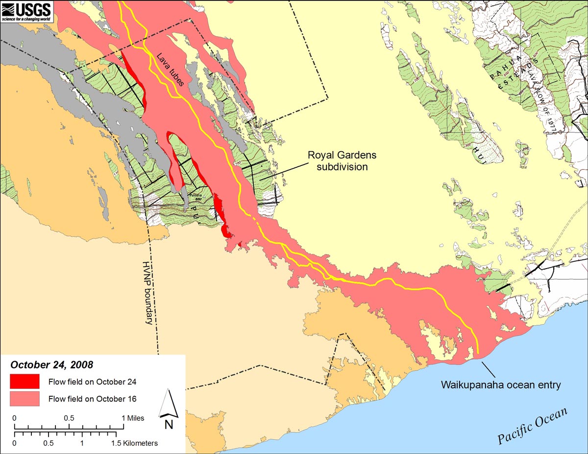
Map showing the July 21, 2007 eruption flow field. The Thanksgiving Eve Breakout (TEB) flow is that portion of the July 21, 2007 eruption flow field that extends south from the TEB vent to the ocean. Light red is the area of the flow as of October 16, 2008, while the bright red shows the flow field expansion that occurred between October 16 and October 24 (see large map).
Halema`uma`u Vent Map

Map showing the location of the Halema`uma`u Vent in the Hawai`i Volcanoes National Park.
Episode 56 Map (with Seismicity): June 20, 2007

Map shows activity from Episode 56 (see large map).
Map of flows from Pu`u `Ō `ō: April 30, 2008

Map shows lava flows erupted during 1983-present activity of Pu`u `Ō `ō and Kupaianaha (see large map).
Yellow, brown, orange, and green areas depict lava flows erupted from October 2003 through April 2008. Green represents the Kuhio (PKK) flow, active from March 20, 2004 to June 2007. The light pink shade denotes the Martin Luther King (MLK) flows, which first erupted in January 2004 from flank vents on the south slope of Pu`u `Ō `ō. Since then, several more pits have formed in the MLK area, although no flows have overtopped the collapse pit at MLK since July 2005. Short flows from the crater, West Gap, and Puka Nui vents are shown in dark orange.
The TEB flow, shown in light red, is the most continuously active part of the flow field. This lava flow originated on November 21, 2007 as a breakout from Fissure D, the most northeastern of four fissures that extend from the east flank of Pu`u `Ō `ō. The TEB flow is moving downslope through one or more tubes located east of the Hawai`i Volcanoes National Park boundary. Lava is currently entering the ocean at Waikupanaha.
Aerial view of Pu`u `Ō `ō and vicinity: April 30, 2008

Aerial view of Pu`u `Ō `ō of the vents, lava flows, and other features at Pu`u `Ō `ō frequently referred to in the updates (see large view). These features can change quickly, but this view should help those viewers lost in the terminology.
Eruption-viewing opportunities change constantly, so refer to this page often. Those readers planning a visit to Kilauea or Mauna Loa volcanoes can get much useful information from Hawai`i Volcanoes National Park.
Contact: hvowebmaster@usgs.gov
Updated: 24 October 2008 (pnf)