Skip Navigation Links weather.gov 
NOAA logo-Select to go to the NOAA homepage
National Oceanic and Atmospheric Administration's   
  Select to go to the NWS homepage
National Weather Service   
 
 
Local forecast by
"City, St"
USA.gov is the U.S. government's official web portal to all federal, state and local government web resources and services.
  Home > Satellite

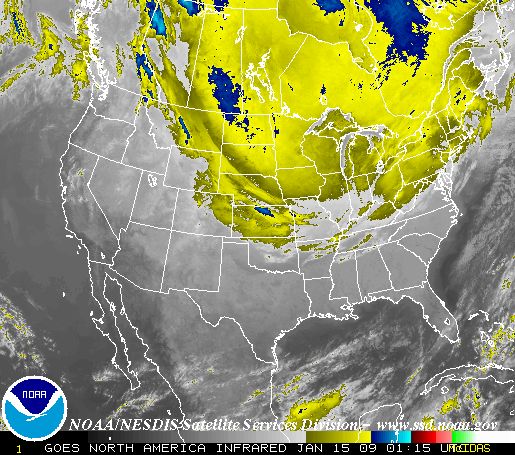
This shows the most recent image of the United States, taken from a NOAA satellite. This image is taken in the infrared band of light and show relative warmth of objects. Colder objects are brighter and warmer objects are darker. Lower layers of clouds, generally warmer and lower in altitude, are colored gray. Colder and generally higher clouds tops are highlighted in colors. IR imagery is useful for determining cloud features both at day and night.

Warnings & Forecasts Graphical Forecasts National Maps   Radar     Water    Air Quality   Satellite   Climate 
Satelite Image

   24 hour Loop     12 hour Loop     6 hour Loop     3 hour Loop  

Alaska   |  Hawaii  |   Guam  |  Puerto Rico  |  American Samoa  |  Hurricane Sectors  |  Details        
 

    US Dept of Commerce
    National Oceanic and Atmospheric Administration
    National Weather Service
    1325 East West Highway
    Silver Spring, MD 20910
    Page Author: NWS Internet Services Team
Disclaimer
Information Quality
Credits
Glossary
Privacy Policy
Freedom of Information Act (FOIA)
About Us
Career Opportunities
     Page last Modified: 28 November, 2007 2:27 PM