DATA CENTER
INFORMATION CENTER
ABOUT THE CALIFORNIA WSC
USGS IN YOUR STATE
USGS Water Science Centers are located in each state.
|
Water Data
Current Real-time Conditions
Historical Data:
Annual Data Reports (Water Resources Data series)
Compilation Reports
Below links require the free viewer for djvu files.
1966-70 Compilation
- Water Supply Paper 2126 (Part 9, Volume 3. Lower Colorado River Basin)
- Water Supply Paper 2127 (Part 10. The Great Basin)
- Water Supply Paper 2128 (Part 11, Volume 1. Pacific slope basins from Tijuana River to Santa Maria River)
- Water Supply Paper 2129 (Part 11, Volume 2. Pacific slope basins from Arroyo Grande to Oregon state line except Central Valley)
- Water Supply Paper 2130 (Part 11, Volume 3. Pacific slope basins, Southern Central Valley basins)
- Water Supply Paper 2131 (Part 11, Volume 4. Pacific slope basins, Northern Central Valley basins)
1961-65 Compilation
- Water Supply Paper 1926 (Part 9, Volume 3. Lower Colorado River Basin)
- Water Supply Paper 1927 (Part 10. The Great Basin)
- Water Supply Paper 1928 (Part 11, Volume 1. Pacific slope basins from Tia Juana River to Santa Maria River)
- Water Supply Paper 1929 (Part 11, Volume 2. Pacific slope basins from Arroyo Grande to Oregon state line except Central Valley)
- Water Supply Paper 1930 (Part 11, Volume 3. Pacific slope basins, Southern Central Valley basins)
- Water Supply Paper 1931 (Part 11, Volume 4. Pacific slope basins, Northern Central Valley basins)
1951-60 Compilation
- Water Supply Paper 1733 (Part 9. Colorado River Basin)
- Water Supply Paper 1734 (Part 10. The Great Basin)
- Water Supply Paper 1735 (Part 11. Pacific Slope Basins in California)
1950 Compilation
- Water Supply Paper 1313 (Part 9. Colorado River Basin)
- Water Supply Paper 1314 (Part 10. The Great Basin)
- Water Supply Paper 1315-A (Part 11-B. Pacific Slope Basins in California, Central Valley)
- Water Supply Paper 1315-B (Part 11-A. Pacific Slope Basins in California, except Central Valley)
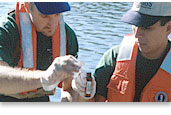
USGS Data Collection Network
The U.S. Geological Survey currently operates about 440 data collection
sites in California for acquiring information on surface-water, ground-water,
water-quality, and precipitation. Sites with satellite telemetry provide
real-time data via GOES satellites and downlinks, which enables the
posting of data to the Web for public dissemination.
Hydrologic data collected by the USGS are published in the annual
hydrologic data reports for California, or in interpretive reports.
Most of the data are also available on the Web through the USGS National
Water Information System NWISWeb server.
In order to help you locate data and reports, we have created Web
pages of publications with specific data types.
You can also ask questions and request data or reports from our Public
Information Officer.
Document Accessibility:
Adobe Systems Incorporated has information about PDFs and the visually impaired.
This information provides tools to help make PDF files accessible. These tools
convert Adobe PDF documents into HTML or ASCII text, which then can be read
by a number of common screen-reading programs that synthesize text as audible
speech. In addition, an accessible version of Acrobat Reader 8.0 for Windows
(English only), which contains support for screen readers, is available. These
tools and the accessible reader may be obtained free from Adobe at Adobe
Access.
|


