 |
|
|
||||
| Earth Resources Observation and Science (EROS) |
Tri-Decadal Global Landsat Orthorectified Overview
| Contents: | 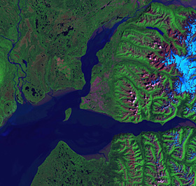
Tri-Decadal Global Landsat Orthorectified ETM+ image |
|
back to Satellite Product List Product DescriptionTri-Decadal Global Orthorectified Overview:
Ground control points are fixed, and images have been registered to the Universal Transverse Mercator (UTM) map projection and coordinate system and the World Geodetic System 1984 (WGS84) datum. All image bands have been individually resampled, using a nearest neighbor algorithm. Positional accuracy on the final image product has a Root Mean Square Error of better than 100 meters (MSS) and 50 meters (TM and ETM+). The Landsat data were acquired and processed through a National Aeronautics and Space Administration (NASA) contract with Earth Satellite Corporation, Rockville, Maryland, and are part of NASA's Scientific Data Purchase program. When possible, data were collected when vegetation was at peak greenness. Peak greenness was determined from global 1-kilometer Advanced Very High Resolution Radiometer (AVHRR) Normalized Difference Vegetation Index (NDVI) data. When peak greenness data were not available, images from other times of the year were substituted. For pricing and further information about the individual data products, see the Tri-Decadal Global Landsat Orthorectified Single Scene and Tri-Decadal Global Landsat Orthorectified Mosaics webpages.
| ||||
