 Recent Earthquakes in the Intermountain West
Utah and Yellowstone Region
Click on an earthquake on the map above for a zoomed-in view.
(Clicking on an earthquake on the zoomed-in map takes you to
a Preliminary Earthquake Report)
Did you feel it? -
Click Here
ShakeMaps -
Utah Region
Special maps:
Yellowstone National Park ||
ANSS Intermountain West Region
Earthquake lists:
big earthquakes ||
all earthquakes
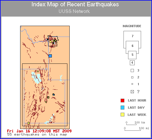
Black lines creating a box around the Utah Region and the outline of
Yellowstone National Park indicate the University of Utah Seismograph
Stations' monitoring area. For earthquakes that occur outside our
monitoring area, but inside the area covered by the index map, please
see Other sites for Intermountain West
Earthquake Information.
During routine business hours, maps are typically updated within two hours of
a significant or felt earthquake, after human processing.
Map need updating? Try reloading the page to your browser.
Brown lines are known hazardous faults and fault zones.
Other Information:
How do earthquakes get on these maps? ||
FAQs ||
Disclaimer
Earthquakes elsewhere in the U.S. and around the world
Home page ||
Other sites for Intermountain West Earthquake Information ||
Credits
Data Sources:
Utah Region + Yellowstone National Park Region =
University of Utah Seismograph Stations
a member of the
Advanced National Seismic System (ANSS)
Please email suggestions and comments to webmaster@seis.utah.edu