
 Feeds & Data
ShakeMaps
ShakeMap is a product of the U.S. Geological Survey Earthquake Hazards Program in conjunction with regional seismic network operators. ShakeMap sites provide near-real-time maps of ground motion and shaking intensity following significant earthquakes. These maps are used by federal, state, and local organizations, both public and private, for post-earthquake response and recovery, public and scientific information, as well as for preparedness exercises and disaster planning.
Networks producing ShakeMaps
Click a network name to view a list of events, or on an image to view the event
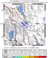
S California

10356753N California

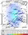
51210163Pacific NW

0807310502Nevada
2008301_263795Utah

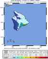
1000001272Hawaii
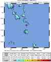
00030482Alaska
76264Global
2008yzcb
Last 10 ShakeMaps from any Network
A list of all ShakeMaps is available in the ShakeMap Archive
| Mag | Name/Epicenter | Date | Time | Lat | Lon | Network | Event ID |
|---|---|---|---|---|---|---|---|
| 6.3 | VANUATU | Nov 04 2008 | 18:35:45 UTC | -17.086 | 168.420 | Global | 2008yzcb |
| 4.0 | 123.2 miles NNW of Galena | Nov 04 2008 | 15:46:34 UTC | 66.463 | -157.964 | Alaska | 76264 |
| 5.7 | NIAS REGION, INDONESIA | Nov 03 2008 | 19:22:02 UTC | 1.201 | 97.281 | Global | 2008yyb9 |
| 4.4 | 94.8 miles ESE of Adak | Nov 03 2008 | 14:52:44 UTC | 51.562 | -174.499 | Alaska | 76020 |
| 3.7 | WYOMING | Nov 03 2008 | 13:14:12 UTC | 42.821 | -105.205 | Global | 2008yybi |
| 4.0 | 99.8 miles ESE of Adak | Nov 03 2008 | 06:01:08 UTC | 51.492 | -174.409 | Alaska | 75968 |
| 5.5 | PUERTO RICO REGION | Nov 02 2008 | 20:42:37 UTC | 19.431 | -66.383 | Global | 2008yxb6 |
| 5.7 | KERMADEC ISLANDS, NEW ZEALAND | Nov 02 2008 | 15:01:00 UTC | -29.985 | -177.044 | Global | 2008yxbk |
| 5.5 | 100.2 miles ESE of Adak | Nov 02 2008 | 13:48:43 UTC | 51.459 | -174.416 | Alaska | 75826 |
| 6.1 | ANDREANOF ISLANDS, ALEUTIAN IS., ALASKA | Nov 02 2008 | 13:48:42 UTC | 51.612 | -174.382 | Global | 2008yxbh |
