
About Us
Earthquake Hazards Program Offices 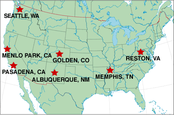
|
Click on location to see map & directions. |
This web site is provided by the United States Geological Survey’s (USGS) Earthquake Hazards Program as part of our effort to reduce earthquake hazard in the United States. We are part of the USGS Geologic Discipline and are the USGS component of the congressionally established, multi-agency National Earthquake Hazards Reduction Program (NEHRP). The USGS participates in the NEHRP with the Federal Emergency Management Agency (FEMA), the National Institute of Standards and Technology (NIST), and the National Science Foundation (NSF). In the 2004 reauthorization of NEHRP by Congress, NIST has been given the lead role to plan and coordinate this national effort to mitigate earthquake losses by developing and applying earth science data and assessments essential for land-use planning, engineering design, and emergency preparedness decisions.
Earthquakes pose significant risk to 75 million Americans in 39 States. The USGS is the only Federal agency with responsibility for recording and reporting earthquake activity nationwide. Citizens, emergency responders, and engineers rely on the USGS for accurate and timely information on where an earthquake occurred, how much the ground shook in different locations, and what the likelihood is of future significant ground shaking.
 The USGS estimates that several million earthquakes occur in the world each year, but many go undetected because they occur in remote areas or have very small magnitudes. The USGS now locates about 50 earthquakes each day; 20,000 a year.
The USGS is working to improve its earthquake monitoring and reporting capabilities through the Advanced National Seismic System (ANSS). In the past three years the USGS has installed approximately 300 new earthquake monitoring instruments in the San Francisco, Seattle, Salt Lake City, Anchorage, Reno, Las Vegas, and Memphis areas. Full implementation of ANSS will result in 6000 new instruments on the ground and in structures in at-risk urban areas, as well as a backbone of modern seismic instruments for the entire Nation. Once in place, the ANSS will provide emergency response personnel with real-time (within 5-10 minutes of an event) information on the intensity and distribution of ground shaking that can be used to guide emergency response efforts. Similarly, information on building "shaking" will equip engineers with the data they need to improve building designs in the future.
USGS External Earthquake Research Support
In addition to activities performed by USGS staff, expertise in earthquake studies that exist outside the federal government is applied through a substantial program of grants, cooperative agreements and/or contracts with universities, state, regional and local government agencies, and private industry. The USGS invites research proposals to develop information, knowledge and methods that will assist in achieving the goals of the National Earthquake Hazards Reduction Program (NEHRP).
