The Journey to Restore America's Everglades - Recover Home Page
National Park Service Home Page South Florida Water Management District Home Page U.S. Army Corps of Engineers Home Page U.S. Geological Survey Home Page
Everglades Depth Estimation Network (EDEN) for Support of Biological and Ecological Assessments


EDEN Depth&DaysSinceDry Tool

EDEN Depth and Days Since Dry Screenshot

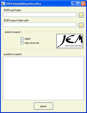
EDEN Depth&DaysSinceDry is a program for creating daily surfaces (in NetCDF file format, .nc) of water depth and days since dry from EDEN daily water level surfaces and ground elevation model.

The daily surface of water depth is created by subtracting the ground elevation for the EDEN grid cell (400 meter by 400 meter cells) from the water level surface. The days since last dry indicates the number of consecutive days since the start of the time period that an EDEN grid cell surface has had a depth value greater than zero. A count of "0" indicates that the cell was wet for that day. Once the cell is dry, the count begins and continues until a wet day is encountered. When this happens, the count is returned to "0".

All water level data are output in units to North American Vertical Datum of 1988 (NAVD88).

Note: the latest version of the Depth&DaysSinceDry Tool was updated with new "Days Since Dry" calculations as well as the ability to select an output path for files. Please see the User's Guide (below) for more information.

Update (October 15, 2008): The calculation issue (which caused the "days since dry" value to be reset when running two or more q1 files for five or more consecutive quarters) has been fixed. Please download the new version of the tool below.

CERPZone users, please see information below.

Installation

You will need the following files:

Required for execution of the program:

(Note: if you previously installed other EDENapp tools, then you may have some or all of these items already installed)

  1. EDEN Depth&DaysSinceDry.exe (.zip, currently at v. 1.2, 178 KB, updated October 15, 2008)
    • Executable file can be copied to any location on your computer.
  2. netCDF dlls (.zip, 176 KB)
    1. Extract all the files in netcdf-3.6.1-win32.zip and copy them to c:\windows\system32
  3. Microsoft .Net version 2.0 (download from Microsoft's website)
    • Note: this may already be installed on your machine. Go to: Start > Control Panel > Add or Remove Programs. If Microsoft .Net Framework is installed, it will appear in this list

Required User Input Files:

  1. EDEN DEM file for ground elevation (.zip, 170 KB)
    • Must be in NetCDF file format (.nc)
    • Please note: This file is a modification of the EDEN DEM released in October of 2007 (i.e., eden_em_oct07) in which the elevation values have been converted from meters (m) to centimeters (cm) for use by EDEN applications software. This file is intended specifically for use in the EDEN applications software.
    • Metadata is also available for this DEM and has been included in the EDEN DEM zip file.
  2. EDEN daily water level surfaces (must be in NetCDF file format (.nc))

User's Guide (pdf, 238 KB, updated July 24, 2008)


Notes:

  • EDEN Depth&DaysSinceDry Tool can only run on a Windows machine
  • The netCDF dll is required to use Depth&DaysSinceDry Tool. Extract all the files in netcdf-3.6.1-win32.zip and copy them to c:\windows\system32
We're looking for feedback! Please contact us.


Running EDENapps from CERPZone:
The EDENapps tools can be run from CERPZone by users who are not able or do not wish to download the EDENapps tools to their computers. CERPZone allows users to run the tools directly from the Citrix server.

To run the tools from CERPZone, users must obtain a CERPZone username and password at http://www.evergladesplan.org/AccessRequest/

To go to the EDENapps tools on CERPZone, got to https://www.cerpzone.org/help/eden.aspx for instructions to access the tools through the Citrix server. If you have any questions regarding EDEN Tools on Cerpzone, please contact cerpgishelp@evergladesplan.org.

Note: New CERPZone users will need to contact the CERP GIS Team (cerpgishelp@evergladesplan.org) to be added to the EDEN application user's pool.

Home
Data
Water Levels (Gage)
Ground Elevation (DEM)
Water Surfaces
Meteorologic
EDENapps
Introduction
DataViewer
xyLocator
Transect Plotter
Depth&DaysSinceDry
GridtoNetCDF
NetCDFtoGrid
Information
Learn About EDEN
Publications
Newsletter
EDEN Personnel
Contacts
Photo of a flower

Technical support for this Web site is provided by the U.S. Geological Survey
This page is: http://sofia.usgs.gov/eden/edenapps/depth-dayssincedry.php
Comments and suggestions? Contact: Heather Henkel - Webmaster
Last updated: October 15, 2008 03:43 PM(HSH)