
 Atom Feed
 Google Earth KML
Click maps for more information
Latest Earthquakes

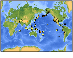
World (Magnitude 4+)
Tue Nov 04 20:44:38 GMT

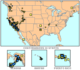
USA (Magnitude 1+)
Tue Nov 04 20:44:32 GMT
Today's Earthquake Fact
During post-tsunami field surveys, inundation and runup measurements are taken to describe the tsunami effects. Inundation is defined as the maximum horizontal distance inland that a tsunami penetrates. Runup is the maximum vertical height above mean sea level that the sea surface attains during a tsunami. Actual tsunami wave heights can be measured from the amplitude of the wave signals seen on sea level or tide gauge instruments.
