 |
|
|
||||
| Earth Resources Observation and Science (EROS) |
Multi-Resolution Land Characteristics 2001 (MRLC2001)
| Contents: | 
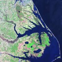
Landsat 7 ETM+ image |
|
back to Satellite Product List Product DescriptionMulti-Resolution Land Characteristics 2001 (MRLC 2001) is a collection of terrain-corrected Landsat 7 Enhanced Thematic Mapper Plus (ETM+) and Landsat 5 Thematic Mapper (TM) scenes that have been acquired by the MRLC Consortium. The MRLC 2001 data cover the United States, including Alaska and Hawaii. Multi-temporal scenes may also be available, depending on the location. Most of the images are of high quality, and cloud cover is generally less than ten percent. The data will also include a 30-meter Digital Elevation Model (DEM) for all scenes that do not include the Canadian or Mexican borders. All MRLC 2001 data are provided with the following standardized set of processing parameters:
Additional Information: PricesMRLC 2001 data are available to download at no charge or are available on DVD for $20 per scene. Search & OrderMRLC 2001 data can be searched and either downloaded or ordered on media on GloVis, EarthExplorer, or through the Multi-Resolution Land Characteristics Consortium. Preview ImagesMRLC 2001 data should always be previewed prior to purchase. Preview images of all MRLC 2001 scenes may be browsed on GloVis, EarthExplorer, or through the Multi-Resolution Land Characteristics Consortium. |
| Accessibility FOIA Privacy Policies and Notices | |
 |
|