 |
|
|
||||
| Earth Resources Observation and Science (EROS) |
Tri-Decadal Global Landsat Orthorectified TM and ETM+ Pan-sharpened Mosaics
| Contents: | 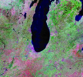
Tri-Decadal Global Landsat Orthorectified TM mosaic |
|
back to Satellite Product List Product DescriptionThe Tri-Decadal Global Landsat TM Orthorectified and ETM+ Pan-sharpened Mosaics data collections are derived from a global set of high-quality, relatively cloud-free orthorectified TM and ETM+ imagery from Landsats 4, 5 and 7. This dataset was selected and generated through NASA's Commercial Remote Sensing Program, as part of a cooperative effort between NASA and the commercial remote sensing community to make available quality-screened, high-resolution satellite images with global coverage over the Earth's land masses. The data collection was compiled via NASA contract with Earth Satellite Corporation, now MDA Federal Inc. (MDA), (Rockville, MD) in association with NASA's Scientific Data Purchase program. The collections are derived from approximately 7,461 TM (Landsat 4-5) images and approximately 8,500 ETM+ (Landsat 7) images, which were selected to provide a full set of global coverage (circa 1990 and circa 2000). All selected images are either cloud-free or contain minimal cloud cover. Only images with a high quality ranking (based on the possible presence of errors such as missing scans or saturated bands) were selected.
All Tri-Decadal Global Landsat Orthorectified data products have been pre-processed according to a standardized set of processing parameters.
Additional Information:
Back to TopSearch & DownloadTri-Decadal Global Landsat Orthorectified TM and ETM+ Pan-sharpened Mosaic data are currently available from the USGS EROS archive and may be searched and downloaded online through EarthExplorer and GloVis. Note: The full Tri-Decadal Global Landsat Orthorectified TM and ETM+ Pan-sharpened Mosaic data collection consists of approximately 608 TM (Landsat 4-5) mosaics and approximately 3,100 ETM+ (Landsat 7) mosaics. However, not all of these images are currently available for search and order from USGS EROS at this time. Users will need to run a search to determine the scene availability for any given location. Please click here to view a map of Tri-Decadal Global Landsat Orthorectified TM Mosaic coverage. Back to Top |
| Accessibility FOIA Privacy Policies and Notices | |
 |
|