Florida DroughtWatch 2007
DroughtWatch: Surface Water Conditions in Florida 
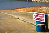
The U.S. Geological Survey (USGS) has a network of 548 surface-water real-time monitoring stations in Florida. The network provides real-time water-stage data along with computed streamflow at 516 of these locations, and rainfall recorded at 86 stations. These sites continuously record data on 15-minute intervals and transmit the data via satellite to be incorporated into the USGS National Water Information System database. These data are automatically posted to the USGS Web site for public dissemination. Surface-Water Drought InformationBelow normal average streamflow
General water conditions |

![]() U.S. Department of the Interior |
U.S. Geological Survey
U.S. Department of the Interior |
U.S. Geological Survey
URL: http://fl.water.usgs.gov/drought/droughtsw.html
Page Contact Information: FISC Webmaster
Page Last Modified: 08:27:39 Thu 30 Oct 2008