Landsat Missions
On April 21, 2008, the USGS announced plans to provide all archived Landsat scenes at no charge to all users. (View the original Technical Announcement - .pdf (66.8 KB).
All Landsat imagery is now expected to be available by the end of 2008.
All scenes will be processed using the parameters shown below, which is the new Standard data product recipe. Scenes that have a quality score of 9 and less than 40 percent cloud cover will continue to be automatically processed, and any archived scene, regardless of cloud cover, will be processed upon request based on the schedule mentioned above.
More details on the Standard Terrain Corrected (Level 1T) data currently available can be found at http://eros.usgs.gov/products/satellite/landsat7.html.
| Product Type | L1T – Terrain Corrected |
|---|---|
| Pixel Size | 15m/30m/60m |
| Output Format | GeoTIFF |
| Resampling Method | Cubic Convolution (CC) |
| Map Projection | UTM Polar Stereographic for Rows 102 to 122* |
| Datum | WGS84 |
| Image Orientation | Map (North Up) |
| Distribution | FTP Download Only |
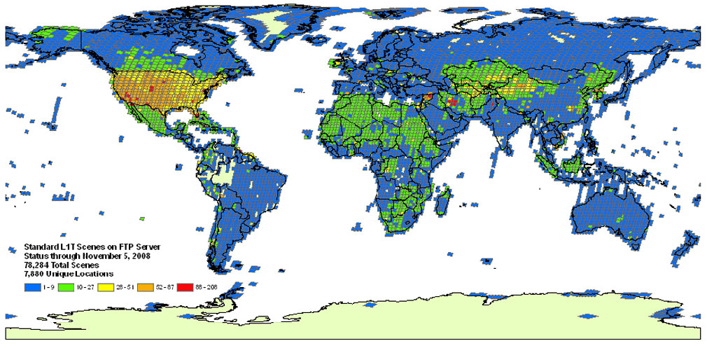
The map below shows the number of free Landsat scenes available for each path/row. Areas without scenes are caused by perpetual cloud contamination or required improvement for geometric accuracy. The Landsat Ground Station processes approximately 130 new clear scenes per day. These scenes can be downloaded for free through GloVis or Earth Explorer.
