 |
 | |
  | |
|
|
|
|
Pictured Rocks National Lakeshore
Enabling Legislation
|
|
|
|
|
|
 |
 |
| NPS photo by Brenda St. Martin | | Indianhead Point |
 |
(pdf - 4 pages)
An Act to establish in the State of Michigan the Pictured Rocks National Lakeshore, and for other purposes.
October 15, 1966
Pictured Rocks National Lakeshore is America's first National Lakeshore. Three other national lakeshores were authorized in subsequent years.
On the same day, President Lyndon B. Johnson also signed into law another piece of landmark legislation -- the National Historic Preservation Act.
On October 6, 1972, ceremonies in Munising marked the establishment of Pictured Rocks National Lakeshore. To symbolically link the park's two gateway communities of Munising and Grand Marais, water and sand was poured from two glass containers into a third. Establishment of a National Park follows the acquisition of acreage within the park boundary.
|
 |
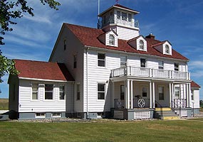
| NPS photo by Ed Lasich | | Grand Marais Coast Guard Station |
 |
(pdf - 189 pages)
Omnibus Parks and Public Lands Management Act of 1996
November 12, 1996
Section 460a-14 (page 14): Pictured Rocks National Lakeshore Boundary Adjustment. Added former U.S. Coast Guard properties in Grand Marais, Michigan, to Pictured Rocks National Lakeshore.
|
 |
| NPS photo | | Alger County Road H-58 near Grand Marais |
 |
(pdf - 4 pages)
An Act to Establish the Lower East Side Tenement National Historic Site, and for other purposes.
November 12, 1998
Section 202 (page 4). Provisions for Roads in Pictured Rocks National Lakeshore. Removed "scenic shoreline drive" and inserted "including appropriate improvements to Alger County Road H-58." Also added sentence prohibiting construction of scenic shoreline drive.
|
 |
| NPS photo | | Munising Front Range Light and Auxiliary Station |
 |
(pdf - 172 pages)
Maritime Transportation Security Act of 2002
November 25, 2002
Section 437 (pages 67-68): Pictured Rocks National Lakeshore Boundary Revision. Added the Munising Front and Rear Range Lights and auxiliary operations station to the boundary of Pictured Rocks National Lakeshore.
|
|

|
 |
|
|
|
|
|
 |
|
Did You Know?
On October 6, 1972, ceremonies in Munising marked the establishment of Pictured Rocks National Lakeshore, America's first national lakeshore. To symbolically link the park's two gateway communities of Munising and Grand Marais, water and sand was poured from two glass containers into a third.
more...
|
|
|
|
Last Updated: November 22, 2006 at 13:44 EST |


