
|
||
Natural Hazards >> Fires >> Fires in Queensland
| ||||
|
Fires in Queensland
Several parts of Queensland, Australia, were experiencing bushfires in late October 2008. This image from the Moderate Resolution Imaging Spectroradiometer (MODIS) on NASA’s Aqua satellite shows scores of fires (locations marked in red) on October 24. The largest fire was burning in the central part of Cape York Peninsula, and multiple fires burned in the area surrounding Rockhampton. Although some of these fires may be intentional brush or grass-burning fires on managed lands or private property, local fire reports indicate that several of them are wildfires that are threatening homes and closing roads. NASA image courtesy the MODIS Rapid Response Team. Caption by Rebecca Lindsey. Recommend this Image to a Friend Fires: Topic Home | Archive | Related Links Natural Hazards Home | Section FAQ |
Where in the World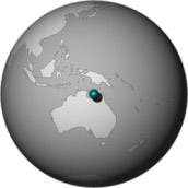
Image Posted October 27, 2008 Satellite & Sensor Aqua- MODIS Fires Latest Events Fires in Northwest India Fires in Madagascar Fires near Los Angeles, California Fires in Oregon and Northern California Fire in the Kalahari | |||
|
Subscribe to Natural Hazards
About the Earth Observatory & Natural Hazards Contact Us Privacy Policy and Important Notices Responsible NASA Official: Lorraine A. Remer Webmaster: Goran Halusa The Earth Observatory is part of the EOS Project Science Office located at NASA Goddard Space Flight Center. |
 Click here to view high-resolution version