|
|
|
 |
| |
From a Distance: Remote Sensing of Planet Earth
|
|
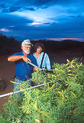
At the Jornada Experimental
Range in New Mexico, soil
scientist Jerry Ritchie and
Carole A. Ritchie measure
leaf area of mesquite.
Such hands-on measurements
of vegetation, soil moisture,
and reflectance help scientists
verify data gathered by
remote sensing techniques.
(K9534-1)
|
The future of weather forecasting is
rapidly changing. By the year 2008, we may have weather maps that can detect a
flood in its infancy.
These maps will be generated from 20-foot-diameter microwave dishes spinning
rapidly on platforms attached to satellites. These dishes capture the natural
microwave emissions from soil as a measure of moisture. The rapid spinning is
the secret to the complete coverage the dish provides of each area the
satellite passes over. A U.S.-European pair of satellites for long-range
weather forecasting may be launched by 2008 and will have the dishes.
It's all part of a "Soil-Moisture Observing System" envisioned by
hydrologist Tom Jackson, who is with ARS' Hydrology and Remote Sensing
Laboratory in Beltsville, Maryland. His soil-moisture remote-sensing work in
joint projects with the National Aeronautics and Space Administration (NASA)
and the National Oceanic and Atmospheric Administration is paving the way for
that launch. Already, NASA is set to launch a satellite named "Aqua,"
which monitors the planetary water cycle with a version of the spinning-dish
sensor tested in airplane and satellite flyover campaigns in Arizona, Oklahoma,
and soon in Iowa. Aqua is the water-targeted match to Terra, a land-monitoring
satellite already in orbit. |
|

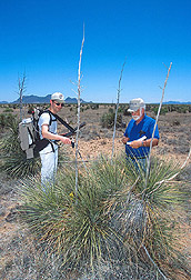
On the Jornada Experimental
Range in New Mexico, physical
scientist Thomas J. Schmugge
(background) and Frederick
Jacobs, a visiting scientist
from France, measure thermal
and moisture flux.
(K9528-1)
|
With the Aqua satellite set to
launch, Jackson must soon verify its microwave-dish data with data from tests
on Earth's soil. To do this, he'll use instruments at four of ARS' watershed
centers—in Arizona, Georgia, Oklahoma, and Idaho—as well as the USDA
Natural Resources Conservation Service's network of 40 ground-monitoring
stations across the country. The service's data, available on the World Wide
Web at http://www.wcc.nrcs.usda.gov/scan/,
can be read 1 hour after being collected, 24 hours a day.
Jackson, his colleagues, and scientists from around the world have developed
and tested various sensors in the flyover campaigns. They've looked at
small-scale, land- and airplane-based monitoring and global-scale satellite
monitoring. From this research, techniques have emerged that will be used to
translate Aqua's data into maps. Jackson cites the recent flooding in
Mississippi as an example of an event that could have been predicted weeks
earlier. His analysis of 2 weeks of satellite data shows the April 12 flood
started in the Dakotas. On March 29, it appeared on the map as a small blue
area of oversaturated soil. "Knowing the terrain and water systems, it
isn't hard to predict where all that water will end up—maybe 1,000 or more
miles away," he says. |
|

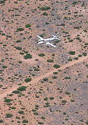
Loading equipment on a twin-engine
Cessna 404 Titan for a flight over
the Jornada Range. The equipment
measures visible and thermal reflectance
of ground vegetation.
(K9533-1)
|
Beyond the Clouds
An atmospheric region Jackson and colleagues call the boundary layer plays an
important role in cloud development and in determining where rainfall is likely
to occur. "It is becoming more evident that reliable predictions of the
growth rate and ultimate depth of this layer are important for accurate weather
forecasts," says ARS physical scientist Tom Schmugge. He, ARS hydrologist
Bill Kustas, and Andy French, a Ph.D. candidate from the University of
Maryland, are using thermal infrared sensors to measure variation in surface
temperature, which is key to defining regions of high and low evaporation that
affect boundary layer growth.
They are using the temperature data collected from aircraft to develop a
computer model to predict patterns of evaporation for eventual use with Terra's
infrared sensors. The present sensor has a 90-meter resolution, perfect for
precision farmers who are interested in monitoring crop growth, which is
strongly affected by surface temperature and moisture variations. The sensor
can also spot areas of drought and crop damage. |
|
Jacobs (left) and soil
scientist Jerry C. Ritchie
take spectral reflectance
measurements at the Jornada
Experimental Range.
(K9532-1)
|
Schmugge and other ARS colleagues
participated in a recent flyover campaign over the ARS Jornada Experimental
Range in Las Cruces, New Mexico. The flyovers occur twice a year, before and
after the summer rainy season. Some planes fly as low as 750 to 1,000 feet, and
some (U-2 spy planes from the Cold War) go up to 70,000 feet. Some data is
obtained from up to 220 miles into space with satellites. The researchers also
have thermal infrared and other sensors on towers 100 feet above the desert, as
well as hand-held devices that provide a close-up look. Similar sensors are on
the airplanes and satellites.
Jerry Ritchie, an ARS soil scientist at Beltsville, participates in the flyover
campaigns by using an airborne laser altimeter to profile landscapes.
"This gives us a better understanding of the effect of plant canopy and
landscape roughness on evaporative losses, soil water infiltration, surface
water movement, and rangeland conditions," Ritchie says.
In an Oklahoma flyover, as rains came and went, Jackson and his Maryland
colleagues, including Kustas and Schmugge, studied the effects as vast areas of
surface soil quickly changed from hot and dry to cool and wet, followed by
rapid evaporation. Significant soil-moisture variations over a large expanse
can create a surface-temperature differential that encourages the development
of storms, including tornadoes. Jackson foresees soil-moisture data from Earth
being part of daily weather forecasts of floods, drought, tornadoes, and
hurricanes. |
|
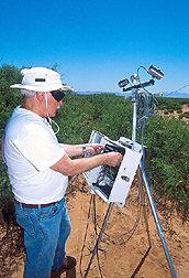
Schmugge sets up a thermal
instrument to measure
temperature on the Jornada
Range.
(K9530-1)
|
A Global Look at Climate
The desert team has been working with the Beltsville lab since 1995, helping
NASA gather data on global climate change as part of that agency's long-term
environmental health checkup of Earth from space. The program, named
"Mission to Planet Earth," takes a broad look at the planet's land,
water, and atmosphere. ARS has the lead role in the soil-hydrology part of the
project.
The Jornada's desert site is a good stand-in for similar sites throughout the
world, that is, semiarid areas further desertified by overgrazing and drought.
As a large land mass with changing vegetation, it is a perfect outdoor lab for
using remote sensing to measure such changes.
In fact, there is a relationship between the water cycle and global change. For
example, warming could speed up the evaporation and precipitation cycle,
causing droughts in some areas and dumping more rain and snow in other areas.
|
|

Agricultural meteorologist Paul
Doraiswamy (right) and Paul
Cook of the National Agricultural
Statistics Service observe a
remote-sensing map of a field
study of corn and soybean crop
yields in McLean County, Illinois.
(K9523-1)
|
The Jornada work helps NASA evaluate
the interaction between desert landscapes and climate. Changes in vegetation
over such vast landscapes can have a more lasting effect on climate and weather
than temporary shifts in moisture and temperature. For example, as the desert
is taken over by shrubs, there could be a rise in erosion and wind-blown dust.
Once this dust goes into the atmosphere, it could accelerate the Earth's
warming. In turn, a cooling or warming of the planet affects these landscapes.
There is preliminary evidence from ARS scientists that global warming may be
responsible for the increased pace at which grasslands are being overtaken by
mesquite and other shrubs.
The Jornada site has large parts of desert land covered with grass, large parts
where brush has replaced the vegetation, and large areas of a grass/brush mix.
"This helps us validate the NASA satellite sensors under three different
landscapes," says Kris Havstad, the head of the Jornada Experimental
Range. |
|
 At the Jornada Range, airplane
pilots follow flight-line markers
during remote-sensing flyovers.
Here, Mark Chopping secures a
marker in place.
(K9526-2)
|
Schmugge says that measuring surface
temperature will provide a "more realistic view of surface variability and
its relationship to regional climate change. For example, when water evaporates
from large areas of rainforests, it can affect climate and weather. If a large
section of rainforest were to be removed in a short time, that would change the
evaporation pattern—and the climate and weather—dramatically.
Likewise with any similar large-scale land-use changes."
Angling to Beat Reflectance
James McMurtrey, with the Beltsville lab, is testing the use of
fluorescence—natural emission of light or colors—rather than
microwave sensors to spot vegetation from afar. He and colleagues studied 45
soil series types across the United States and found that when the soils were
bare they had very low fluorescence. This encouraged them to proceed further in
trying to develop a way to distinguish bare ground from ground protected by
plants or harvested crop residue. |
|
ARS pilot Michael René
Davis flies the Cessna over
the Jornada Range as researchers
collect light-reflectance data.
(K9536-2)
|
"Methods like this, plus my
colleague Craig Daughtry's reflectance work, help with conservation tillage
surveys," McMurtrey says. Reflectance uses sunlight reflected from plants
to distinguish bare land from plant and crop residue cover.
This will be useful to NRCS inventories of land use and the Conservation
Technology Information Service's annual surveys of conservation tillage usage.
Conservation tillage typically requires at least 30 percent of the land to be
covered with residue from a previous crop. This can cut soil erosion by 90
percent.
McMurtrey and colleague Paul Doraiswamy, an agricultural meteorologist with the
Beltsville lab, are also working with scientists in Nebraska to use reflectance
to develop a "nitrogen needs index" to spot how much nitrogen plants
really need. |
|

A reflective tarpaulin on
the ground is used to
calibrate the visible and
infrared spectrometers
aboard the Cessna.
(K9527-1)
|
Light, Shadows, and Angles
An example of the close cooperation between the Beltsville lab and other ARS
labs is the recent transfer of Al Rango and Mark Chopping from Beltsville to
the Jornada. Rango is a hydrology expert who has developed ways to estimate
annual snowmelt and studied the effects global warming could have on these
estimates. Chopping is a remote-sensing scientist who is testing ways to make
"surface corrections." These adjust for errors in remote measurements
caused by shadows of plants and clouds and other light distortions caused by
the sun-target-satellite sensor alignment. Light reflects off plant leaves at
different angles, which contributes to a scattering of light that can cause the
radiation measured by sensors to be significantly overestimated or
underestimated. Semiarid regions like the Jornada are so bright that plant
canopy shadowing has a more significant effect on remote-sensing measurements
than in humid regions, Chopping says.
"If you've ever taken off in a plane in a semiarid region, you may have
noticed that as the plane gains altitude and your viewing perspective changes
relative to the surface, what looked like a green field from the ground appears
increasingly like bare soil. The vegetation cover is the same, but at higher
viewing angles you—and the satellite sensor—see a smaller proportion
of illuminated soil," Chopping says.
The Jornada scientists are using satellite data to map various types of
vegetation, including creosote bushes, mesquite shrubs, and grasses. Chopping
hopes to improve the accuracy of these maps by using multiangle sensing
techniques and has tested these using data from two sites in the Chihuahuan
Desert as well as over similar semiarid rangelands in Inner Mongolia. |
|

Probes like this one,
held by soil scientist
Tim Gish, monitor soil
moisture. Soil-moisture
data may one day help
predict floods, drought,
tornadoes, and hurricanes.
(K9518-1)
|
Multiangle remote sensing
has only recently been widely accepted as necessary, Chopping says. "Most
satellites we use now for land remote sensing view only from one angle,
covering about a 14-degree point of view." He is developing and testing
mathematical equations to add more viewing and sun angles. NASA's Multiangle
Imaging Spectro-Radiometer is an important recent addition to Terra, providing
nine different views of the surface almost simultaneously.
In his recent light-reflectance experiments at the Jornada, Chopping relies on
the skill of Cessna 404 pilot Michael RenŽ Davis (with ARS at Weslaco).
Davis must fly with the sun directly behind him in relation to the target areas
as the researchers photograph digital images at different viewing and sun
angles. Practical applications that could come from these experiments, says
Chopping, "are techniques to help ecologists and land-use managers
identify areas that are critically threatened as well as those that are
potentially suitable for remediation."
Working Together
The move of Chopping and Rango to the Jornada demonstrates the importance of
the Jornada experiment as well as the scientists' determination to work in
collaboration. For example, the National Science Foundation has several
long-term ecological experiments at the Jornada and at the adjoining Chihuahuan
Desert Rangeland Research Center.
Through a close relationship with nearby NASA's Goddard Space Flight Center, in
Greenbelt, Maryland, the Beltsville lab's scientists contribute to the
development of sensors for an ever-increasing number of NASA satellites. NASA's
recently launched Earth Observing-1 satellite is serving as a prototype for the
many commercial companies that intend to launch satellites for various
purposes, some devoted solely to agricultural uses such as precision farming.
One such company, Resource 21, provided ground-based light-sensing radiometers
for an ARS-University of Nebraska study.
Far-Reaching Research
It isn't just rangeland or global issues or even hydrology that the Hydrology
and Remote Sensing Lab gets involved with. The lab deals with a wide range of
topics and landscapes.
At Beltsville, the lab has one of the most heavily instrumented watersheds in
the world, with much of the instrumentation below ground, including automated
soil-moisture sensors. The site has also been analyzed with ground-penetrating
radar, the same type used to detect escape tunnels dug by prisoners. Scientists
at this site are tracing the movement of soil water and chemicals below
cornfields and under a nearby swamp and into a creek. NASA uses the site as one
of its "ground-truth" stations to verify accuracy of the data from
satellite microwave dishes.
USDA is the single largest nonmilitary user of satellite data, says ARS
physical scientist Charles Walthall, at Beltsville. He's benefiting from the
rapid changes in satellite technology over the past quarter century. "It's
a whole new ballgame," Walthall says. "Now, you can practically
custom-order a satellite. That's been the major change I've seen in my career.
Before, you had to stand in line for data from a few satellites. Now we have
these multisensor flyover campaigns all over the United States and the
world."
Walthall has spent hundreds of hours aboard NASA planes, operating remote
sensors, but he is doing his research on the ground now. He has developed
mathematical equations to make satellite data more accurate, including
procedures for using images taken from different angles.
Doraiswamy has combined the traditional crop-yield models developed by USDA
with climate data and data from satellite imagery to provide real-time crop
conditions during the growing season. Also, over the past decade, Doraiswamy
and his colleagues have worked with the research division of USDA's National
Agricultural Statistics Service (NASS) to harness satellite remote-sensing
technology to benefit and complement NASS's program to provide accurate reports
of crop production for the United States.—By
Don Comis,
Agricultural Research Service Information Staff.
This research is part of Water Quality and Management (#201) and Global
Change (#204), two ARS National Programs described on the World Wide Web at
http://www.nps.ars.usda.gov.
To reach scientists mentioned in this article, contact Don
Comis, USDA-ARS Information
Staff, 5601 Sunnyside Ave., Beltsville, MD 20705; phone (301) 504-1625,
fax (301) 504-1641.
|
|
"From a Distance: Remote Sensing of Planet
Earth" was published in the
August 2001
issue of Agricultural Research magazine.
|
|
|
[Top]
|
|
|
|