
|
||
Natural Hazards >> Fires >> Fires in Southern California
| ||||
|
Fires in Southern California
This Moderate Resolution Imaging Spectroradiometer (MODIS) image from the Terra satellite on November 2, 2003 shows one of the regions in southern California that was severely damaged by raging wildfires in late October 2003. Northwest of Los Angeles, fires roared through the Santa Monica Hills around Simi Valley and Thousand Oaks, leaving behind a burn-scarred landscape, which appears deep red in this image. Unaffected vegetation appears green, while naturally bare soil (low vegetation) appears pinkish. The white rectangle shows the area covered in a high-resolution image acquired by the Advanced Spaceborne Thermal Emission and Reflection Radiometer (ASTER) during the same overpass of the Terra satellite. Image courtesy Jesse Allen, based on data from the MODIS Rapid Response Team at NASA GSFC Recommend this Image to a Friend Fires: Topic Home | Archive | Related Links Natural Hazards Home | Section FAQ |
Where in the World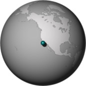
Image Posted November 13, 2003 Satellite & Sensor Terra- MODIS Other Images for this Event Posted: Nov 18, 2003 Posted: Nov 17, 2003 Posted: Nov 14, 2003 Posted: Nov 13, 2003 Posted: Nov 03, 2003 Posted: Oct 30, 2003 Posted: Oct 30, 2003 Posted: Oct 30, 2003 Posted: Oct 29, 2003 Posted: Oct 28, 2003 Posted: Oct 28, 2003 Posted: Oct 27, 2003 Posted: Oct 27, 2003 Posted: Oct 27, 2003 Posted: Oct 27, 2003 Posted: Oct 26, 2003 Posted: Oct 24, 2003 Fires Latest Events Fires in Oregon and Northern California Fire in the Kalahari Fires in Mozambique, Zimbabwe, and South Africa Fires in Central South America Fires in Idaho Bushfires in Northern Territory, Australia | |||
|
Subscribe to Natural Hazards
About the Earth Observatory & Natural Hazards Contact Us Privacy Policy and Important Notices Responsible NASA Official: Lorraine A. Remer Webmaster: Goran Halusa We're a part of the Science Mission Directorate |
 Click here to view high-resolution version