
|
||
Natural Hazards >> Fires >> Fires in Southern California
| ||||
|
Fires in Southern California
Several massive wildfires were raging across southern California over the weekend of October 25, 2003. Whipped by the hot, dry Santa Ana winds that blow toward the coast from interior deserts, at least one fire grew 10,000 acres in just 6 hours. (Compare this scene with one captured by Aqua MODIS just one day before.) The Moderate Resolution Imaging Spectroradiometer (MODIS) on the Terra satellite captured this image of the fires and clouds of smoke spread over the region on October 26, 2003. Moving northwest to southeast along the coast, the first cluster of red dots is a combination of the Piru, Verdale, and Simi Incident Fires; the next cluster�to the east of Los Angeles�is the Grand Prix (west) and Old (east) Fires; to their south is the Roblar 2 Fire; next is the Paradise Fire; then the massive Cedar Fire, whose thick smoke is completely overshadowing the coastal city of San Diego; finally, at the California-Mexico border is the Otay Fire. At least 13 people have lost their lives because of these fires, many of which appear to have been caused by carelessness and arson. Thousands have been evacuated across the region and hundreds of homes have been lost. The high-resolution image provided above is 500 meters per pixel. The MODIS Rapid Response System provides this image at MODIS� maximum spatial resolution of 250 meters. Image courtesy Jacques Descloitres, MODIS Rapid Response Team at NASA GSFC Recommend this Image to a Friend Fires: Topic Home | Archive | Related Links Natural Hazards Home | Section FAQ |
Where in the World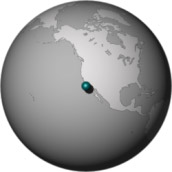
Image Posted October 27, 2003 Satellite & Sensor Terra- MODIS Other Images for this Event Posted: Nov 18, 2003 Posted: Nov 17, 2003 Posted: Nov 14, 2003 Posted: Nov 13, 2003 Posted: Nov 13, 2003 Posted: Nov 03, 2003 Posted: Oct 30, 2003 Posted: Oct 30, 2003 Posted: Oct 30, 2003 Posted: Oct 29, 2003 Posted: Oct 28, 2003 Posted: Oct 28, 2003 Posted: Oct 27, 2003 Posted: Oct 27, 2003 Posted: Oct 27, 2003 Posted: Oct 26, 2003 Posted: Oct 24, 2003 Fires Latest Events Fires in Oregon and Northern California Fire in the Kalahari Fires in Mozambique, Zimbabwe, and South Africa Fires in Central South America Fires in Idaho Bushfires in Northern Territory, Australia | |||
|
Subscribe to Natural Hazards
About the Earth Observatory & Natural Hazards Contact Us Privacy Policy and Important Notices Responsible NASA Official: Lorraine A. Remer Webmaster: Goran Halusa We're a part of the Science Mission Directorate |
 Click here to view high-resolution version