

Sedimentation and River Hydraulics Group
Group Manager: Tim Randle, (303) 445-2557, trandle@do.usbr.gov
Erosion and Sedimentation Manual 2006
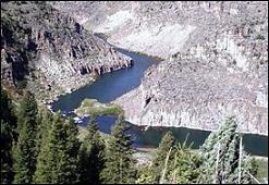
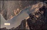
Teton River near Driggs, ID
The Sedimentation and River Hydraulics Group conducts studies on how rivers and reservoirs have or will respond to changes in river flow, sediment supply, or channel modification. Studies are prepared for a variety of purposes including operation and maintenance, dam safety, and fish and wildlife habitat restoration. Many studies focus on Reclamation facilities; their physical impact on river channels and endangered species habitat, recreation, wetlands, and cultural resources.
This Group assists in planning effective water and sediment management programs including:
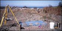
- Reservoir sedimentation surveys
- Sediment management studies for rivers, reservoirs, and structures;
- Environmental impact studies;
- Flood inundation mapping and emergency planning; and
- Research.
Our ability to collect and analyze data, identify and simulate physical processes, apply a range of models, and synthesize results for complex systems places our group in a unique class among river consultants. Our Group includes 21 hydraulic engineers who specialize in sedimentation, river hydraulics, geomorphology, river mechanics, and computer modeling. Nearly every eligible member is a licensed professional engineer, 19 have Master of Science degrees, 3 are Ph.D. engineering candidates, and 5 have their Ph.D. engineering.
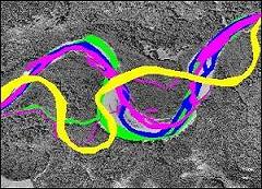
Historic Channel Migration Patterns
Our group capabilities are summarized below:
- Reservoir and river channel surveys;
- GIS and data analysis;
- Geomorphic analysis;
- Research and development:
- Numerical model development,
- River channel process investigations, and
- River structure design criteria;
- Numerical Modeling (1D, 2D, and 3D):
- River and floodplain hydraulics,
- Sediment transport,
- Channel migration, and
- Vegetation and habitat;
- Environmental impact analysis; and
- Dam safety and loss of life analysis.
Read more about our Capabilities, explore the Project Gallery for example projects, or reference the Knowledge Base for manuals, guidelines, and research information.
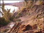
Sediment impact studies of rivers and reservoirs link changes in stream flow and sediment supply to processes controlling changes in channel shape and bank erosion. Applied research and customized investigations range from simple technical advice to in-depth, multi-year studies integrating diverse disciplines.
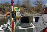

Data Collection, Reservoir Sedimentation, Geomorphic Features, Dam Analysis
Many of our investigations focus on the hydraulic and sediment impacts to fish and wildlife habitat, recreation, wetlands, or cultural resources and can incorporate assessment, planning, and design of water resource facilities. We frequently participate in inter-disciplinary and interagency teams in evaluating ecological systems and providing input for environmental impact statements and assessments.
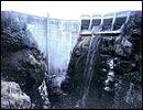
Our dam break inundation studies and maps are used for emergency planning, hazard classification, and guidance in selecting risk reduction alternatives for dams. Our group has also developed procedures for estimating the loss of life from dam failures.
We use a wide range of modeling and analysis software including an extensive suite developed and maintained in-house. Our in-house software allows us to customize and optimize numerical models to solve specific problems. We have designed our software to work together and provide an integrated view of river hydraulic and morphological processes. View our Model Development pages for the latest information.
We are available to assist you with reservoir and river sedimentation, river restoration, channel stabilization, and river hydraulics problems associated with water resources development, planning and management, dam safety, and river ecosystem restoration.
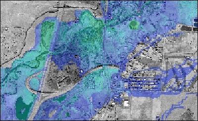
Flood Inundation Mapping
Web site maintained by: Kurt Wille