 |
||
Natural Hazards >> Severe Storms >> Hurricane Omar
| ||||
|
Hurricane Omar
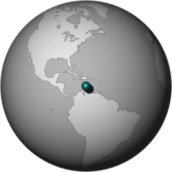
By mid-October 2008, when Caribbean Islands such as Haiti, the Dominican Republic, and Cuba had already been battered by Hurricanes Gustav and Ike, even more destruction appeared headed their way. By afternoon of October 15, 2008, Hurricane Omar seemed poised to strike. Classified as a Category 1 hurricane at that time, the storm was strengthening at it moved toward the northeast. A hurricane watch was in effect for Puerto Rico, and a hurricane warning had been issued for the Virgin Islands and the northern Leeward Islands. The Moderate Resolution Imaging Spectroradiometer (MODIS) on NASA’s Aqua satellite captured this image at 1:45 p.m. local time (17:45 UTC) on October 15, 2008. In this image, the storm more than covers the expanse of ocean between the northern coasts of Colombia and Venezuela, and Puerto Rico. The clouds extend toward the northeast, well past the string of Caribbean Islands east of Puerto Rico. A report issued 15 minutes later by the U.S. National Hurricane Center stated that the center of the storm was about 330 kilometers (205 miles) south of San Juan, Puerto Rico. The report also stated that the storm had maximum sustained winds near 140 kilometers (85 miles) per hour, and would likely strengthen to a Category 2 hurricane by the time it reached the northern Leeward Islands. Omar actually reached Category 3 hurricane status, but fortunately for residents of the islands in the storm’s path, it soon weakened and headed for the Atlantic. On October 16, the National Hurricane Center reported that the storm was rapidly weakening, but the trailing side of the storm could produce several inches of rain in Puerto Rico and neighboring islands.
NASA image created by Jeff Schmaltz, MODIS Rapid Response, NASA Goddard Space Flight Center. Caption by Michon Scott. Recommend this Image to a Friend Severe Storms: Topic Home | Archive | Related Links Natural Hazards Home | Section FAQ |
Where in the World
Image Posted October 16, 2008 Satellite & Sensor Aqua- MODIS Severe Storms Latest Events Tropical Storm Rashmi Tropical Depression Three, Gulf of Aden Hurricane Norbert Sub-tropical Storm Laura Tropical Storm Mekkhala | |||
|
Subscribe to Natural Hazards
About the Earth Observatory & Natural Hazards Contact Us Privacy Policy and Important Notices Responsible NASA Official: Lorraine A. Remer Webmaster: Goran Halusa The Earth Observatory is part of the EOS Project Science Office located at NASA Goddard Space Flight Center. |