|

Discovery
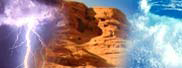
Yellowstone Rising

Volcano inflating with molten rock at record rate
November 13, 2007
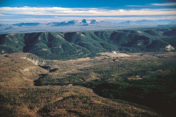
The Yellowstone "supervolcano" rose at a record rate since mid-2004, likely because a Los Angeles-sized, pancake-shaped blob of molten rock was boiled up 6 miles beneath the slumbering giant, scientists funded by the National Science Foundation (NSF) report in the Nov. 9 issue of the journal Science. "There is no evidence of an imminent volcanic eruption or hydrothermal explosion, that's the bottom line," says seismologist Robert Smith, lead author of the study and a geophysicist at the University of Utah. "A lot of calderas [giant volcanic craters] worldwide go up and down over decades without erupting." The upward movement of the Yellowstone caldera floor--nearly 3 inches (7 centimeters) per year for the past three years--is more than three times greater than ever observed since such measurements began in 1923, say Smith, geophysics postdoctoral associate Wu-Lung Chang and colleagues. "Our best evidence is that the crustal magma chamber is filling with molten rock," Smith says. "But we have no idea how long this process goes on before there either is an eruption or the inflow of molten rock stops and the caldera deflates again." The magma chamber beneath Yellowstone National Park is not a chamber of molten rock, according to Leonard Johnson, program director in NSF's Division of Earth Sciences, but a sponge-like body with molten rock between areas of hot, solid rock. "To say if there will be a magma [molten rock] eruption or hydrothermal [hot water] eruption, we need more independent data," says Chang. Calderas such as Yellowstone, California's Long Valley (site of the Mammoth Lakes ski area) and Italy's Campi Flegrei (near Naples) huff upward and puff downward repeatedly for decades to tens of thousands of years without catastrophic eruptions. Yellowstone is North America's largest volcanic field, produced by a "hotspot"--a gigantic plume of hot and molten rock--that begins at least 400 miles beneath Earth's surface and rises to 30 miles underground, where it widens to about 300 miles across. There, magma or molten rock occasionally breaks off from the top of the plume and rises farther, resupplying the magma chamber beneath the Yellowstone caldera. Previous research indicates that the magma chamber begins about 5 miles beneath Yellowstone and extends down to a depth of at least 10 miles. Its heat powers Yellowstone's geysers and hot springs--the world's largest hydrothermal field. As Earth's crust moved southwest over the Yellowstone hotspot during the past 16.5 million years, it produced more than 140 cataclysmic explosions known as caldera eruptions, the largest but rarest volcanic eruptions known. Remnants of ancient calderas reveal that the eruptions began at the Oregon-Idaho-Nevada border some 16.5 million years ago, then moved progressively northeast across what is now the Snake River Plain. The hotspot arrived under the Yellowstone area about 4 million years ago, producing gargantuan eruptions there 2 million, 1.3 million and 642,000 years ago. These eruptions were 2,500, 280 and 1,000 times larger, respectively, than the 1980 eruption of Mount St. Helens. The eruptions covered as much as half the continental United States with inches to feet of volcanic ash. The most recent giant eruption created the 40-mile-by-25-mile oval-shaped Yellowstone caldera. The caldera walls have eroded away in many areas - although they remain visible in the northwest portion of the park. Yellowstone Lake sits roughly half inside and half outside the eroded caldera. Many smaller volcanic eruptions occurred at Yellowstone between and since the three big blasts, most recently 70,000 years ago. Smaller steam and hot water explosions have been more frequent and more recent. In the new study, the scientists measured uplift of the Yellowstone caldera from July 2004, through the end of 2006, with two techniques: - Twelve Global Positioning System (GPS) ground stations that receive timed signals from satellites, making it possible to measure ground uplift precisely.
- The European Space Agency's Envisat satellite, which bounces radar waves off the Yellowstone caldera's floor, another way to measure elevation change.
The measurements showed that from mid-2004 through 2006, the Yellowstone caldera floor rose as fast as 2.8 inches (7 centimeters) per year--and by a total of 7 inches (18 centimeters) during the 30-month period. "The uplift is still going on today but at a little slower rate," says Smith, adding there is no way to know when it will stop. Smith says the fastest rate of uplift previously observed at Yellowstone was about 0.8 inch (2 centimeters) per year between 1976 and 1985. He says that Yellowstone's recent upward motion may seem small, but is twice as fast as the average rate of horizontal movement along California's San Andreas fault. The current uplift is faster than ever observed at Yellowstone, but may not be the fastest ever, since humans weren't around for its three supervolcano eruptions. Conventional surveying of Yellowstone began in 1923. Measurements showed the caldera floor rose 40 inches during 1923-1984, and then fell 8 inches during 1985-1995. GPS data showed the Yellowstone caldera floor sank 4.4 inches during 1987-1995. From 1995 to 2000, the caldera rose again, but the uplift was greatest--3 inches--at Norris Geyser Basin, just outside the caldera's northwest rim. During 2000-2003, the northwest area rose another 1.4 inches, but the caldera floor itself sank about 1.1 inches. The trend continued during the first half of 2004. Then, in July 2004, the caldera floor began its rapid rate of uplift, followed three months later by sinking of the Norris area that continued until mid-2006. Smith believes that uplift of the middle of the caldera decreased pressure within rocks along the edges of the giant crater, "so it allowed fluids to flow into the area of increased porosity." That, in turn, triggered small earthquakes along the edge of the "pancake" of magma. The amount of hot water flowing out of the deflated Norris area is much smaller than the volume of magma injected beneath the caldera, Smith says. The research was also funded by the U.S. Geological Survey and the Brinson Foundation.
Investigators
Robert Smith
Related Institutions/Organizations
University of Utah
Locations
Utah
Wyoming
Related Programs
Continental Dynamics
Related Awards
#0314237 Collaborative Research: Geodynamics of the Yellowstone Hotspot from Integrated Data and Modeling
Total Grants
$24,959
|