
The Weather Forecast Office in Grand Junction, Colorado currently has 6 operational NOAA Weather Radio (NWR) transmitters that broadcast continuous weather information 24 hours a day, 7 days a week across portions of Western Colorado and Eastern Utah. In Colorado, the transmitters are located near Grand Junction, Montrose, Durango, and Glenwood Springs. In Utah, transmitters are located near Vernal and Moab. In the future, NWR will be expanding, with potential listening areas in Cortez, Craig, and Steamboat Springs.
.png)
NOAA Weather Radio Listening Areas
in western Colorado and eastern Utah.
Click image for larger picture

Click this image for a nationwide list of NOAA
Weather Radio frequencies
The following is a summary for each current transmitter that includes their respective listening areas and tone alert coverage. The tone alert represents an area that will receive both the SAME alert and 1050 Hz tone when any weather warning is issued from the Weather Forecast Office in Grand Junction. This does NOT mean that other counties/areas within the listening zone will not hear the warning. It will be broadcast on NWR; however, the broadcast cycle will not be interrupted by the 2 tone alerts.
NOAA Weather Radio stations operated by the NWS Grand Junction include:
-
Grand Junction, CO - 162.550 MHz
WXM-55 sits atop the Grand Mesa at the 10,000 foot level in Mesa County. Warning tone alerts are generated for Mesa and Garfield Counties. Good reception of this broadcast can be found throughout the Grand Valley, along Interstate 70 from the Utah-Colorado border to Palisade, as well as the north face of the Uncompahgre Plateau, and most of the Grand Mesa. Broadcasts from this radio are repeated on 106.7 FM in the Grand Valley and also in the Parachute and Battlement Mesa area of Garfield County, courtesy of the Colorado Department of Transportation. -
Montrose, CO - 162.450 MHz
At an elevation of 10,200 feet, KXI-90 broadcasts from Storm King Peak in southeast Montrose County. Good listening coverage can be found from Montrose to Delta, with coverage as far north as Cedaredge and Paonia. Good coverage can also be found as far east as Blue Mesa Dam near Sapinero. Reception to the south is good to Ridgway along US Hwy 550. The counties that receive warning tone alerts include: Montrose, Delta, Gunnison, and Ouray. Weather broadcasts from this radio are repeated on 99.1 FM, courtesy of the Colorado Department of Transportation.
-
Glenwood Springs, CO - 162.500 MHz
WWG-43 is located atop Sunlight Peak, just south of Glenwood Springs. This radio broadcasts weather information targeting the I-70 corridor from Rifle to Glenwood Springs, and south to Aspen along Highway 82. The counties that receive warning tone alerts include: Garfield, Eagle, and Pitkin. Weather broadcasts from this radio are repeated on 107.9 FM, and 530 AM, courtesy of the Colorado Department of Transportation. -
Durango, CO - 162.425 MHz
KWN-54 transmits weather broadcasts from a transmitter located on Missionary Ridge at the 9860 foot level in La Plata County. The broadcast listening area includes La Plata County and western Archuleta County in southwest Colorado, as well as San Juan County and northwest Rio Arriba County in northwest New Mexico. Locations in the reception area include Durango, Bayfield, Ignacio, Farmington, Durango Mountain Ski Area, and significant portions of the Southern Ute and Navajo Indian Reservations.
-
Vernal, UT - 162.400 MHz
Atop Asphalt Ridge, station WXM-23 is located in Uintah County just southwest of Vernal. Good coverage includes most of the Uinta Basin from Duchesne to the Utah-Colorado border, and from the Ouray Wildlife Refuge to Bonanza. The Uintah and Ouray Indian Reservation is also within the broadcast reception area. The Northern extent of the signal hits the south facing slopes of the Eastern Uinta mountains, including Dry Fork. The counties that receive warning tone alerts include Uintah and Duchesne.
-
Moab, UT - 162.475 MHz
WNG-556 broadcasts from a site 12 miles southeast of Moab, Utah. The transmitter is located at an elevation of 8638 feet on Bald Mesa in the La Sal Mountains. The primary coverage area of this station is east central Utah, including the counties of Grand, northern San Juan, and southeast Emery. Locations in the reception area include the towns of Moab, Monticello, and Green River, as well as Arches National Park, and the northern section of Canyonlands National Park. -
Monticello, UT – 162.450 MHz
WNG-687 broadcasts from a site 7 miles west-southwest of Monticello, Utah at an elevation of 11,200 feet on the Abajo Mountains (also known as the Blue Mountains). The primary coverage area of this station is eastern San Juan County in Utah and the western portions of three Colorado counties, including San Miguel, Dolores, and Montezuma. Locations in the reception area include the towns of Monticello, Cortez, and Dove Creek, as well as portions of the Navajo and Ute Mountain Indian Reservations.
-
Steamboat Springs, CO – 162.525
KWN-56 is located 12 miles southeast of Steamboat Springs at an elevation of 10,600 feet on Walton Mountain. Counties that receive warning tone alerts include Routt, Moffat, Jackson, Grand, and Summit. The broadcast reception area includes the towns of Steamboat Springs, Craig, Kremmling, Walden, Silverthorne, and Frisco, as well as Steamboat Springs Ski Area and US Highway 40, including Rabbit Ears Pass. Weather broadcasts from this radio are repeated on 107.9 FM in Kremmling, courtesy of the Colorado Department of Transportation.
Programming Schedule:
The programming schedule consists of taped messages which run continuously and are routinely revised and updated to keep western Colorado and eastern Utah listeners informed of the latest weather information affecting the region. The entire broadcast cycle typically runs from 4 to 6 minutes in length, but may vary as conditions warrant. Routine products broadcast on the radios include, but are not limited to:
-
Regional Weather Synopsis - an overview (in layman terms) of the synoptic weather patterns affecting, or expected to affect western Colorado and/or eastern Utah within the 5-day forecast period, with emphasis given to the first 48 hours. Updated 3 times a day or as needed.
-
Hazardous Weather Outlook - A daily product, issued early each morning but updated as needed. This outlook extends across a 7-day period, alerting the public to any weather, hydrologic, or no-precipitation even that has a significant chance of creating a harmful impact on people over the next week. These evens may include, but are not limited to, lightning, heavy rain, significant snowfall, very dry conditions associated with fire potential and behavior, strong winds, dense fog, bitter cold, and extremely hot temperatures. The outlook will be appended with a spotter statement, expressing whether or not weather spotters will be needed that day.
-
Local Forecasts - a 7-day forecast for sky condition, temperatures, precipitation, and wind.
-
Current Regional Weather Conditions - updated hourly, this product gives complete hourly weather observations for selected cities in western Colorado and eastern Utah on the respective radios, as well as additional regional cities across the western U.S.
-
Nowcasts - a short term forecast, concentrating on the next 1 to 3 hours, typically for a specific area or location. The forecast will incorporate current Doppler radar, satellite and automated/manned surface observations, to provide accurate and descriptive short-range outlooks.
-
Other products - are broadcast as needed. These include Weather Warnings/Watches, Special Weather Statements, Public Information Statements, Avalanche Bulletins, and extreme Fire Weather Statements. Also, educational and promotional recordings covering various topics of interest to the general public are broadcast occasionally.
Weather Warning Alarms:
When severe weather threatens a location within the County Warning Forecast Area (CWFA), the routine broadcast cycle will be interrupted in order to activate the warning alarm . This alarm triggers specially-built weather radios to sound, letting the listener know that important live weather information will be broadcast immediately. Tests (during clear weather) of this warning alarm feature are normally conducted every Wednesday, between the hours of 11 am and noon.
Some new NOAA Weather Radio models have a SAME (Specific Area Message Encoding) alarm capability. To learn more about it:
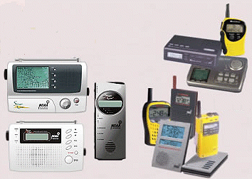
How do I get a NOAA Weather Radio?
If I don't have NWR in my area, what can I do?
If you have suggestions or comments concerning the Grand Junction weather radio
program, please contact:
National Weather Service
792 Eagle Dr.
Grand Junction, Co. 81506-8646
(970) 243-7007 (weekdays, 8-4 pm)