Severe Thunderstorm Forecast and Analysis Page
Note: Always check the time and date of any product or map to ensure it is
current.
Thunderstorm Outlooks
|
Day 1 Outlook |
Day 2 Outlook |
Day 3 Outlook |
 |
 |
 |
Latest Watches, Warnings, and Advisories
Note: Always check the time and date of any product or map to ensure it is
current.
|
All National Watches, Warnings, and Advisories |
 All national counties with any active watches, warnings or advisories. All national counties with any active watches, warnings or advisories.
|
|
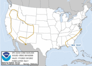
Current Severe Thunderstorm and Tornado Watches |
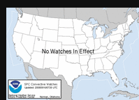 Current graphic showing any severe thunderstorm and
tornado watches in effect over the contiguous United States. Current graphic showing any severe thunderstorm and
tornado watches in effect over the contiguous United States.
|
|
Current Convective Activity Chart from the Storm Prediction Center |
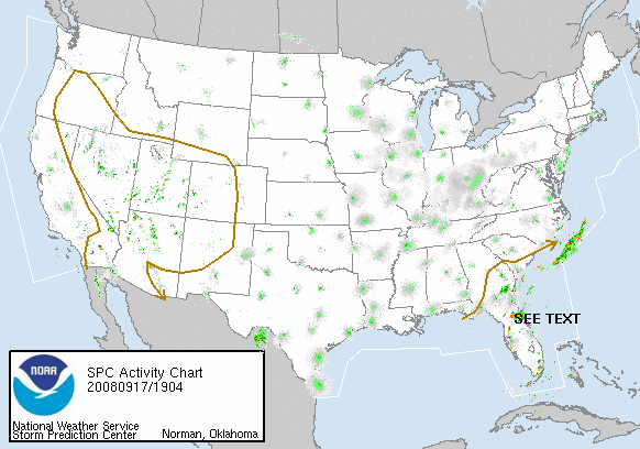 The national mosaic radar, with an overlay of the current
day 1 convective outlook and any current severe thunderstorm and
tornado watches and warnings. The national mosaic radar, with an overlay of the current
day 1 convective outlook and any current severe thunderstorm and
tornado watches and warnings.
|
|
Mesoscale Convective Discussions from the Storm Prediciton Center |
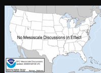 Current graphic showing any mesoscale
discussions (MD's) which are in effect over the contiguous
United States. Current graphic showing any mesoscale
discussions (MD's) which are in effect over the contiguous
United States.
|
|
Mesoscale Convective Analysis from the Storm Prediciton Center |
 Severe weather analyses updated hourly and usually centered on
an SPC risk area. Each hour a National analysis along with three
sub-sector analyses will be produced. The three sub-sectors will
change as SPC forecasters monitor these areas for hazardous
weather. This information is provided by SPC as a way of sharing
the latest severe weather forecast techniques with local forecasters. Severe weather analyses updated hourly and usually centered on
an SPC risk area. Each hour a National analysis along with three
sub-sector analyses will be produced. The three sub-sectors will
change as SPC forecasters monitor these areas for hazardous
weather. This information is provided by SPC as a way of sharing
the latest severe weather forecast techniques with local forecasters.
|
|
Storm Reports - Large hail, High winds, and Tornadoes |
 Today's preliminary storm reports. Today's preliminary storm reports.
|
Hazard
Assessment from the Climate Prediction Center
Watch, Warning, and Advisory Text Products
|
| 