Technical Attachment
Shawn P. Bennett
National Weather Service
Vanda Grusbisic and Roy M. Rasmussen
National Center for Atmospheric Research, Boulder, Colorado
INTRODUCTION
Studies based on data collected during the 1985 Joint Hawaii Warm Rain Project and the
1990 Hawaiian Rainband Project (Austin et al. 1996; Smith and Grusbii 1993; Rasmussen et al.
1989; Smolarkiewicz et al. 1988) show that gravity waves, rainbands, and deep convection may form
as a result of trade wind flow over a tropical island. These mesoscale phenomenon: gravity waves
and rainbands are the source of deep convection that results in frequent heavy rains and flooding
in Puerto Rico. Carter and Elsner (1997) describe Puerto Rico has having the greatest recurring
threat to life and property due to flash flooding of any U.S. state or territory. Thus, a thorough
understanding of the interaction of the trade winds with the topography of Puerto Rico is key to
accurate warnings and forecasts. In this paper we will present a comparison of high resolution
numerical model results with the Puerto Rico's climatological rainfall pattern and the climatological
diurnal wind regimes at San Juan, Mayagüez and Ponce.
GEOGRAPHICAL AND CLIMATOLOGICAL CONTEXT
2.1 Geographical Context
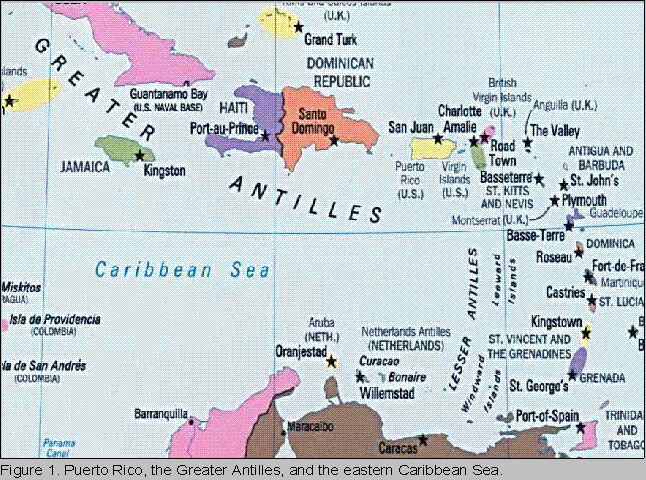
The Commonwealth of Puerto Rico is situated in the northeastern Caribbean Sea (ref. Fig.1).
It is the smallest and easternmost island of the Greater Antilles chain. The U.S. Virgin Islands lie
just to the east. Puerto Rico stretches about 180 kilometers (112 miles) from west to east and about
65 kilometers (40 miles) from north to south.

2.2 Climatological Patterns: Wind
Puerto Rico's wind regime is characterized by two principal factors: diurnal land and sea
breezes, and persistent 10 ms-1 northeasterly trade wind flow. Figure 3 shows a weak nighttime
offshore southeasterly land breeze followed by a daytime onshore northeasterly sea breeze at San
Juan. Figure 4 shows a weak nighttime offshore easterly land breeze followed by a westerly onshore
sea breeze at Mayagüez. Figure 5 shows a weak nighttime offshore northeasterly land breeze
followed by a daytime onshore southeasterly sea breeze at Ponce.


2.3 Climatological Patterns: Rainfall
Carter et al. (1997) present a study of the Puerto Rico monthly rainfall climatology based on data collected from the National Weather Service cooperative observation network. Daily rainfall totals from 1980-1989 were used. Rainfall from tropical storms and hurricanes were excluded. The 95th percentile values of daily precipitation that were calculated and are shown in Figure 6.

MODEL SETUP AND DESCRIPTION
We conducted our numerical experiment with a model developed by Smolarkiewicz and
described by Smolarkiewicz and Margolin (1996). The model resolution was set at 5 kilometers in
the horizontal and 150 meters in the vertical. The model uses a finite difference approximation to
the anelastic, non-hydrostatic fluid dynamics equations. Our numerical simulation was initialized
with the 1200 UTC 1 October 1995 sounding at San Juan and the diurnal solar cycle for 1 October
1995 and was allowed to run for 24 hours. The island of Puerto Rico was represented in the model
by an idealized island geometry and terrain, roughly equivalent to the actual island dimensions (ref.
Fig. 8). An average ridge line elevation of 930 meters (3051 feet) was used to represent the
Cordillera Central.
3.1 The Froude Number: Flow Reversal, Gravity Waves, Lee Vorticies
Smolarkiewicz and Rotunno (1990), hereafter, SR90, present a numerical study of the flow
of an inviscid, non-rotating, density stratified fluid past a three-dimensional obstacle with a Froude
number of 0.33. Conceptually, the Froude number is proportional to the ratio of the kinetic energy
to potential energy (Fr = U/Nh, where U is the mean upstream flow speed, N is the Brunt-Väisälä
frequency, and h is the height of the obstacle). The Froude number calculated from the San Juan
sounding used in our numerical simulation was 0.6. Figure 7 (adapted from the first panel of SR90
Fig. 11) shows that in the case where the aspect ratio ß = 0.5, this is the case most closely
representing Puerto Rico, lee vortices form without an upwind flow reversal and a standing gravity
wave forms just downstream of the ridge axis of the obstacle. We expect that the results of our
numerical simulations should be similar to the results presented in Figure 7.

DISCUSSION
4.1 Model Results: Wind, Theta, qc
Figure 8 shows a daytime xy vector plot of the u wind and u wind perturbation. Wind vectors
indicate an onshore northeasterly flow along the north and east coasts and an onshore southeasterly
flow along the south coasts and an onshore westerly flow along the west coast where the hint of lee
vortices and a flow reversal zone are evident. The wind is decelerating as it encounters the mountain
slopes on the east coast and in the flow reversal zone off the west coast. The wind is accelerating
as it flows down the slope from the windward (north and east) sides of the island toward the leeward
(south and west) sides of the island. Figure 9 shows a nighttime xy vector plot of the u wind and u
wind perturbation. This plot shows the diurnal wind reversal in the offshore southeasterly flow along
the north coast and in the offshore northeasterly flow along the south coast. An increase in the
magnitude of the deceleration of the u wind along the east and west coasts can be seen at night. This
may be indicative of the offshore flow associated with the land breeze generated by the diurnal wind
reversal opposing the persistent onshore trade wind flow along the east coast and the persistent
onshore westerly wind on the west coast. This westerly wind is the manifestation of the flow
reversal created by a cyclonic lee vortex off the northwest coast and a anticyclonic lee vortex off the
southwest coast of the island. Figure 10 shows the theta perturbation field associated with the flow
past the island: a positive theta perturbation along the leeward side of the island and a negative theta
perturbation along the windward side. This positive theta perturbation coincides with the regions
of flow subsidence on the leeward side of the island while the negative theta perturbation coincides
with the region of ascent due to orographic lift on the windward side of the island.


Figures 11, 12, and 13 are west to east (left to right) cross sections of the island. Figure 11
shows a high amplitude gravity wave anchored over the western slope of the island. A low
amplitude gravity wave is anchored just over the crest of the eastern slope of the island. Figure 12
shows the vertical velocity field, w, associated with these gravity waves: a strong positive w over the
western slope and weak positive w over the eastern slope. Figure 13 depicts the cloud water field,
qc. Two areas should be noted: 1) atop the eastern slope and crest of the ridge, and 2) between 1.5
to 2.5 kilometers altitude just above the maximum intensity of the gravity wave over the western
slope. These are the areas that coincide with the highest annual and daily average rainfall. In
addition, the area over the western slope is where deep convection regularly occurs in Puerto Rico.


SUMMARY AND CONCLUSIONS
The model simulated wind, cloud water, vertical velocity, and theta perturbation fields were
quite similar to the climatological daily wind and rainfall patterns. Although, we do not present
model rainfall, we can infer the rainfall pattern, from the theta perturbation , w, and qc plots. Perhaps
the most significant finding is that standing gravity waves develop over western and eastern Puerto
Rico because of the islands spatial geometry, topography, as well as its typical tropical atmospheric
moisture, instability, and trade wind flow regime. These gravity waves are manifested in the form
of deep convection and very heavy rainfall that often leads to flash flooding. Other significant
findings include: 1) the lack of an upwind flow reversal zone offshore from the eastern end of the
island, instead, it appears that flow reversal takes place onshore over the Sierra de Luquillo, in the
form of persistent rainshowers and occasional rainbands, 2) cyclonic and anti-cyclonic lee vortices
offshore from the western end of the island, 3) a positive theta perturbation on the windward side
of the island.
In short, the model simulations have led to improved weather forecasts and warnings through
an increase in our understanding of the interaction of the trade winds with the topography of Puerto
Rico, and by providing us with a quantitative physical explanation for several interesting
hydrometeorological phenomena: the El Yunque tropical rainforest, persistent deep convection and
thunderstorm occurrence maxima over western Puerto Rico, the semi-arid southwest coast, and the
high average wind speed over the northwest coast.
REFERENCES
Austin, G.R., R.M. Rauber, H.T. Ochs, and L.J. Miller, 1996: Trade-wind clouds and Hawaiian
rainbands, Mon. Wea. Rev., 124, 2126-2151.
Carter, M.M., and J.B. Elsner, 1997: A statistical method for forecasting rainfall over Puerto Rico,
Wea. Forecasting, 9, 265-278.
, S.P. Bennett, J.B. Elsner, 1997: Monthly rainfall climatology for Puerto Rico, submitted to
NWS Southern Region, Technical Attachment to Southern Topics, in process.
, and J.B. Elsner, 1996: Convective rainfall regions of Puerto Rico, Int. J. of Climatol. , 16,
1033-1043.
Galianes, M.T., Editor, 1977: Geovisión de Puerto Rico, Universidad de Puerto Rico, 59-62.
Miranda, P.M.A., and I.N. James, 1992: Non-linear three-dimensional effects of gravity-wave drag:
Splitting flow and breaking waves. Q.J.R. Meteorol. Soc., 118, 1057-1081.
Rasmussen,R.,P.K. Smolarkiewicz and J. Warner, 1989: On the dynamics of Hawaiian cloud bands:
Comparison of model results with observations and island climatology. J. Atmos. Sci., 46,
1589-1608.
Smith, R.B., and V.Grusbii, 1993: Aerial observations of Hawaii's wake. J. Atmos. Sci., 50, 3728-3750.
Smolarkiewicz, P.K. and R. Rotunno, 1990: Low Froude number flow past three dimensional
obstacles. Part II: Upwind flow reversal zone. J. Atmos. Sci., 47, 1498-1511.
Smolarkiewicz, P.K, and L.G. Margolin, 1996: On Forward-in-Time Differencing for Fluids: an Eulerian/Semi-Lagrangian Non-Hydrostation Model for Stratified Flows, Numerical Methods in Atmospheric and Oceanic Modelling. The Andre J. Robert Memorial Volume (C.Lin, R. Laprise, H. Ritchie, Eds.), Canadian Meteorological and Oceanographic Society, Ottawa, Canada.