George
W. Mindling, a Weather Bureau official in Atlanta, Georgia,
wrote prophetic lines as part of a group
of "Weatherman Poems" in 1939.
Twenty-one years
later, George Mindling's prophetic poem ceased to be prophesy and
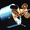
became fact with the launching of TIROS I on April 1, 1960.
TIROS
is an acronym for Television and Infra-Red
Observation Satellite. Data from this
first meteorological satellite was processed at the Weather Bureau's
Meteorological Satellite Laboratory. This laboratory ultimately
evolved into the satellite operations of NOAA's National Environmental
Satellite, Data, and Information Service (NESDIS).
Since those
first exciting days, satellite systems have become an intrinsic
part of weather forecasting, oceanography, terrestrial mapping,
and hazard detection. NESDIS and its ancestor organizations have
processed, interpreted, and archived millions of satellite images
that were acquired by those early systems and the thirty or so NOAA
owned and operated satellites that have done so much to protect
and warn the citizens of the United States. This album of images
is a pictorial history of only a small part of those accomplishments.