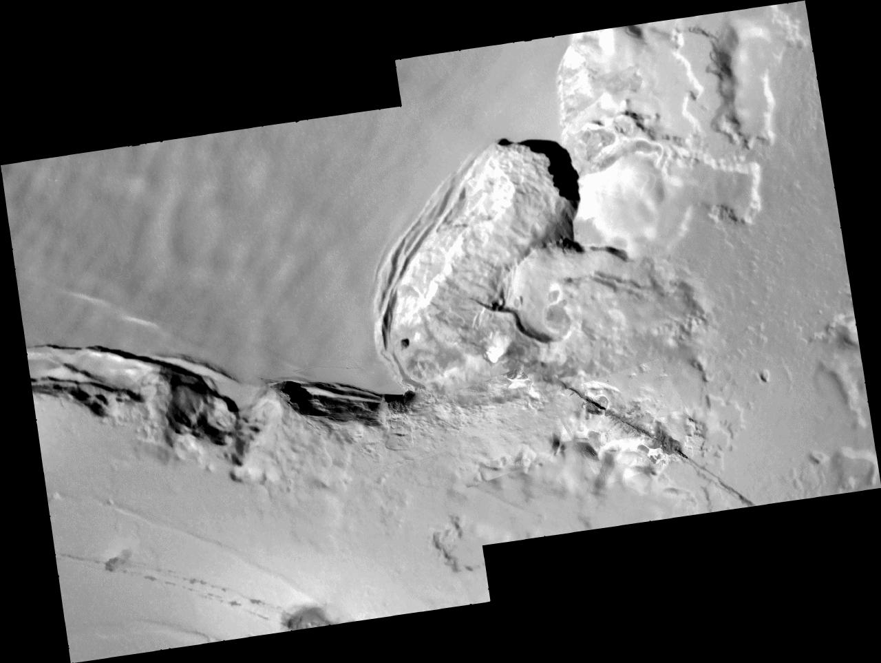
These images of an area called Telegonus Mensa on Jupiter's moon Io, taken by NASA's Galileo spacecraft on Oct. 16, 2001, reveal a complex interplay of geologic processes.
Four small, high-resolution frames (9.6 meters, or 32 feet, per picture element) have been set into the larger context mosaic, which has a resolution of 42 meters (140 feet) per picture element. The illumination is from the upper right and north is to the top of the mosaic.
A fracture runs northwest from the lower right corner of the mosaic into the amphitheater in the center of the frame. A high-resolution image along this fracture reveals that lava has erupted from it.
The amphitheater itself is the site of extensive erosion, as the cliff has slumped southeastward under the influence of Io's gravity. High-resolution frames directly south of the amphitheater show another slumping cliff in detail. Flat tops of massive slump blocks—up to 6 kilometers (3.7 miles) long and 0.5 kilometers (0.3 miles) across—are illuminated by the Sun and cast shadows down the face of the cliff. Based on these shadows, Galileo scientists estimate that the cliff is 1 to 2 kilometers (3300 to 6600 feet) high. Just to the left of center a series of landslides can be seen, the longest of which extends 4 kilometers (2.5 miles).
The mosaic is centered at 21.45 degrees south latitude and 124.8 degrees west longitude and is 67 kilometers (42 miles) across.
The Jet Propulsion Laboratory, a division of the California Institute of Technology in Pasadena, manages the Galileo mission for NASA's Office of Space Science, Washington, D.C. Additional information about Galileo and its discoveries is available on the Galileo mission home page at http://galileo.jpl.nasa.gov. Background information and educational context for the images can be found at http://solarsystem.nasa.gov/galileo/gallery/index.cfm.


