|
The Historic Columbia River Highway is located in the state of Oregon, along the south side of the Columbia River between the cities of Troutdale (14.2 miles east of Portland) and The Dalles (88 miles east of Portland). It was patterned after the Axenstrasse in Swizerland (photo below).
The HCRH was the first modern highway constructed in the Pacific Northwest and the first scenic highway in the United States. The road became a trunk route from Portland's large commercial center to eastern Oregon and points beyond. The highway's alignment remains true to the plan that Samuel C. Lancaster and others envisioned for its original configuration. Lancaster, who located the HCRH in Multnomah County, and Sam Hill, who advocated for construction of a scenic highway in the Columbia River Gorge, are shown below.
.  
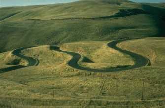
Sam Hill invited Sam Lancaster to build an experimental road at his Maryhill estate at the eastern end of the Columbia River Gorge (shown below).
The road is the pinnacle of early-20th-century rural highway design created to take visitors to the Columbia River Gorge's most breathtaking and beautiful natural wonders and scenic vistas. The HCRH was a portion of the longer "Columbia River Highway," and was constructed between 1913 and 1922.
By the 1920s, the Columbia River Highway extended beyond The Dalles to just west of Pendleton (where the Columbia River turns north into Washington), about 200 miles east of Portland. The road east of that point became the Old Oregon Trail Highway and headed southeast toward Boise, Idaho. During the teens and 1920s, the Columbia River Highway was also lengthened from Portland some 80 miles west to the river's mouth at Astoria. During the 1920s, the entire Columbia River Highway and the Old Oregon Trail Highway became part of US 30.
The portions of the Columbia River Highway east of The Dalles and west of Portland (later known as the Lower Columbia River Highway) were constructed to the same high design standards as employed on the HCRH. However, they were not envisioned as scenic highways and never received the accolades given to the road laid out through the Columbia River Gorge. Much of the roadway east of The Dalles was destroyed during construction of Interstate 84.
The HCRH possesses an extraordinary integrity to the period of construction. All of the western 21.6 miles, from Troutdale to Dodson, is on its original alignment except at Oneonta Gorge Creek, where in 1948 it was slightly realigned to bypass Oneonta Tunnel and crosses Oneonta Gorge Creek on a 1948 reinforced-concrete girder span. All of the engineering features associated with this portion of the highway, including the original Oneonta Gorge Creek Bridge, the Oneonta Tunnel, and Interstate 84's Toothrock Tunnel, are intact.
Portions of the HCRH between Dodson and Hood River were sacrificed in the 1950s, 1960s, and 1970s for construction of the water-level route that became Interstate 84. Those discontinuous segments that remain between Dodson and Hood River, however, possess much of their original integrity, including masonry walls, bridges, viaducts, and pavement. The Oregon Department of Transportation is restoring several of these segments for non-motorized use.
|