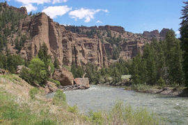

Ecosystems are self-regulating associations of living plants and animals interacting with their nonliving physical and chemical environment, and the flow of materials and energy between them. Since ecosystems are not merely abstract constructs of flow of matter and energy, but occupy real phenomenal space and have geographic extent, they should be properly understood as terrain or landscape ecosystems. The goal of this site is to utilize quantitative geographic approach based on existing scientific principles to better understand the spatial distributions and relationships of natural structures and processes occuring on public land ecosystems. Understanding these geographic patterns will permit development of better land management approaches to maintain the health of the national treasure that are our public lands. The methods discussed here will utilize various terrain and landscape analysis techniques based on geographic information system and remote sensing data and technologies. While discussing the methods of mapping and analysis of various ecosystem components it is the additional goal of the site to, over time, map out the known basic links between physical, chemical, and biological ecosystem components and provide access to simple means for their analysis. All resource specialists with some knowledge of mapping and ability to access and log on to ARC/INFO should be able to use these tools without much difficulty, and potentially also learn how to modify them to their own needs.
Jacek Blaszczynski, Physical Scientist, jacek_blaszczynski@blm.gov
GIS Modeling the physical form and processes of ecosystem landscapes with AMLs
- Hydrologic terrain analysis: watershed (catchment) and stream network delineation
- Geomorphometric analysis of terrain features
- Sheet and rill erosion evaluation with the Revised Universal Soil Loss Equation (RUSLE) – GIS Interface
- Reference and Suggested Reading
Future topics:
- Storm watershed runoff and sediment yield modeling.
- Applications of fourth-order-of-relief terrain analysis methods.
- Automated derivation of a terrain database for resource analysis.
- Developing a GIS watershed project database.
- Terrain and landscape classification utilizing microbasins.
- Terrain morphology and ecosystem process modeling.
(These pages are in the process of being built)
Disclaimer:
The software provided on this website is solely intended for distribution of information and the BLM National Science and Technology Center cannot guarantee itÃs performance or take responsibility for any loss, economic or otherwise, that might be incurred by using it.
Content manager - Jacek Blaszczynski (jacek_blaszczynski@blm.gov)

